Ten miles east of Palm Springs in the bluffs and mesas of Indio Hills lay the 20,000-acre Coachella Valley Nature Preserve. The natural area was cooperatively managed by the federal Bureau of Land Management, the US Fish and Wildlife Service, the privately-funded The Nature Conservancy, and the state of California's Department of Fish and Games.
This Daily Travelogue is a labor of love for our families and friends at home and around the world. Prior to 2020, all our trips were documented on separate, yearly blogs which can be accessed below. Remember that clicking on any picture will open it for better viewing. Also, please consider adding your name at the end of any comments. Be safe, stay healthy, and stay connected.
Saturday, February 26, 2022
1/19/22: Palm Springs' Coachella Nature Preserve
Anyone living in the US is aware of the notorious San Andreas Fault and how California might one day be facing the 'big one' aka the earthquake. We learned that the fault ran roughly east and west through the northern part of Coachella Valley.
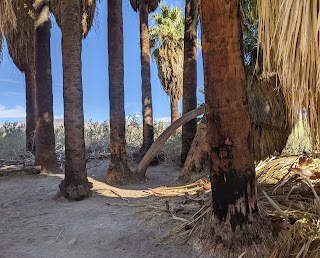
We overheard a volunteer ranger say the preserve was also home to several palm oases formed because San Andreas Fault lines allow water flowing underground to rise to the surface. He mentioned the Thousand Palms Oasis comprised California fan desert palm trees that had existed since the time of dinosaurs!
In the center of the oasis was the Paul Wilhelm Grove, also the location of the preserve’s rustic visitor’s center.
I don't ever remember seeing palm trees pruned on trails before as they were on this mile-long boardwalk. The trail wound past pools containing endangered desert pupfish.
Because the Coachella Valley climate is similar to ancient Mesopotamia, dates can be grown.
For thousands of years, particles of sand from the San Bernardino Mountains and Indio Hills washed into the Coachella Valley, forming a system of dunes.
The marsh areas provided significant habitat for many plants and animals including bobcats and cougars who prefer moving in the thick vegetation or 'feline highways' to hunt as they move.
The preserve was home to several species of increasingly rare wildlife including the Coachella Valley fringe-toed lizard that depends on this unusual blowsand desert for survival. The lizard "swims" through the sand to escape predators or summer heat on the desert surface.
We were advised to keep our hands and feet where we could see them, i.e. stay on the trails, in this sensitive habitat area because of rattlesnakes in the marsh's deep brush. Duly noted!
Twenty-five miles of hiking trails wound through the oases, covering a few different ecosystems ranging from sand dunes, mountain canyons, or dried-up riverbeds.
Unfortunately, the rest of the McCallum Pond Trail was closed because it was being worked on. Oh well, we figured that was a great reason to return for Steven's birthday next year as we always like to leave something to come back to.
I wondered what scary animals lurked in this marshy area!
We then followed the Smoke Tree Ranch Trail back to the Thousand Palm oasis.
Even though we've spent a good chunk of time in the Southwest, we'd never heard of cattle spinach before whose range extends to Utah and Mexico. Apparently, however, the high-value forage for cattle and native browsers is common in both the Mojave and Colorado deserts.
The preserve and, in particular, the oasis was a hidden gem in the middle of the desert!
We spent most of the afternoon lounging by the resort's pool that backed up to one of Palm Springs' 100 golf courses. What a life we have we keep reminding ourselves!
Next post: Hiking at Indian Canyon outside of Palm Springs.
Posted on February 26th, 2022, from Phoenix where we're spending the last few days here hiking each morning and soaking up more sun each afternoon before returning to the much colder Denver.
Wednesday, February 23, 2022
1/18/22: A Birthday in Joshua Tree National Park!
The day before Steven and I had flown nonstop from Denver to Palm Springs in southeastern California for a few days to celebrate his birthday. I joked with a friend that normally people go out for dinner to celebrate a birthday and here we were flying out to one of the country's major resort cities for Steven's! The reason was January was the last month we could take advantage of Southwest Airlines' companion pass where my return ticket was free except for taxes so we figured why not.
I don't think we've ever flown into an airport that was almost totally open to the elements as was the case in Palm Springs. It was named after entertainer and former Palm Springs mayor Sonny Bono. Though the city was home to nearly 100 golf courses, we didn't come to play the links as neither of us are golfers.
Our home away from home for a few days:
I was flabbergasted by the number of cars from the western Canadian province of British Columbia in a local parking lot. Canadians were restricted from traveling for so long because of Covid so snowbirds must have decided to take advantage of the loosened restrictions to enjoy Palm Springs' warmer climes and beautiful scenery.
As Steven's birthday was on the 18th, he got to choose that we spend it on a day trip to Joshua Tree National Park located an hour's drive east where the high Mojave Desert meets the low Colorado Desert. The aptly-named community of Windy Springs was home to hundreds and hundreds of wind vanes.
At the park's visitor center, we read that the destruction of the desert by unthinking visitors in the early 1900s so alarmed wealthy Pasadena socialite Minerva Hoyt that she campaigned for nearly ten years for the creation of a park protected by the government. Her efforts were rewarded in 1936 by President Franklin D. Roosevelt, an ardent conservationist himself when he set aside 825,000 acres for Joshua Tree National Monument. It became a national park in 1994. Hoyt also campaigned tirelessly for the preservation of other southern California's unique desert landscapes including Death Valley and Anza-Borrego Desert.
It was shocking to read that three-quarter of California's indigenous people had died of smallpox brought by settlers in the 1860s. Local tribes who were left struggled to maintain their traditional ways, with many taking new jobs and adopting a new way of life to survive in a land reshaped by miners, settlers, and ranchers.
The Mojave Desert is located between the higher, colder Great Basin Desert and the lower, warmer Sonoran Desert. Because of its intermediate elevation, the land bakes in the hot, dry air much of the year with winter bringing snow and freezing nights. It was amazing that anything survives in the Mojave or "the land of little rain" where heat and arid winds combine to evaporate most available moisture.
These Rock Piles or formations were once a solid mass of granite called monzogranite which formed 85 million years ago from magma crystallizing 15 miles below where we stood. After the rock was stressed and cracked by earthquakes, mountain uplifting moved the rock closer to the earth's surface. Groundwater then seeped into the cracks which helped to round and shape the rock blocks. That was followed by further uplifting and erosion exposing the rocks above the ground.
The narrow gap in the rocks funneled into the legendary Hidden Valley where cattle rustlers were said to have hidden their illicit herds. In the late 1870s, a band of cowboys led by the McHaney brothers purportedly rustled cattle from Arizona and horses from California and drove the herds here to be re-branded.
The stolen stock grazed on the once-abundant grasses in the desert valleys and then sold in markets out-of-state. It was a profitable business until lawmen, miners, and more respectable cattlemen moved into the region at the end of the 19th century.
The trail took us through the narrow opening in these rocks that had been blasted open just before the park's establishment as a national monument in 1936.
The birthday boy!
The single-leaf pinyon pine tree is mostly found in the mountains of the Mojave Desert and the Great Basin Desert Steven and I explored in the summer of 2020. The short-trunked trees grow slowly and use water sparingly since adapting to more seasonally dry conditions 30-60 million years ago.
The pinyon pine was one of the most important plants used by the desert indigenous people. They collected seeds by beating the green cones off the branches and then placing the cones in a fire. The heat caused the cones to open and expose the seeds. The tree's wood was used for construction and cooking. Finally, pine pitch made excellent glue for waterproofing baskets and repairing broken pots.
Our hike through Hidden Valley's unique and otherworldly landscape has to be considered a 'must' for anyone lucky enough to visit the national park.
Joshua Tree National Park has been described as one of America's rock climbing meccas. I read that the park has more than 8,000 established climbing routes, from easy beginner scrambles to extreme vertical cracks on more than 400 climbing formations! I'd think that many of those formations must be in the park's Hidden Valley section as we saw many climbers out on that beautiful day.
I read that the large granite rocks around Hidden Valley act as giant water collectors when rainfall runs off through cracks in the rocks and collects around the base. Plants growing nearer to the rocks will have greater access to moisture and protection from drying winds.
Rock climbers call this monolith in Hidden Valley the Great Burrito. Though Joshua Tree National Park is considered a world-class climbing area, some associated problems have arisen. Vegetation has been trampled by climbers creating a network of trails to and from formations in the more popular areas. Nesting birds have become disturbed and archaeological sites have been imperiled. A balance for resource protection and climbing is being sought between climbing groups and park staff.
I liked the view of the barren tree against the sky and mountain backdrop.
I wonder if climbers knew the cracks in the rocks not only provided handholds for them but also homes and a quick getaway for many species of snakes and lizards! The park's largest lizard, the chuckwalla, can live up to 40 years. When it's threatened, it runs into a crack and inflates its body. If I were a rock climber, I'd want to be very careful about putting my hands in any shady crevices lest there were any snakes there!
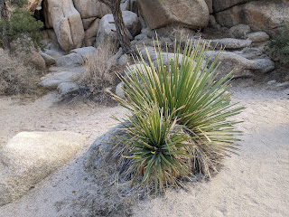
The nolina, also sometimes called beargrass, had long, thin leaves. After its tall flower stalk was baked in a pit, it was eaten.
The thick-leaved Mojave yucca wasn't the main source of food for the indigenous people although they did roast and eat the fruit pods. It was most valued for its strong leaf fibers which were used to weave mats and sandals, and for the soap extracted from the roots.
I could understand why the desert had been described as "a mosaic of miniature worlds." Even though the Mojave desert could be a hostile place, these miniature worlds provided habitats for many diverse life forms. The microclimate at Hidden Valley caused by the rocks circling the valley which block the wind and collect moisture supports many plant and animal species. The secluded valley has been a lure for people, both past and present, as a source of food, protection, and for its special beauty.
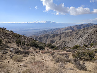
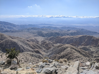
Further in the park, we took the 20-minute side trip up to 5,185-foot-high Keys View, which overlooked a vast panorama of Mount San Jacinto and Mount Gorgonio with the Salton Sea shimmering in the distance.
Unfortunately, the view wasn't as clear as it could have been due to haze from sources such as water vapor, dust, and air pollution. I read that once Southern Californian industrial plants, power plants, wood stoves, and cars belch soot, dust, and smoke into the atmosphere, prevailing winds direct the air until it is dispersed throughout the Coachella Valley where Joshua Tree is located. Haze hangs around the longest when winds are calm, the temperature is hot and humidity is high.
Palm Springs was located in the dead center on the horizon but our view of 10,831-ft-high Mount San Jacinto was obscured by the haze.
We then strolled around the Cap Rock nature trail. A sign indicated that no pets were allowed on the park's trails because dogs smell like predators and scare the park's bighorn sheep away from wildlife water sources that are drying up.
Even though many Mojave desert plants, such as this peachthorn, looked dead during the winter, they were actually just dormant which was an energy-saving adaptation. The leaves, present during the warmer months, are small which minimizes evaporation from leaf surfaces.
Joshua trees for whom the park was named were giant branching yuccas and a member of the agave family. The tree was revered by indigenous tribes because its leaves provided durable materials for baskets and footwear, and the buds and seeds made a healthy addition to their food supply.
Another dead-looking bush was actually called Mormon Tea. With no leaves entirely, food production or photosynthesis is carried on in the plant's green stems. Like pine trees to which they're related, the plant instead bears cones and is wind-pollinated.
Vegetation was noticeably thicker and more diverse in areas with larger boulder piles than in the more open areas. That was because rain runs off the boulders and collects around the bases of rocks which creates a moister habitat for plants like goldenbush and skunkbush.
Joshua trees, either alive or dead, have a large role in the ecology of Mojave Desert because creatures shelter in the leaves and small rodents burrow beneath the roots. Deer and bighorn sheep browse on the leaves. Once termites feast on the dead wood, nutrients are released into the soil for use by new plants.
As we neared the end of the trail, we spotted a man who must have been been just bouldering because he had a massive pad on his back.
Reading this hard-hitting sign was like a sucker punch for those who choose to hike in the heat of the day.
By its very name, the Hall of Horrors Trail made us want to hike it but it was oh, so, so frustrating as there was nary a single sign alluding to why it achieved its odd name. Not only that, there was no defined path either which was so different from the rest of the park. We certainly weren't the only hikers wandering in this area hoping to discover something about the trail as we encountered several other groups asking us and others if anyone knew anything about the trail.
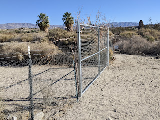
This was the only spot in the park where we noticed that trees had been newly planted and thus protected by fencing.
Although the hike was a total bust in terms of what actually constituted the Hall of Horrors, the views were simply spectacular.
Not too far away was the spooky-looking Skull Rock!
The fun Skull Rock trail took us through this narrow space where we had to crouch down to get through!
It was a little like being a kid again clambering the rocks and through the cave at Skull Rock! I was sure glad I'd brought along a jacket, though, as it was got quite nippy at just 3 in mid-January.
Skull Rock from a different perspective:
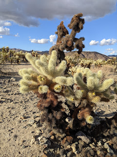
Before returning to Palm Springs, Steven wanted to make sure we stopped again at Cholla Gardens, even though we'd visited this section of the park almost exactly a year ago on the way back from touring Death Valley National Park. We'd found the massive cholla (pronounced choy-ya) cactus gardens to be captivating then and our experience last month was just as riveting.
The interior of a dead cholla cactus:
Though the cholla cactus looked deceivingly 'soft and cuddly,' they were obviously anything but. Signs warned those hiking the short trail through the gardens to be very careful about staying on the trail to avoid being severely hurt.
For some reason, a handful of the cholla were significantly taller than others.
The park's immense boulder piles, colorful cactus fields, endless desert spaces, and one-of-a-kind Joshua trees made for an other wordly setting and, fortunately, a perfect birthday outing for Steven!
Next post: Coachella Nature Preserve near Palm Springs.
Posted on February 23rd, 2022, from Phoenix where we're staying for the month to get away from the cold and snowy weather back home in Denver. As I write this post, my thoughts and prayers are far away with the people of Ukraine as they awoke to their country being invaded by Russia. Steven and I fervently hope that peace will return soon to a nation we so admired on our visit there in 2016.
Subscribe to:
Comments (Atom)


