Showing posts with label Maui. Show all posts

Friday, May 13, 2022

4/6/22: Maui-Big Island & Hilo in the Rain


As Steven and I boarded the plane to Kailua/Kona on the Big Island for the last part of our trip, the Hawaiian flag reminded me more of Britain than Hawaii. When I looked into the history behind the flag, I read that in the late 18th century, King Kamehameha I flew a British flag that had been given to him as a token of friendship from King George III. When an American flag was raised over Kamehameha’s home during the War of 1812 to placate American interests, it was soon removed after British officers in Kamehameha’s court opposed it. 
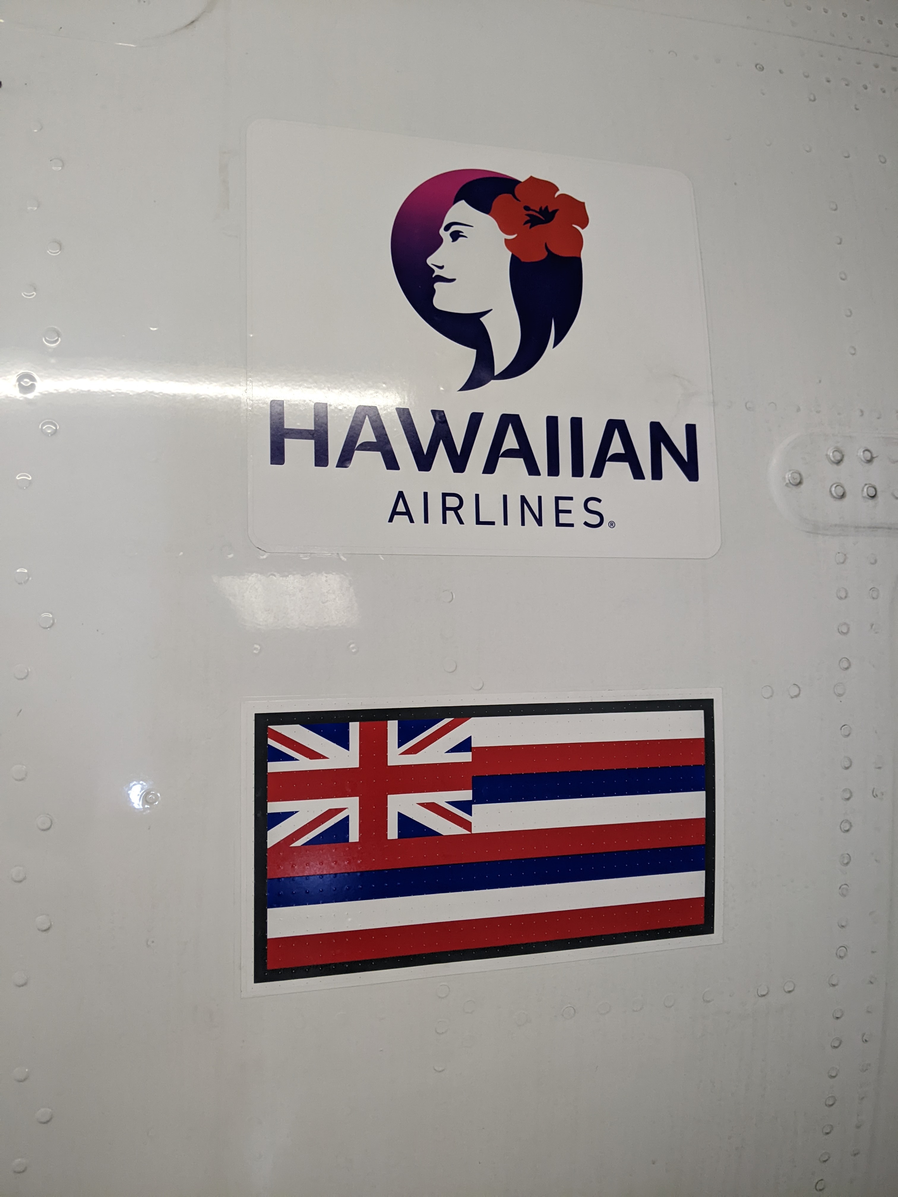

Instead, Kamehameha commissioned this new flag, that incorporated elements of both nations: the Union Jack of the British Empire is in the top left corner, while the body reflects the stripes of America’s Old Glory. The Hawaii flag’s eight stripes represent the major islands.


The sculpture of the three dancers at the airport conveyed the grace and power of the hula, the ancient dance of Hawaii. I loved how the flow of their skirts and the harmony of their movements captured the rhythm of the dance which highlighted many sacred and ceremonial occasions.


As we drove immediately from the island's west coast to the town of Hilo on the east coast, we passed absolutely nothing but barren scrubland over lava rock for almost 90 miles through the island's center. It was one of the dreariest and most depressing roads one could imagine. Signs warned drivers to be wary of "wild animals" but never indicated what sort of wild animals, definitely a first for us in all our travels!


Sarah: I thought of your stunning black and white photos when the rain started and the terrain looked even more desolate and any photo automatically became black and white!


By the time we reached Hilo, it was pouring cats and dogs so our plans to take a leisurely stroll through its historic downtown went out the window.

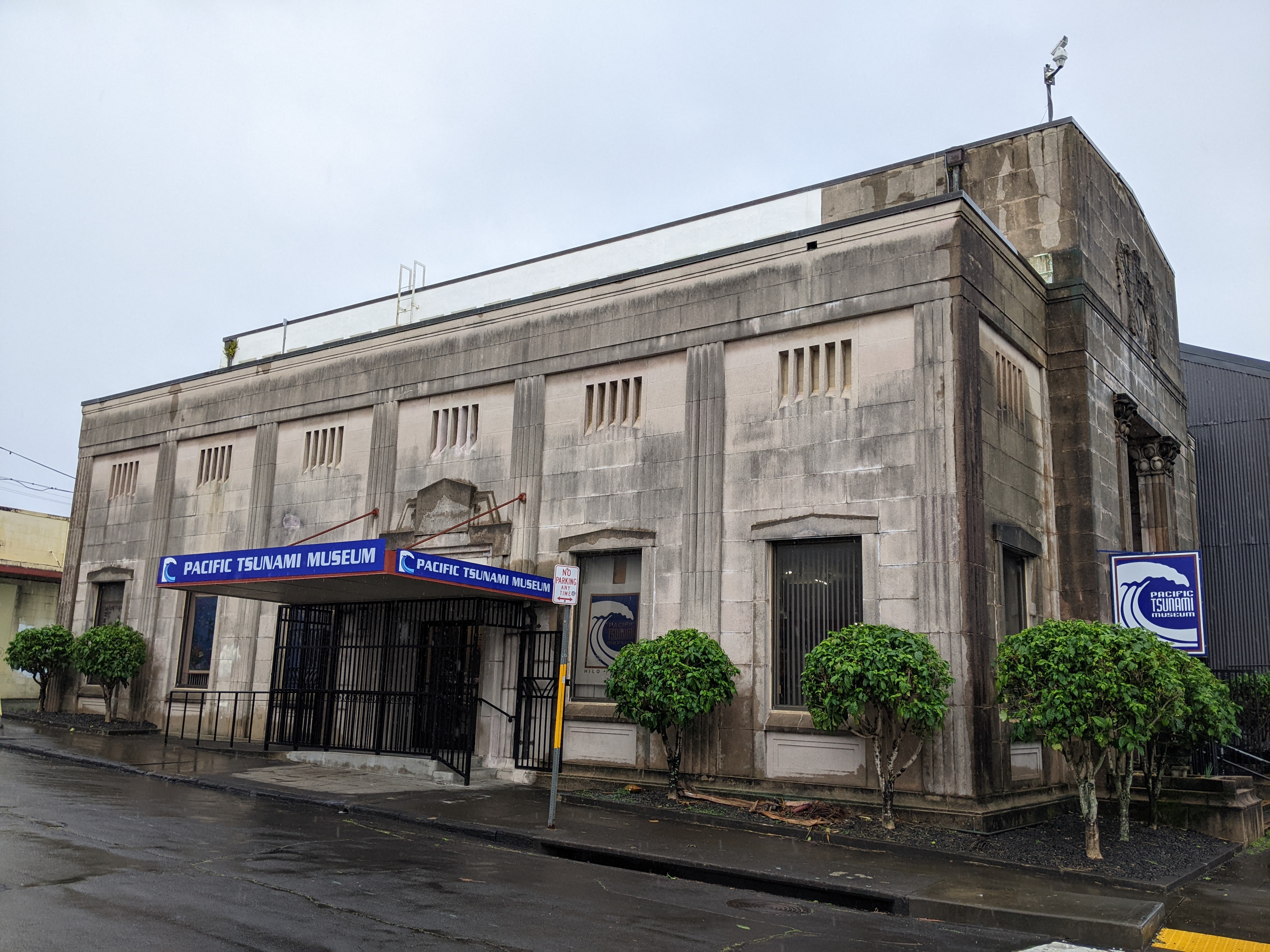
Initially, spending time in the Pacific Tsunami Museum hadn't been terribly appealing but with the rain coming down in sheets, being inside anywhere sounded ok. 


First things first - what does the word "tsunami" mean? The Japanese word tsunami translates as "harbor waves" but they are also called "seismic sea waves." A tsunami is a series of enormous waves created by an underwater occurrence such as an earthquake or landslide. A tsunami can move hundreds of miles per hour in the open ocean and smash onto land with waves as high as 100ft or more. 

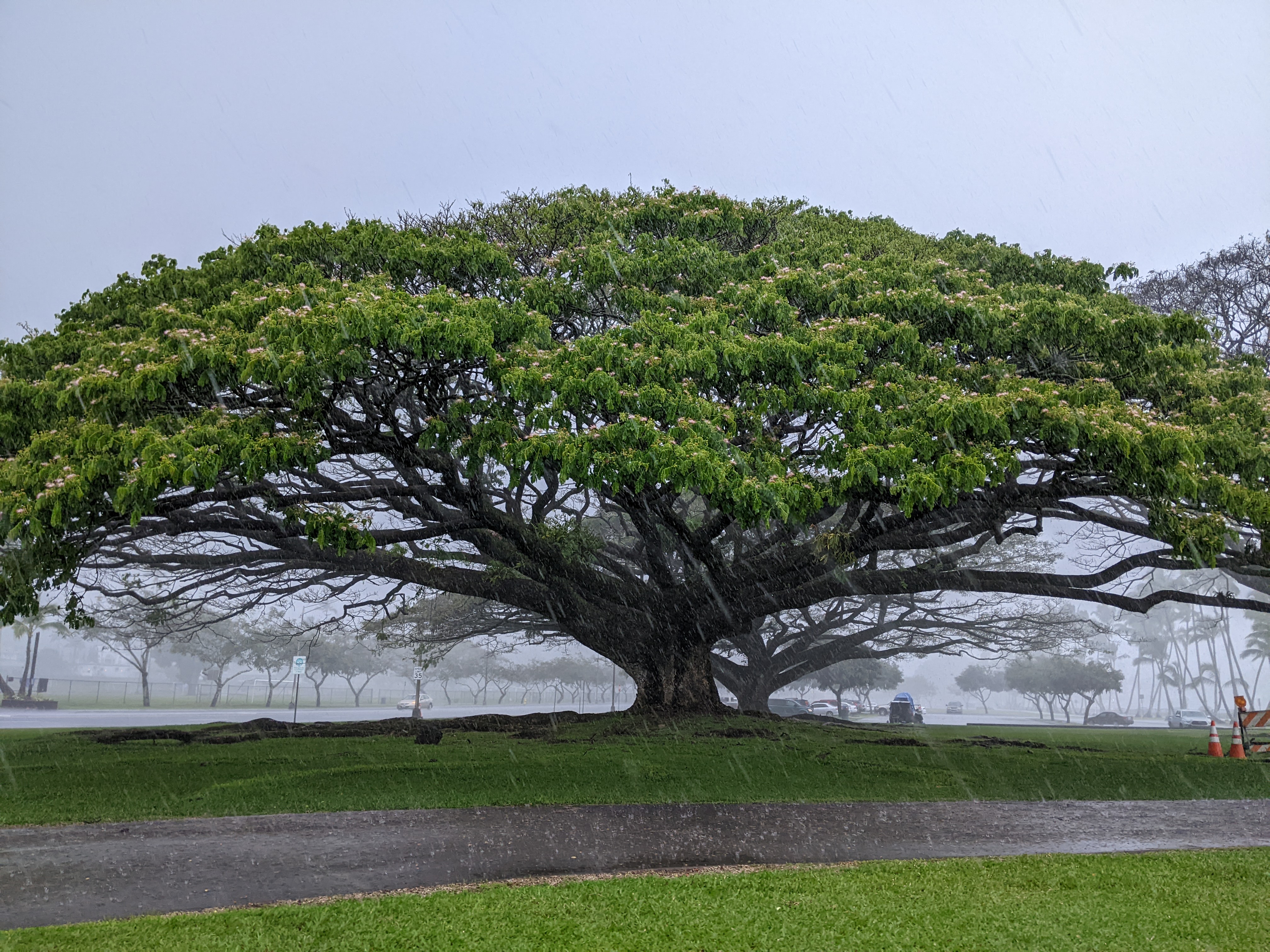
Tsunamis are a fact of life in Hilo with disastrous tsunamis hitting the town in both 1946 and 1960, causing downtown residents to flee downtown forever. Hilo has been a town shaped by tsunamis and they have no doubt struck the Hawaiian islands since they were first formed. Hilo's cultural and socioeconomic development has been shaped by its tsunami history: its railroad is gone as have the oceanfront mom and pop stores, the plantations, and sugar mills. Much of downtown Hilo is now park land which sounds lovely but belies the town's history.


Tsunami waves have most often been described as incoming or outgoing "rushes" of water with huge amounts of energy. These waves often produce severe floating and damage to coastal areas. 


The photo showed just one in a series of tsunami waves that impacted Hilo in April of 1946. It wasn't the first wave as the shoreline had already been inundated and buildings were already damaged or swept away.


After the Hilo community was asked for tsunami survivor stories in 1988, there was a push to create a tsunami museum in Hilo. The First Hawaiian Bank donated its 1930 Kamehameha branch building and the land beneath it as a permanent museum site. The Pacific Tsunami Museum opened its doors to the public in 1998.


Scientists believe "it's not if but when" the next tsunami will strike. As the museum's Scientific Advisor Chairman stated: "Since written records began in the early 19th century, at least a dozen tsunamis have roared onto the shore in Hawaii, killing 291 people, more than earthquakes, volcanic eruptions, and hurricanes together. ... The waves will come again .... will move across the Pacific at incredible speeds, sometimes with little or no warning, to crash onto the shore with unimaginable power."


Though tsunami waves are fast, seismic waves generated by earthquakes are much faster. The map shows the networks of seismometers used by the Pacific Tsunami Warning Center (PTWC) to detect and characterize earthquakes in order to estimate the threat of a tsunami. 


A tsunami warning is issued by the PTWC for earthquakes originating in Hawaii with a magnitude of 6.9 or higher. For earthquakes coming from outside the state, the bar is magnitude 7.9 or higher for a tsunami warning to be issued. With thousands of earthquakes every year, it's the third most seismically active state in the country. Rapid alerts for earthquake, volcano and tsunami events are provided by a combined network of over 100 stations in Hawaii.

Hawaii's Tsunami Observer Program was set up to record all important data associated with a tsunami event. Volunteer observers are provided with training and equipment before being located on each Hawaiian island. In the event of a tsunami, the observers are ready to be deployed to their pre-determined spots.


The museum had powerful displays and gripping oral histories of people who have been impacted by tsunamis the world over. Perhaps the most devastating one was what happened on March 11, 2011, when a magnitude 9.1 earthquake struck the coast of northeastern Japan. It was the largest earthquake ever recorded in Japan and the fourth largest globally since modern earthquake record-keeping began in 1900. The quake, which ruptured an area 300 miles long and 124 miles wide, triggered a massive tsunami that devastated communities.


The photo illustrated the force of the tsunami washing away in Yamada Town. The tsunami later disabled the power supply and the cooling system in the Fukushima Daiichi Nuclear Power Plant causing the most severe nuclear accident since the 1986 Chernobyl disaster.


I hadn't realized that Hawaii became the first state to develop tsunami evacuation maps in 1991by taking inundation data from five historical tsunamis to calculate potential tsunami inundation. Tsunami evacuation mapping has continued to evolve as technology advances.  Tsunami drills are conducted in every Hawaiian school that is in a tsunami zone.

The museum made us realize we couldn't understand Hilo without knowing its history as a two-time tsunami survivor and the steps that were subsequently taken to prepare its citizens should a tsunami come again.


With the rain letting up, we took a chance to walk around what has remained of downtown since so much of it was destroyed in the two tsunamis. It was quite frankly pretty depressing, comprised mostly of rundown shops and lackluster buildings.


The Art Deco SH Kress Company was Hilo's branch of the popular five-and-dime store until 1980.


I read that the 1910 FW Koehnen Building was supposed to be the home of a museum highlighting the Northwestern Hawaiian islands but that must have been a thing of the past.


Though the buildings generally held little appeal for me, the street art certainly did.


Just a block off the main drag was the Burns Building from 1913 which now housed a hostel. It seemed sad that such a piece of prime real estate could only make a go of it as a hostel.


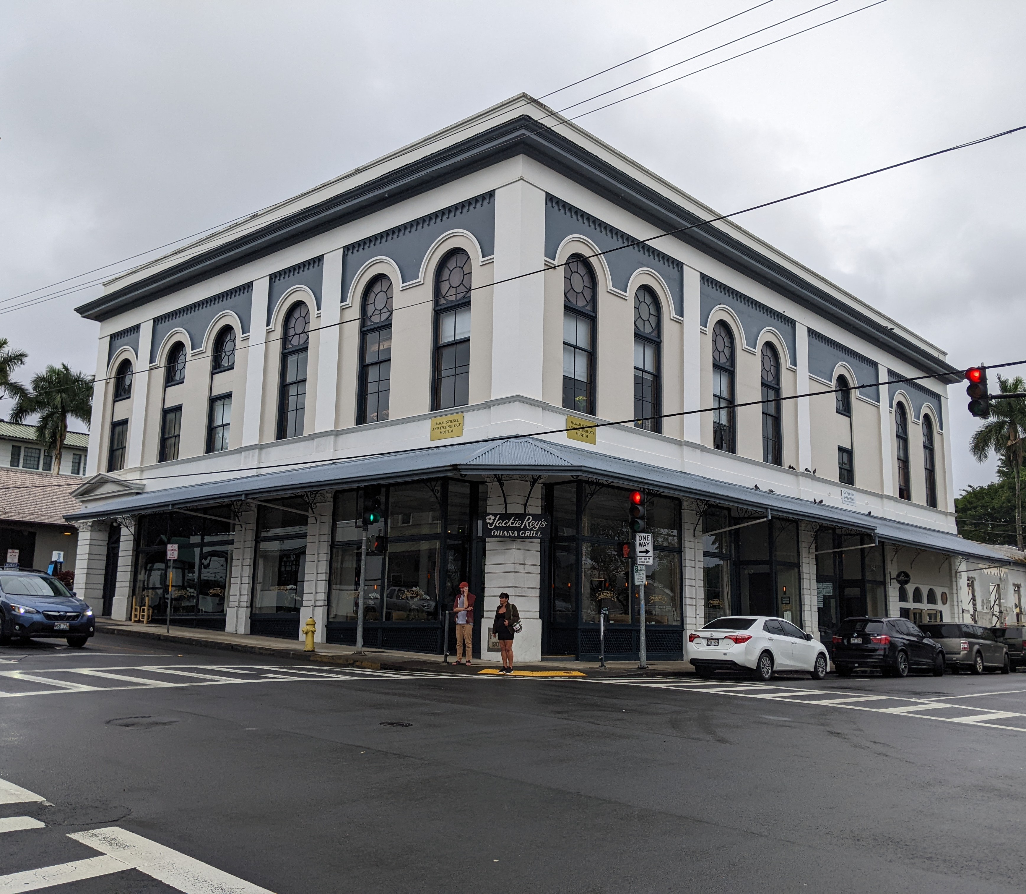
On the opposite corner was the attractive 1908 Kalkodo Building that had been built with the then-novel fireproof steel beans on reinforced concrete. Once the first Masonic Lodge, it was now Jackie Rey's Ohana Grill. 


In the small but pleasant Kalakaua Park, the lily pond honored Korean War veterans. In the center of the park was a statue of King David Kalakaua, the "merrie monarch."


The most attractive building we saw in Hilo was the 1919 Federal Building which apparently was typical of Hilo's early 20th-century government buildings.


The 1932 East Hawaii Cultural Center had once been a courthouse and then the county police department headquarters.


It was great seeing a spot of color on one of the buildings back on the main street as that cheered us up even in the rain.


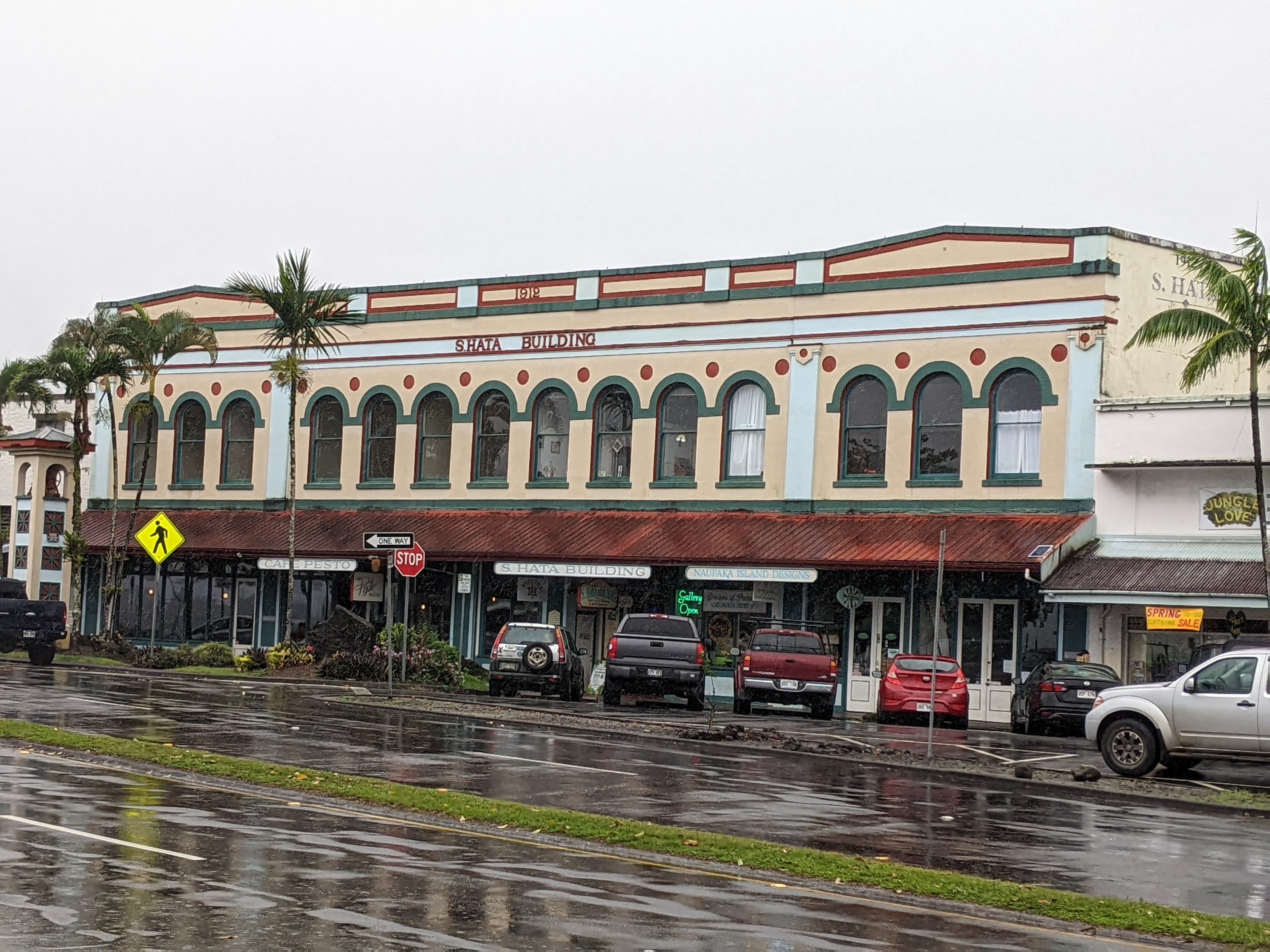
The S Hata Building was described as "a 1912 example of Renaissance revival architecture with a distinctive row of arched windows."

While Steven took refuge in the car, I dodged puddles to get to the 1905 Mo'oheau Bandstand which was a rare survivor of the 1946 tsunami.


The Tsunami Memorial Clock was permanently stopped at 1:04 which marked the morning of May 23rd, 1960, when the second major tsunami demolished Hilo. The clock had survived the previous 1946 tsunami.


Even though we found Hilo disappointing and pretty gritty, the row of giant banyan trees planted by royalty and celebrities in the 1930s was very striking.


I am the first to admit that the rain played a big factor in our non-enjoyment of Hilo as did our limited time as we arrived after noon and had to leave several hours later to reach the community of Volcano located a good distance away. Perhaps, Hilo might have tugged our heartstrings as it has for others if better weather and more time had been in our favor. 

Next post: A rainy but very worthwhile visit to Hawaii Volcanoes National Park.

Posted on May 13th, 2022, from Chicago, Illinois, where we arrived today to spend a few precious hours with our very young granddaughter, Clara.

Tuesday, May 10, 2022

4/5/22: To Maui's Heavenly Hana & Back!

After Steven and I had spent quite a bit of time discovering extensive lava tubes on Maui's celebrated Road to Hana, it was fun getting back on the road itself. The nearer we got to Hana, the more roadside trucks and farms there were.


At Waianapanapa State Park on the outskirts of Hana, many of the flower stands just had honor boxes out. Known as the 'Hana honor system,' people put money in the box in exchange for exotic wild ginger and plumeria.


Before reaching Hana Bay, we saw the old wood-frame Hana District Police Station and Courthouse that was built in 1871. The courthouse is still used infrequently for minor local affairs. Next door was the Hana Cultural Center & Museum. Both were unfortunately closed.


It was ironic that the last unspoiled town on Maui was, in fact, the home of Maui's first resort which opened back in 1946. Really a small, coastal village, Hana is located in a rainforest inhabited by just 1,200 people. Green, tropical Hana owes its lushness to the fact that it receives more than 90 inches of rain per year. Commerce was brought to Hana when the first sugar plantation was planted in 1849. That was followed by five more sugar plantations and rubber, wheat, and pineapple farms nearby by the turn of the 20th century.


Even before the state paved Hana Highway in 1962, Hana had caught the eye of writers who dubbed the community Heavenly Hana. Tourists "discovering" Hana in the 1970s were willing to make the long trek there from Central Maui. 

I admit to feeling a little anticlimactic once we reached Hana as, although it was certainly pretty enough, it wasn't an OMG moment or spot. Our day had been all about the road to Hana and not the destination itself - definitely, the journey was why we'd traveled the famous road!


A view of the village from the far side of the bay:


Beside the bay was the 386-foot, red cinder cone Kauiki Head, the scene of many fierce battles in ancient Hawaii.


A Maui institution was supposed to have been the Hasegawa General Store but it was undergoing a major facelift at the very least.


The stately 1838 Wananalua Congregational Church was placed on the National Register of Historic Places because of its location atop an old heiau or temple. Am I the only one to think that it is rather perverted to honor a Christian church intentionally placed on top of an indigenous religious building? 


Close by was St. Mary's Catholic Church. I hope it didn't share the same history.


On the green hills above Hana stood the 30-foot Fagan's Cross made of lava rock that was erected in honor of the man who put Hana on the map in the mid-1800s.


A full seven hours after setting out that morning, Steven and I left Hana for the drive back to Kihei in Central Maui. However, we decided to live life on the wild side and not just return the way we came but to continue going all the way around the eastern coast of the island. It was one of the best decisions we made as there was virtually no traffic on the road so it was far easier to find a spot to pull off the road when we saw spectacular sights like this waterfall!


We happened to be at the waterfall just moments after the man had proposed. As she was holding a printed sign that said: "I said YES," the proposal had obviously been in the works for a while!


One of the highlights of our trip to Maui had been the terrific drive several days earlier from Central Maui to the 10,023-foot summit of Haleakala National Park. The park's Kipahulu District could only be reached by continuing east along the sinuous Hana Highway. There were five phases of land use in the Kipahulu district beginning with Hawaiians settling there several hundred years ago. After Western contact began in 1848, major changes occurred when land ownership was privatized for the first time. 


Kipahulu began as a sugar plantation in the late 1880s followed by pineapples being grown in the mid-1920s. The area later became the Kipahulu Cattle Company and almost was converted into a resort until the Rockefellers, The Nature Conservancy, and local residents advocated for the lower Kipahulu Valley to be added to the national park in 1969. 


The Hawaiian proverb, "Water that recognizes no friend," describes a dangerous stream or waterfall and could easily be applied to Makahiku Falls in this section of the national park. The proverb was a warning to always be respectful of the power of natural forces as flooded streams, waterfalls, and falling rocks stop for no one in their path. I read that Makahiku also referred to water for people and the food they grow and consume. This wasn't simply a beautiful spot but a cultural journey for Hawaiians.


This tree was almost as glorious as the Indian banyan we saw in Lahaina, also on Maui.


 A hale or Hawaiian house:


Trees were in all stages of growth as park staff, volunteers, and partners worked to restore the native landscape that had been changed by a hundred years of plantation and ranch use. A key species of native Hawaiian coastal forests were these hala trees as they had so many traditional uses from weaving canoe sails to making a tonic for women following childbirth to paintbrushes to perfume and cloth!


The Kipahulu coastline has always provided bountiful marine resources for residents. The steep cliffs are home to limpet and nerite snails and the lava shelf offshore is home to mackerel, tuna, and Hawaiian spiny lobster. This ku'ula or fishing shrine generally indicated good fishing grounds and was also where Hawaiian religious offerings were left to help ensure successful fishing.


We had to make our way extremely carefully along the path because of the strong wind and proximity to the cliff. As one park sign said, your safety depends on your good judgment!


As you can imagine, sightseeing and exploring in Oheo Gulch have always attracted people. Swimming in the chilly pools became a local tradition long before this area was added to Haleakala National Park in 1969.


Though called the Seven Sacred Pools, there were actually about 24 pools!


IF you ever have a chance to visit the Kipahulu section of Haleakala, I am confident you will also count your lucky stars.


A mile past Kipahulu or Oheo Gulch as it's properly known was a dirt road off the Hana Highway to Palapala Congregational Church. Built in 1857 of limestone coral, the church was famous for being the final resting place of Charles A. Lindbergh, the first man to fly solo across the Atlantic in 1927.


After his young son died in a notorious kidnapping in 1932, Lindbergh reportedly found peace in the Pacific in the 1960s, settling in Hana where he died of cancer in 1974.


Though it was getting late, we still found the church doors open. A sign said all were welcome but visitors were reminded that out of respect for church members, relatives, and descendants buried in the graveyard, all should treat this religious site with reverence and care.


It didn't take us long to find the famous aviator's grave under river stones in the small cemetery shaded by Java plum trees. 


After visiting the church, our phone/camera batteries were so low I had to turn them off so I could use Google Maps to find our way home that evening. Everyone who loves to take photos finds themselves in the situation from time to time of missing a certain shot. That was my case times 100 as we drove along the southeastern coast of Maui from Hana and found ourselves on an 8-mile-long, scarily narrow dirt road, hugging the cliffs with one blind curve after another! Driving that road was a very fine line between extreme danger and being so excited and thrilled you didn't want to turn away. We were so lucky that there was barely any traffic as it was sunset. I know it was hellacious driving for Steven but I just ached to take photos of the experience! 


Steven wasn't too happy with me when I mentioned I'd love to redo this drive someday only so I could take photos of that treacherous road! I felt safe enough to turn on my camera again when these awesome scenes begged me to capture them.


This is actually the road for miles!!!!


We felt like we'd been transported to the wilds of Ireland or Scotland in the blink of an eye!


Steven was pretty exhausted when we finally reached our condo after 8, almost 13 hours after we left Kihei. We'd never driven so many blind curves and one-lane bridges as we did on the back-to-back hair-raising drives these last two days - one, all around Maui's east coast followed by its west coast!


Next post: On to our last Hawaiian island, Hawaii itself also called the Big Island for obvious reasons.

Posted on May 10th, 2022, from our home in Denver just before we leave the Rocky Mountains for a three-plus-month road trip east, north, AND eventually south! Steven has never been to the Canadian province of Newfoundland so The Rock will be our easternmost destination for 2.5 weeks before driving to the Florida Panhandle for our annual summer respite beginning in mid-July.