
As Steven and I boarded the plane to Kailua/Kona on the Big Island for the last part of our trip, the Hawaiian flag reminded me more of Britain than Hawaii. When I looked into the history behind the flag, I read that in the late 18th century, King Kamehameha I flew a British flag that had been given to him as a token of friendship from King George III. When an American flag was raised over Kamehameha’s home during the War of 1812 to placate American interests, it was soon removed after British officers in Kamehameha’s court opposed it.
Instead, Kamehameha commissioned this new flag, that incorporated elements of both nations: the Union Jack of the British Empire is in the top left corner, while the body reflects the stripes of America’s Old Glory. The Hawaii flag’s eight stripes represent the major islands.

The sculpture of the three dancers at the airport conveyed the grace and power of the hula, the ancient dance of Hawaii. I loved how the flow of their skirts and the harmony of their movements captured the rhythm of the dance which highlighted many sacred and ceremonial occasions.


Sarah: I thought of your stunning black and white photos when the rain started and the terrain looked even more desolate and any photo automatically became black and white!

By the time we reached Hilo, it was pouring cats and dogs so our plans to take a leisurely stroll through its historic downtown went out the window.
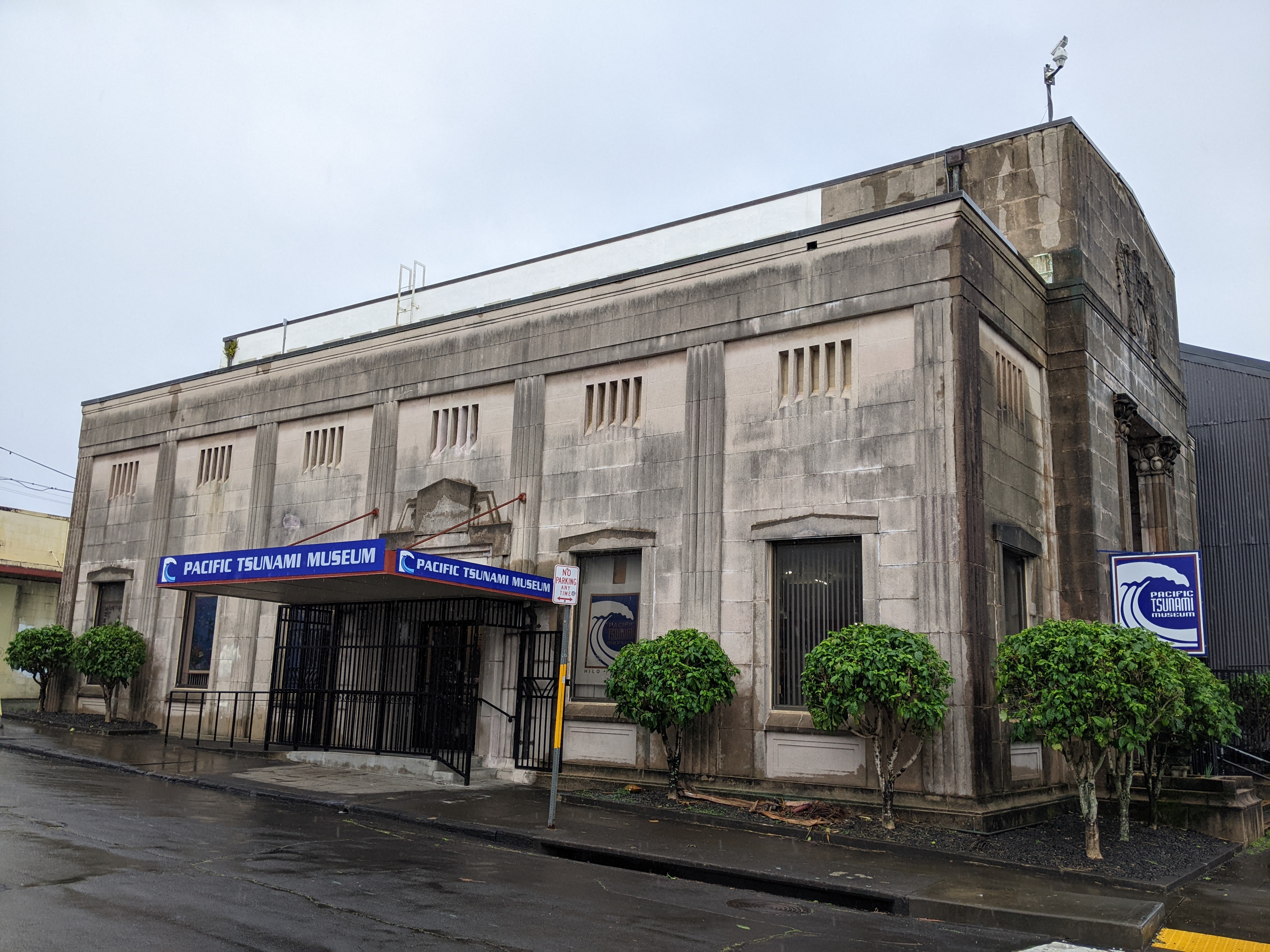
Initially, spending time in the Pacific Tsunami Museum hadn't been terribly appealing but with the rain coming down in sheets, being inside anywhere sounded ok.

First things first - what does the word "tsunami" mean? The Japanese word tsunami translates as "harbor waves" but they are also called "seismic sea waves." A tsunami is a series of enormous waves created by an underwater occurrence such as an earthquake or landslide. A tsunami can move hundreds of miles per hour in the open ocean and smash onto land with waves as high as 100ft or more.


Tsunami waves have most often been described as incoming or outgoing "rushes" of water with huge amounts of energy. These waves often produce severe floating and damage to coastal areas.

The photo showed just one in a series of tsunami waves that impacted Hilo in April of 1946. It wasn't the first wave as the shoreline had already been inundated and buildings were already damaged or swept away.

After the Hilo community was asked for tsunami survivor stories in 1988, there was a push to create a tsunami museum in Hilo. The First Hawaiian Bank donated its 1930 Kamehameha branch building and the land beneath it as a permanent museum site. The Pacific Tsunami Museum opened its doors to the public in 1998.


I hadn't realized that Hawaii became the first state to develop tsunami evacuation maps in 1991by taking inundation data from five historical tsunamis to calculate potential tsunami inundation. Tsunami evacuation mapping has continued to evolve as technology advances. Tsunami drills are conducted in every Hawaiian school that is in a tsunami zone.

Scientists believe "it's not if but when" the next tsunami will strike. As the museum's Scientific Advisor Chairman stated: "Since written records began in the early 19th century, at least a dozen tsunamis have roared onto the shore in Hawaii, killing 291 people, more than earthquakes, volcanic eruptions, and hurricanes together. ... The waves will come again .... will move across the Pacific at incredible speeds, sometimes with little or no warning, to crash onto the shore with unimaginable power."

Though tsunami waves are fast, seismic waves generated by earthquakes are much faster. The map shows the networks of seismometers used by the Pacific Tsunami Warning Center (PTWC) to detect and characterize earthquakes in order to estimate the threat of a tsunami.

A tsunami warning is issued by the PTWC for earthquakes originating in Hawaii with a magnitude of 6.9 or higher. For earthquakes coming from outside the state, the bar is magnitude 7.9 or higher for a tsunami warning to be issued. With thousands of earthquakes every year, it's the third most seismically active state in the country. Rapid alerts for earthquake, volcano and tsunami events are provided by a combined network of over 100 stations in Hawaii.
Hawaii's Tsunami Observer Program was set up to record all important data associated with a tsunami event. Volunteer observers are provided with training and equipment before being located on each Hawaiian island. In the event of a tsunami, the observers are ready to be deployed to their pre-determined spots.

The museum had powerful displays and gripping oral histories of people who have been impacted by tsunamis the world over. Perhaps the most devastating one was what happened on March 11, 2011, when a magnitude 9.1 earthquake struck the coast of northeastern Japan. It was the largest earthquake ever recorded in Japan and the fourth largest globally since modern earthquake record-keeping began in 1900. The quake, which ruptured an area 300 miles long and 124 miles wide, triggered a massive tsunami that devastated communities.

The photo illustrated the force of the tsunami washing away in Yamada Town. The tsunami later disabled the power supply and the cooling system in the Fukushima Daiichi Nuclear Power Plant causing the most severe nuclear accident since the 1986 Chernobyl disaster.

The museum made us realize we couldn't understand Hilo without knowing its history as a two-time tsunami survivor and the steps that were subsequently taken to prepare its citizens should a tsunami come again.


With the rain letting up, we took a chance to walk around what has remained of downtown since so much of it was destroyed in the two tsunamis. It was quite frankly pretty depressing, comprised mostly of rundown shops and lackluster buildings.


The Art Deco SH Kress Company was Hilo's branch of the popular five-and-dime store until 1980.

I read that the 1910 FW Koehnen Building was supposed to be the home of a museum highlighting the Northwestern Hawaiian islands but that must have been a thing of the past.


Though the buildings generally held little appeal for me, the street art certainly did.


Just a block off the main drag was the Burns Building from 1913 which now housed a hostel. It seemed sad that such a piece of prime real estate could only make a go of it as a hostel.


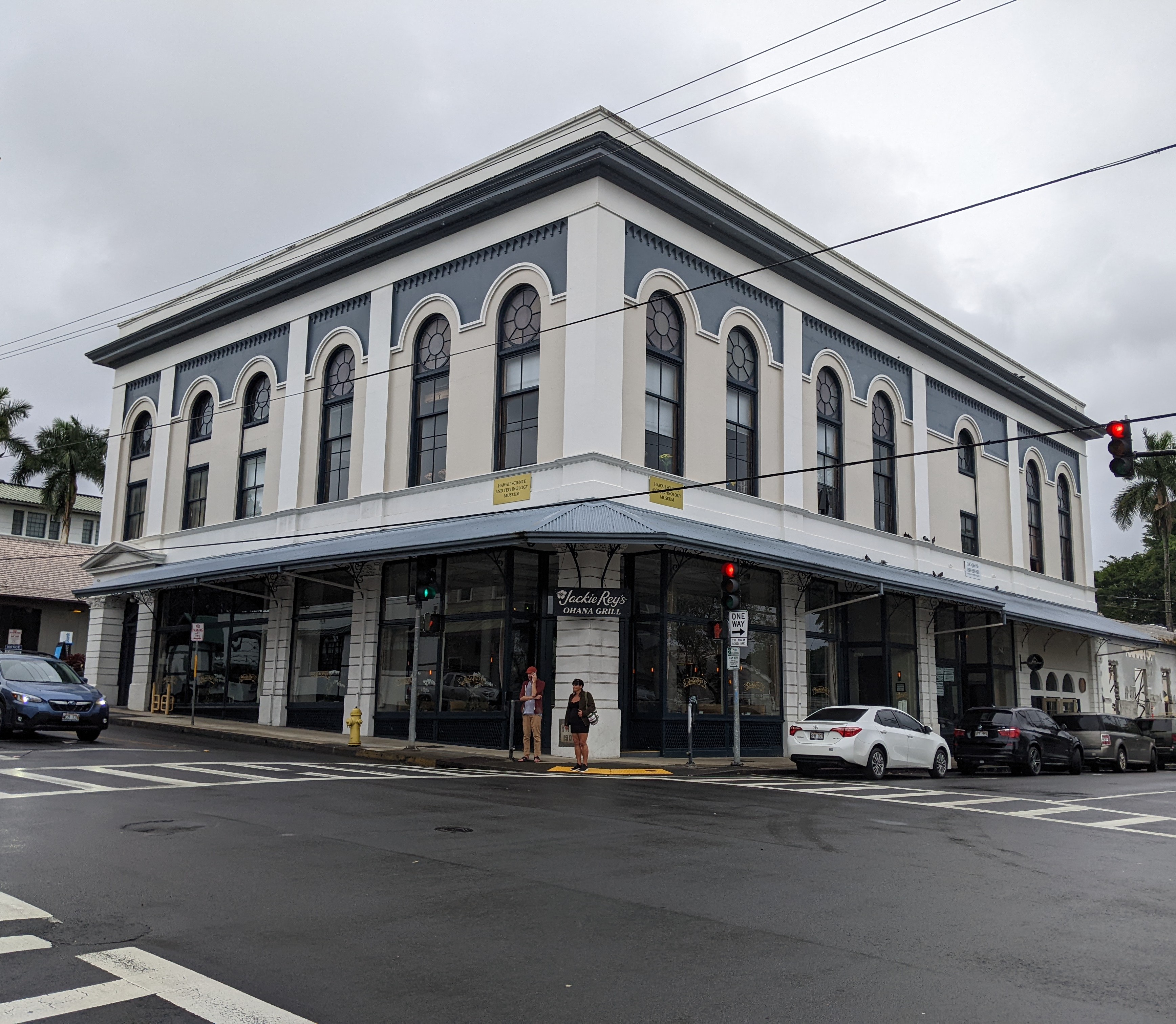
On the opposite corner was the attractive 1908 Kalkodo Building that had been built with the then-novel fireproof steel beans on reinforced concrete. Once the first Masonic Lodge, it was now Jackie Rey's Ohana Grill.

In the small but pleasant Kalakaua Park, the lily pond honored Korean War veterans. In the center of the park was a statue of King David Kalakaua, the "merrie monarch."


The most attractive building we saw in Hilo was the 1919 Federal Building which apparently was typical of Hilo's early 20th-century government buildings.

The 1932 East Hawaii Cultural Center had once been a courthouse and then the county police department headquarters.


It was great seeing a spot of color on one of the buildings back on the main street as that cheered us up even in the rain.

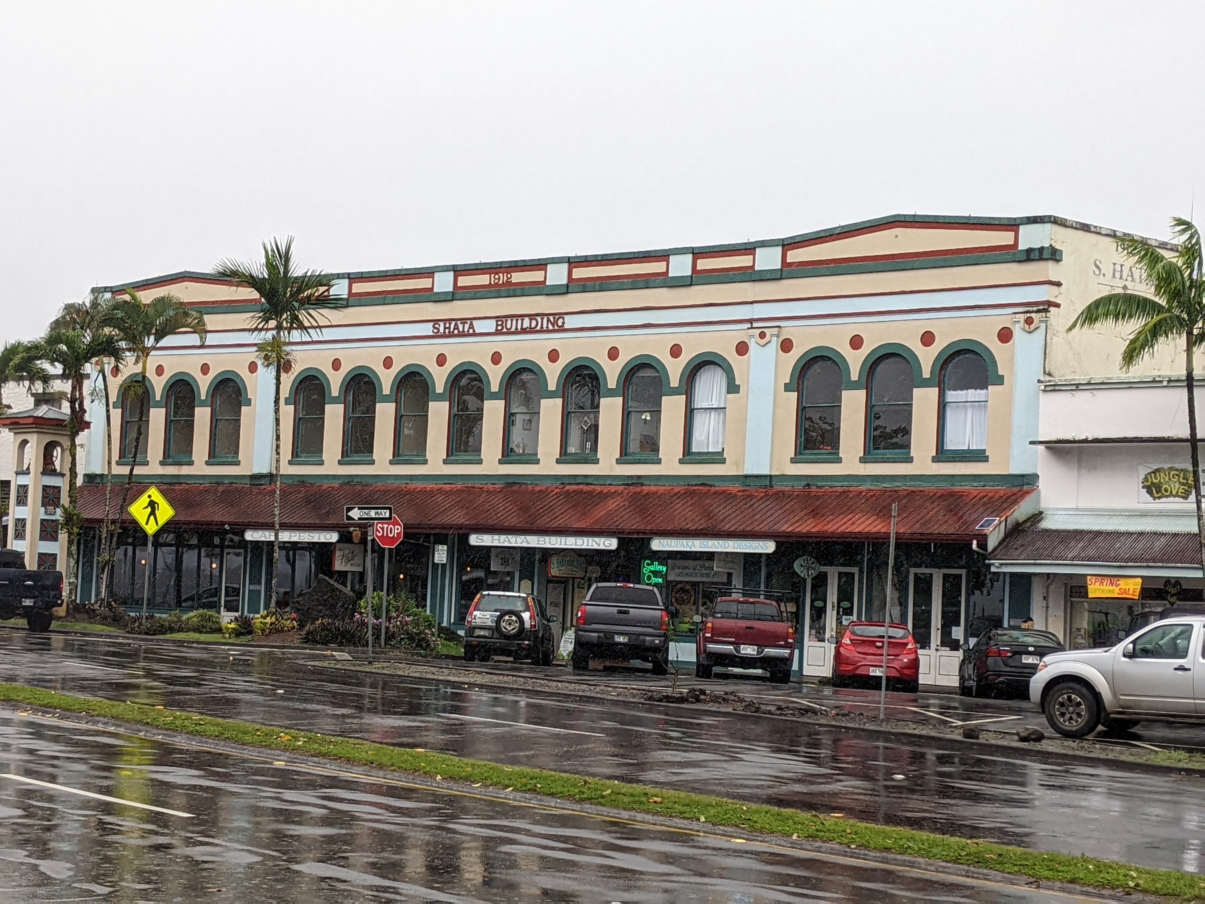
The S Hata Building was described as "a 1912 example of Renaissance revival architecture with a distinctive row of arched windows."
While Steven took refuge in the car, I dodged puddles to get to the 1905 Mo'oheau Bandstand which was a rare survivor of the 1946 tsunami.

The Tsunami Memorial Clock was permanently stopped at 1:04 which marked the morning of May 23rd, 1960, when the second major tsunami demolished Hilo. The clock had survived the previous 1946 tsunami.

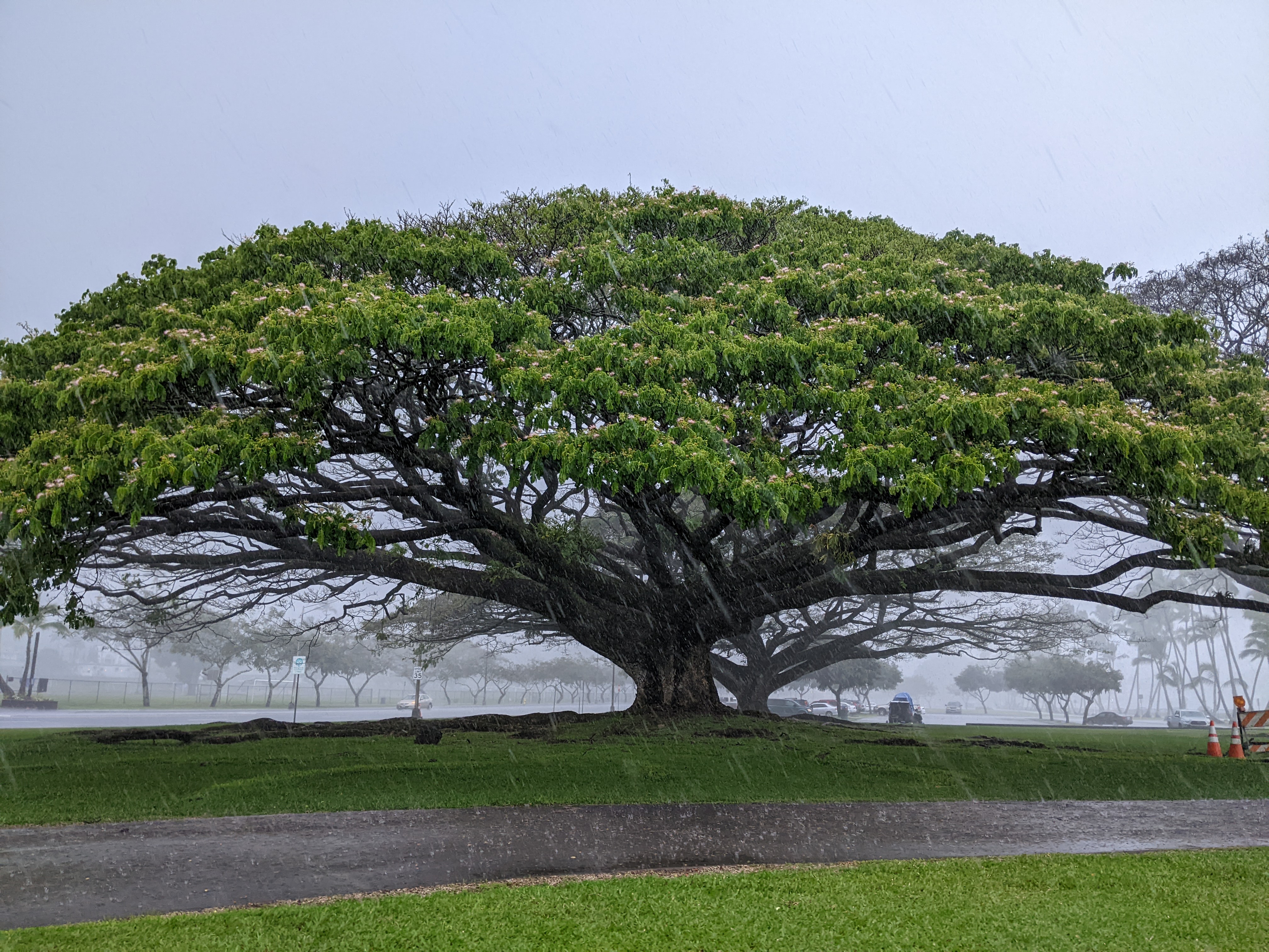
Even though we found Hilo disappointing and pretty gritty, the row of giant banyan trees planted by royalty and celebrities in the 1930s was very striking.

I am the first to admit that the rain played a big factor in our non-enjoyment of Hilo as did our limited time as we arrived after noon and had to leave several hours later to reach the community of Volcano located a good distance away. Perhaps, Hilo might have tugged our heartstrings as it has for others if better weather and more time had been in our favor.
Next post: A rainy but very worthwhile visit to Hawaii Volcanoes National Park.
Posted on May 13th, 2022, from Chicago, Illinois, where we arrived today to spend a few precious hours with our very young granddaughter, Clara.
No comments:
Post a Comment