
Flowers at our Volcano rental:


After spending the entire previous day in Hawaiian Volcanoes National Park on the east side of the Big Island, we had a long day ahead of us from the village of Volcano to the island's major city of Kona. If you know our traveling style by now, there's almost never a straight line between any two places for us if we can possibly add on places north, west, east, AND south of the two places! That was definitely the case this past April 8th when instead of going northwest toward Kona, we headed east toward Hilo, then southeast toward the coast along the South Puna Road.

Our initial destination was the Pahoa Transfer Station, billed as an award-winning solar-powered solid waste management marvel, but we weren't there to look at its trash! Rather, it was to see how one arm of the July 27th, 2014 Lava Flow threatened the facility with smooth-flowing lava oozing through the fence that was trying to keep it at bay! This was a daily reminder of the near-apocalyptic scene of how close residents came to losing everything.


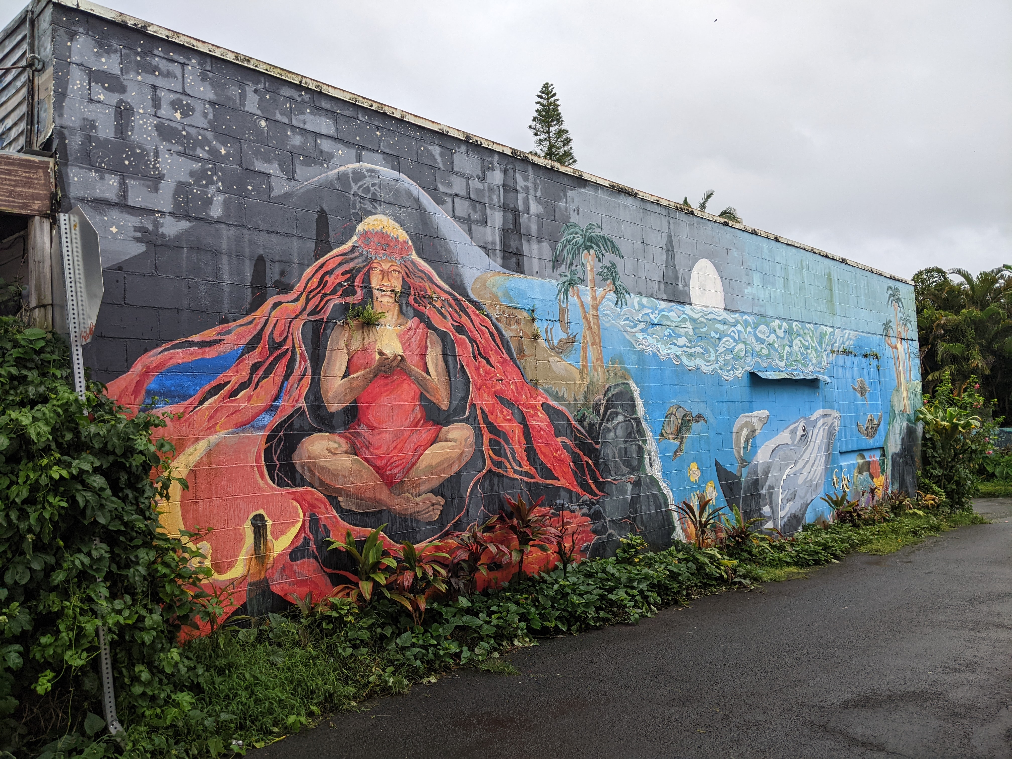
The only word we could possibly think of to describe the town of Pahoa was "funky" with its electric paint choices and vibrant murals! The elevated covered sidewalks and flat-fronted storefronts reminded me of an Old West town gone amok.


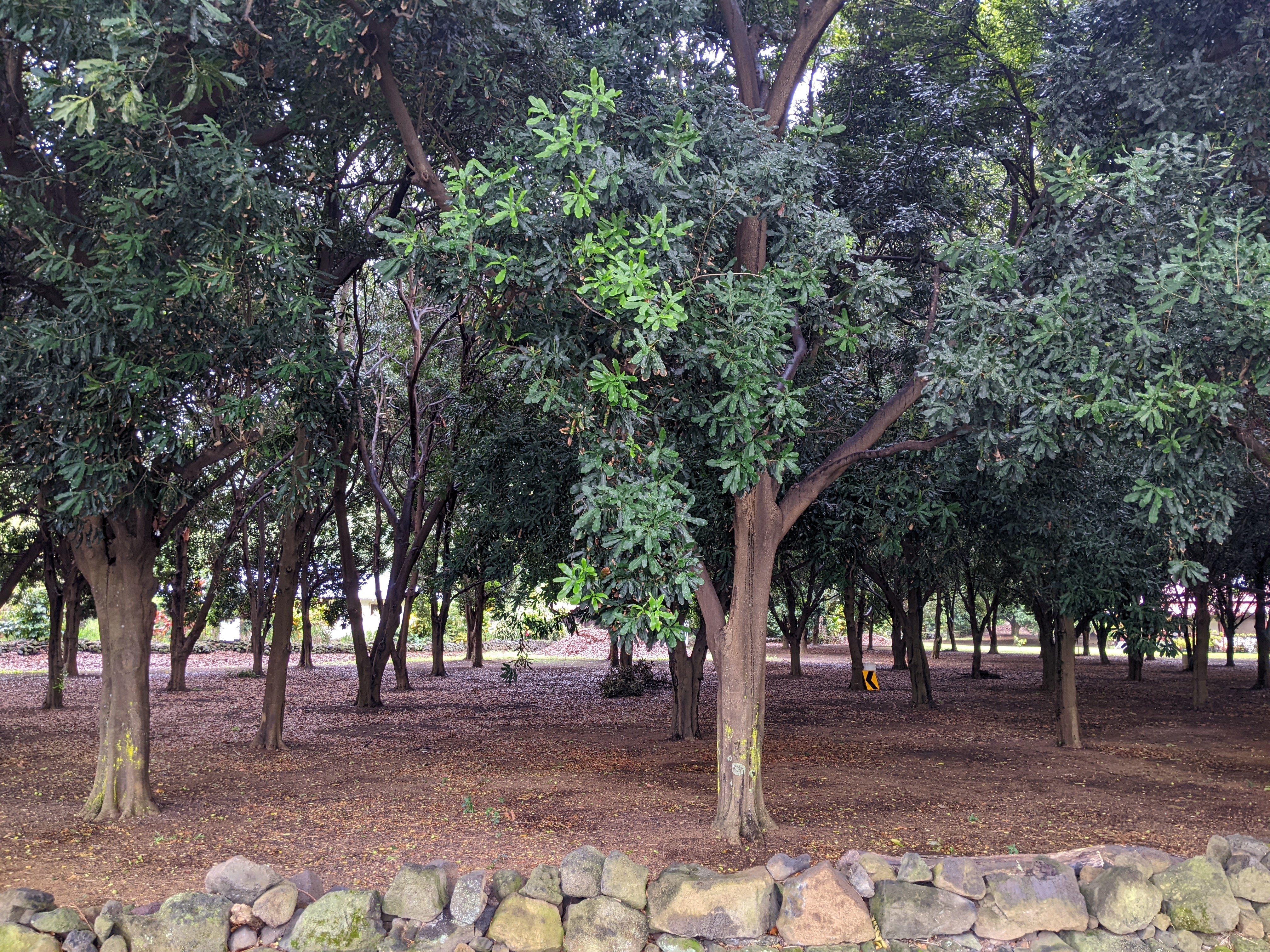
Not too far away in Puna was the Lava Tree State Monument which was comprised of a grove of mature 'ohi'a trees and uluhe ferns in an area that had been part of the Kilauea volcano. The plants thrived in the rich, moist organic soils formed atop earlier lava flows.

When a fiery eruption three centuries ago from Kilauea sent red-hot lava flowing down the volcano slopes, falling and burning trees followed in the wake of the lava flow. The stark landscape made up of tree molds recorded the lava's maximum thickness as it passed the 'ohi'a trees.

The ghostly-looking towering impressions of destroyed tree trunks were the result as the lava receded. Nature is so remarkable that lichens and ferns began to grow in just months in the moist lava cracks!

Though there were about 85 lava tree molds preserved in the park, only about half of them were visible from the trail. As you no doubt can imagine, climbing on them or touching them was absolutely verboten as that would hasten their deterioration and collapse.

We'd read that the quarter-sized Coqui Puerto Rico frog would be very tough to see here in the monument but its distinctive "ko-kee" call certainly echoes throughout the park. Accidentally introduced in 1990, the coqui population has subsequently exploded in Puna, and its nightly chirping registers between 90 and 100 decibels from two feet away! The number of these tiny frogs is the highest in the entire state around the monument and twice that of their native habitat.

The park's collection of ferns was almost as spectacular as the tree molds.

Some of the molds had fallen and broken while others were in various stages of collapse from natural causes. I'd definitely not want to be here at night time or on a haunted tour when the tree molds might look like otherworldly beings!
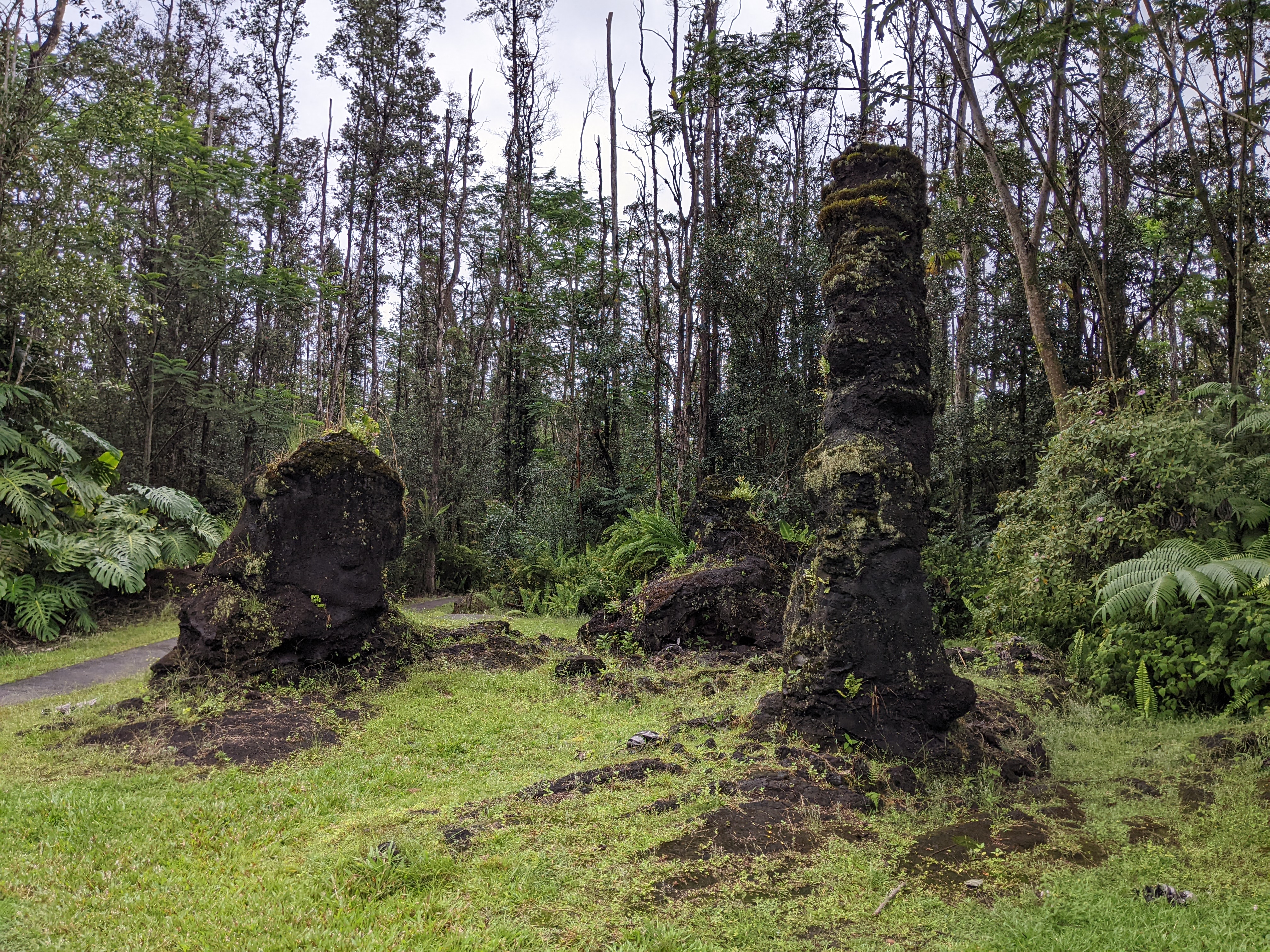

It was fascinating to see how a new forest of 'ohi'a trees had become established among the tree molds and realize a similar forest would have existed at the time of the lava flow. The burning of the trees and the draining of the lava left an incredible diversity of sizes and interesting shapes.


These certainly looked like fiddlehead ferns but I didn't know they existed in Hawaii. Funnily enough, I'm writing this about six weeks later from Saint John, New Brunswick, where Steven and I saw fiddlehead ferns for sale in the local farmers' market!


I wonder if this massive tree in the monument was a non-native albizia that had toppled in Hurricane Iselle's high winds.


We've seen a lot of very unusual things in our travels but these tree molds rank near the top for natural oddities. For us, it was certainly a worthwhile stop.

As we continued to Kapoho Beach, we were amazed how engineers had been able to construct the road cut right through hardened lava. It reminded us of villages in Iceland we'd seen on our first overseas trip together in 2013 when molten lava came so close to a road that entire villages had to be evacuated.
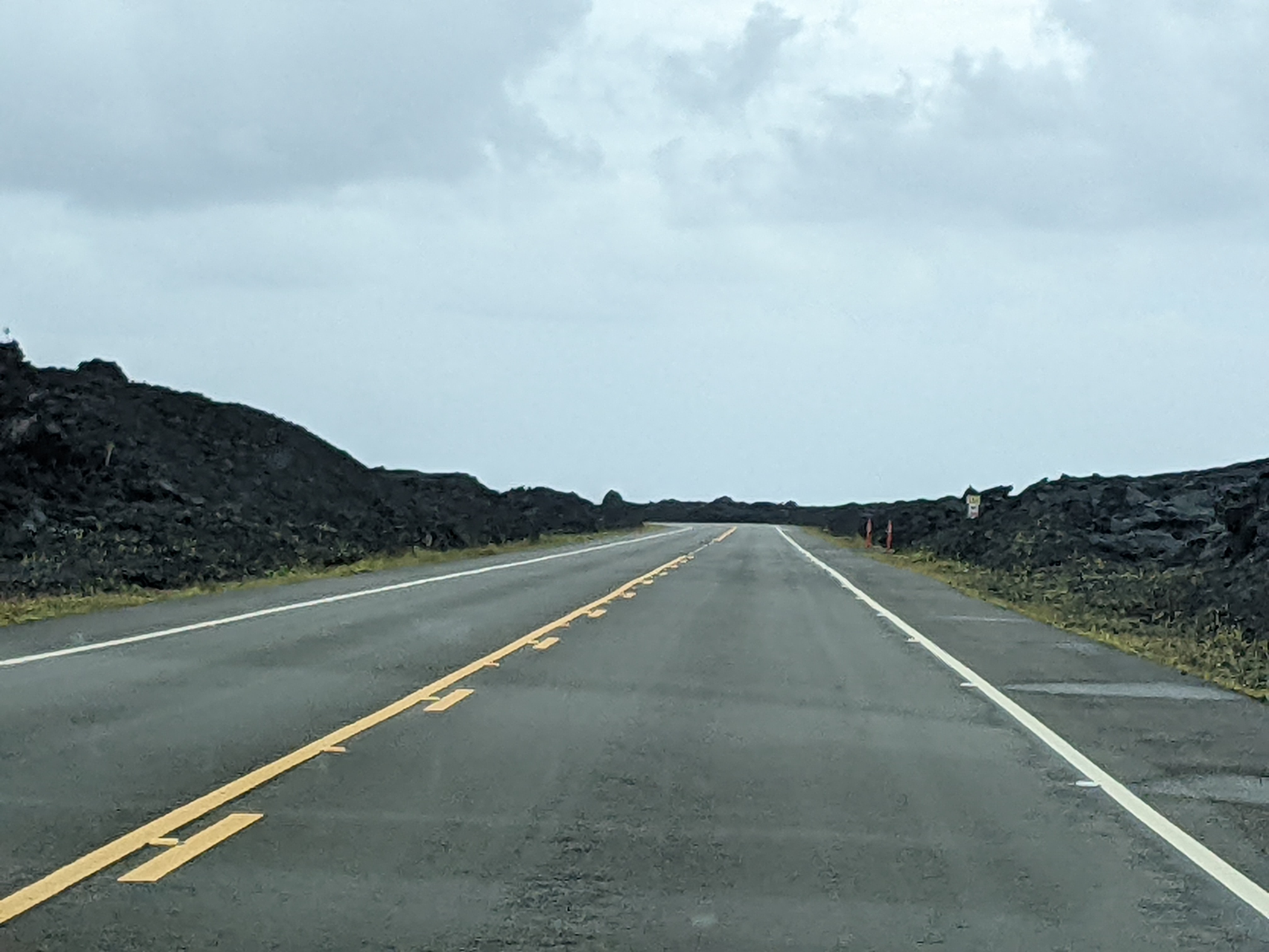
The barren landscape continued for miles and miles. Goodness only knows what had once lain under the lava.


A shrine to a young man who had died:


When we reached where Google Maps said Kapoho Beach should have been, there was nothing but endless lava to see. The Kapoho Tide Pools we'd also hoped to look at no longer existed so we had to backtrack and head inland again.

We had to return to Pahoa and then head southwest and east to reach Kehena State Beach another way.

We joked we were at least getting a free roller coaster ride on the decidedly-not-red Red Road aka Highway 130.

A small parking lot led to what was described as one of the best patches of sand in Puna at Kehena Beach.

As enticing as the black-sand beach looked, the path down was pretty treacherous so we contented ourselves with a few shots from above. Plus, our skinny-dipping days are long behind us!


We continued on to Mackenzie State Recreation Area past forested coastlines and spectacular monkeypod tree tunnels that both took our breath away.


The state recreation area was almost empty, possibly because of its remote location.


Lots of bacon on this pig!

After making our go-to peanut butter and tuna sandwiches, we walked over to the cliffs but made sure to stay away from the edge after seeing these signs and knowing people had been swept over the cliffs.


The powerful waves had even created this sea arch.

It was more than a little humorous when we noticed signs saying "narrow, winding road" but it was nothing like what were truly narrow, winding roads on Maui!

The Star of the Sea Painted Church was originally built on the shoreline of Kaimu Black Sand Beach. From the outside, the church looked quite plain, but it was famous for the well-preserved, beautiful hand-painted murals and paintings that cover most of the walls and ceiling inside the church. It was so important to the community of Kalapana that it was hauled out of the way of the approaching lava in 1990 when lava flows from the Kupaʻianaha vent of Kilauea destroyed and partly buried most of the town. Thank goodness it was relocated to this safer spot three miles away because the beach was buried under 80 feet of lava!

The church, listed on the National Register of Historic Places, was built in 1928 by a Belgian Catholic priest, Father Evarist Matthias Gielen, in the colonial revival architectural style that was typical for many wooden churches built in Hawaii during the missionary era.

His magnificent paintings covered the vaulted ceiling, across the central nave, as well as above the altar and the portico area. These life-sized, elaborate paintings depicted various scenes and religious characters from the Catholic Book of Catechism. Father Gielen was said to have done all his artwork at night by the light of an oil lamp!


The lower part of the church was painted in 1941 by American artist George Heidler. His paintings tell the life story of another Belgian priest, Father Damien De Veuster, who came to Kalapana in 1864 before going to the remote Hawaiian island of Molokai to oversee a leprosy colony in 1873.


Lepers were considered outcasts by society and forcibly quarantined by the government as a means to prevent the spread of leprosy. After caring for the lepers for 16 years, Father Damien himself eventually died of leprosy in 1889. After being canonized by the church in 2009, he became known as St. Damien of Molokai, the patron saint of lepers.


The church's vibrant colors, exquisite details, and fascinating stories behind the artwork must enchant all who know about it.

The 1990 lava flow that erased Kalapana from the map failed to consume the nearby Uncle Robert's family compound, however. One of the most uncomfortable places I remember being at, it was part restaurant, part cafe, part market, and just gave off the weirdest vibes that made me want to turn around and get back to the safety of our car where Steven had wisely stayed!

The Hawaiian flag:


Driving southwest finally for the first time that day, we headed toward the town of Pahala and Ka'u Coffee Mill. En route, we noticed vegetation growing through the lava flow ...

and then stunning verdant hills that reminded us of our travels in Italy last fall.


I wondered if these might have been macadamia nut trees as this area was famous for its nut tree farms?

Lezlie: You'd be interested to know that the hydro-powered coffee farm is known for roasting its own award-winning coffee beans which are rated as high as Kona coffee by some connoisseurs. Unfortunately, we arrived too late for its last tour so just had to "make do" in the gift shop instead!


I very much doubt I was supposed to, but I poked around and talked to a couple of workers who told me that the dark brown beans were the "natural" beans and the others were the washed beans. Beans dry for one week on the ground or 24 hours in the mechanical dryer.
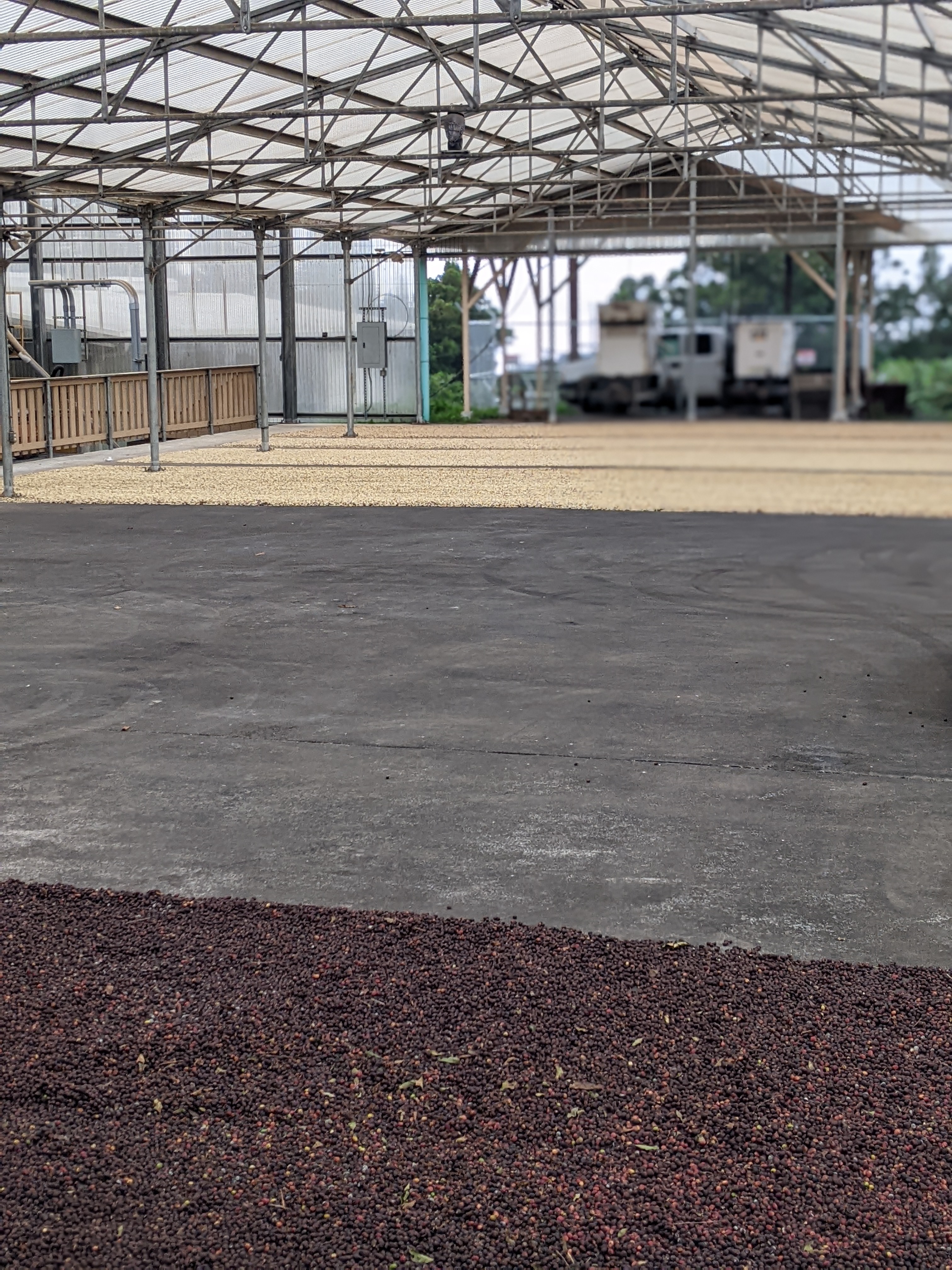


One of the men mentioned that the coffee plants I'd noticed behind the shop are cut down every five years to regrow.


Down the same road in Pahala was Wood Valley Temple, a Tibetan Buddhist temple nestled in a 25-acre forested retreat.


Once a major Hawaiian settlement, Punalu'u was now mostly an uninhabited black sand beach flanked by temple ruins.

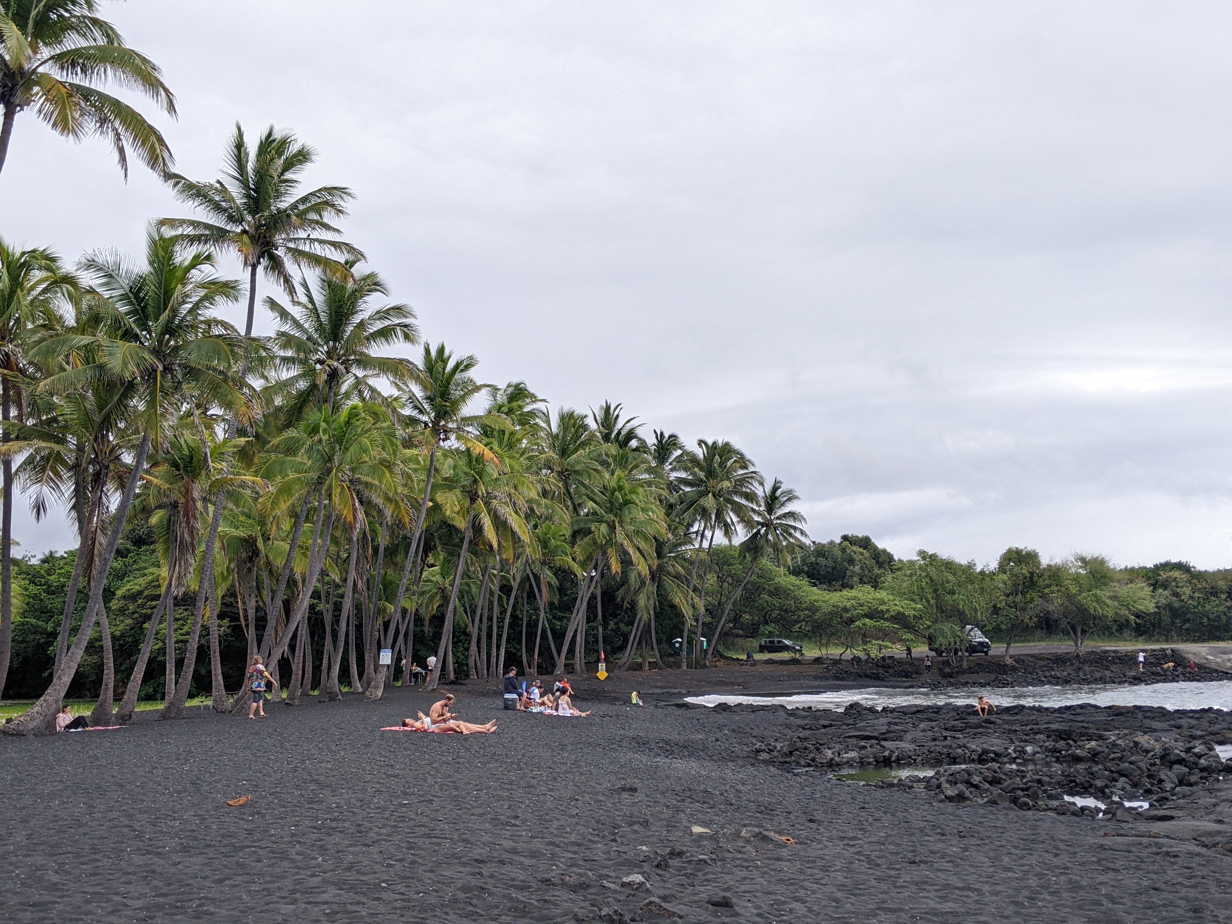

I would have loved to take home some of the black sand but signs alerted people it was against the law. Too bad some didn't even manage to find its way into my shoes!

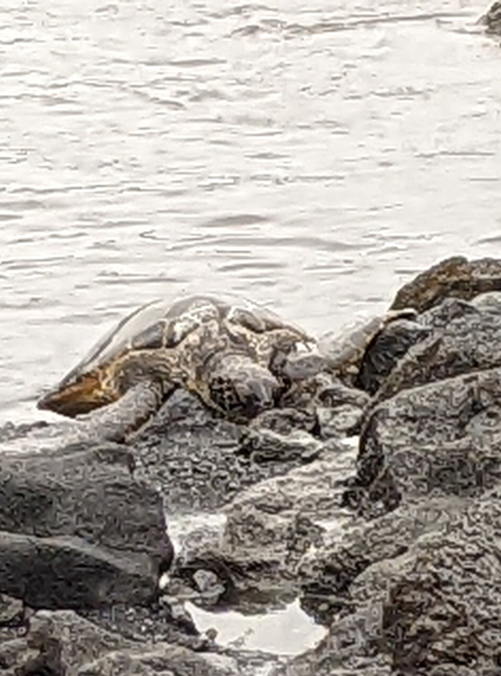
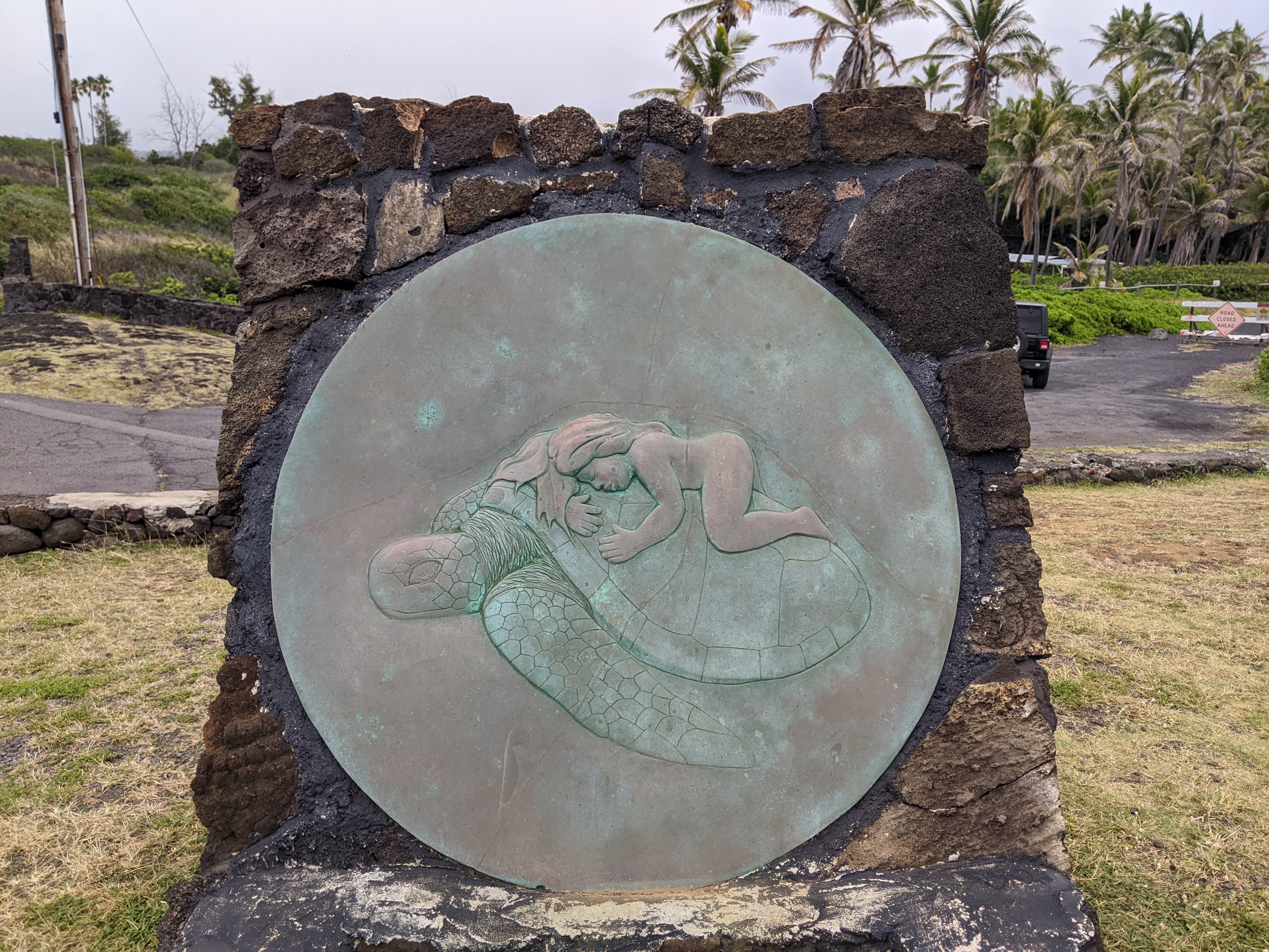
The beach attracted us particularly for its sea turtles that must manage okay even with all the throngs of people like us eager to see them.


As unbelievably stunning as this area also was, it was a little disconcerting seeing Entering Tsunami Evacuation Zone signs everywhere!

As we headed further west along the southern coast, the views were just drop-dead gorgeous at Haleokane Overlook, also known as the Honu'apo Bay Overlook. These killer views were on the longest stretch of undeveloped shoreline in either the state or the island of Hawaii, I'm not sure which.

The landscape was so markedly different from what we'd seen earlier on the island's southeast coast.


If it had been a clear day, we might have been lucky to see Kilauea's Halema'uma'u crater.

The tiny village of Na'alehu which meant "Volcanic Ashes" is the southernmost 'town' or enclave in the US with a population of just 866 souls.

Along the main street was the boarded-up Na'alehu Theatre, a 1940s movie house.

The town was also known for its Mark Twain Monkeypod Tree although the historical marker pointed to a grove of trees and not any singular one. According to legend, Twain wrote a letter home in 1866 about "trees and flowers flourish luxuriantly ... will live in my memory as the greenest, freshest, and most beautiful I ever saw."

Our last exploration of the day took us south of Na'alehu along the South Point Road to as far south as was possible before falling off the edge of the US!


The site of the 1868 Lava Flow was now the site of the Swedish Space Corporation's satellite tracking station! Sadly, much of this land that had been promised to Hawaiian families by the Department of Hawaiian Home Lands, was still left mostly vacant because of decades of administrative and funding issues. It sounded all too much like a familiar tale to indigenous people throughout North America.

We could actually see where the lava had roared down the hill!


A few miles further on were what was described as the "rusty carcasses" of 37 windmills from the failed Kamoa wind farm but these ones looked "alive and kicking" to me.

When we reached Ka Le at the southernmost tip of the island, I strolled around for a bit while Steven rested in the car as we were still a ways from our condo in Kona-Kailua that night.


Now, having reached the southernmost point of the US, I guess it would be pretty neat to also travel to Barrow, Alaska, the northernmost point someday!

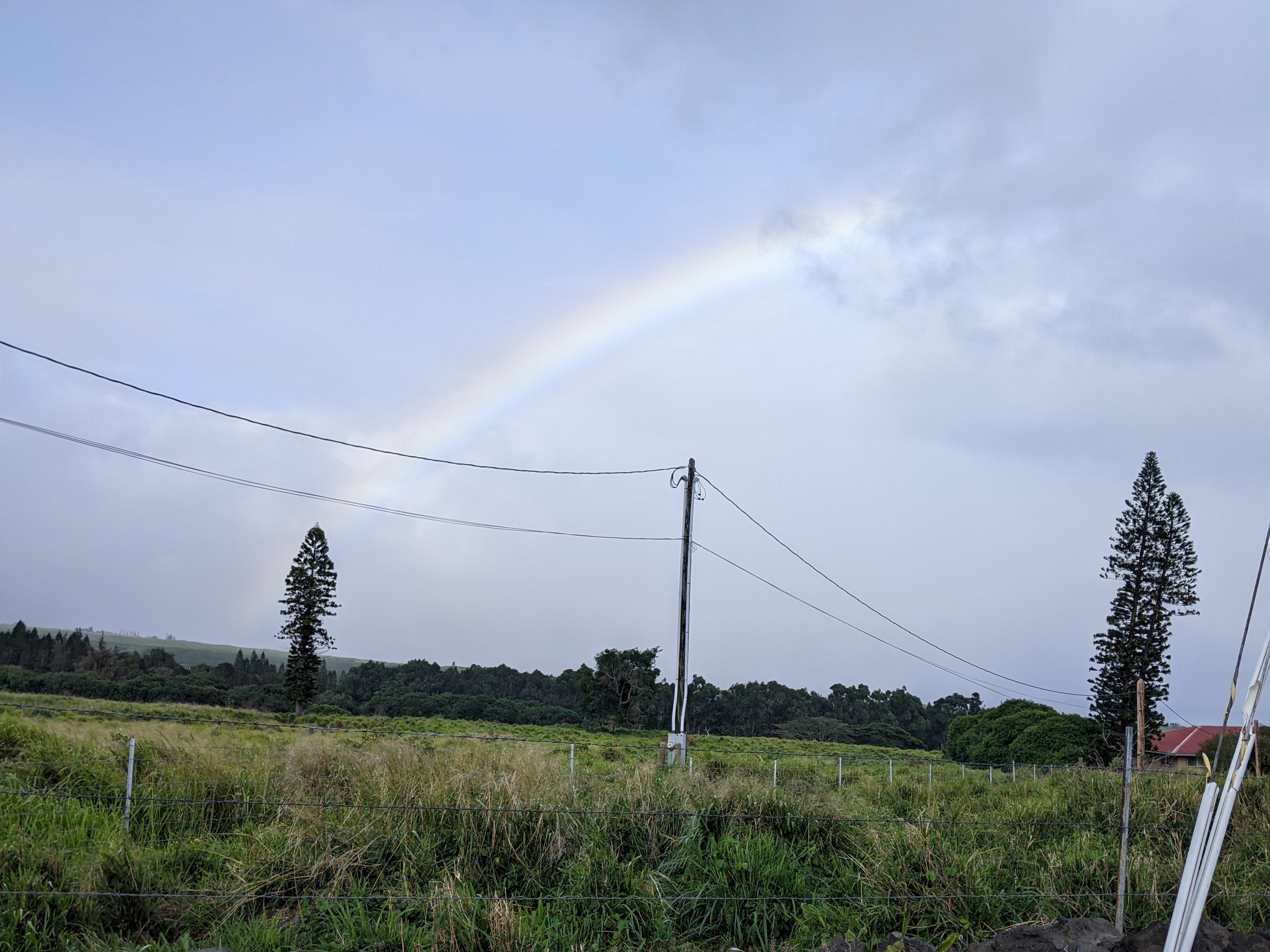
The rainbow was exceptionally pretty as we drove the final 60 miles of a 300-mile day north toward Kailua-Kona.
Next post: A more relaxing day at some of the island's beaches, thank goodness!
Posted on May 27th, 2022, from my father's hometown of Saint John, New Brunswick, where we came for a couple of nights between a visit to Quebec City before heading to visit long-time friends in Nova Scotia.
Lovely pics Annie, not only the subject matter which is highly expressive and impressive.
ReplyDeleteWow, that was fast, Andrew! Thanks for reading and posting.
ReplyDeleteRaven black pebbly sand is certainly not the norm for beach lovers ! And I agree with Andrew-- your photos are wonderful, especially the one of you and Steven! Perhaps it belongs in your birthday frame :)
ReplyDeleteThanks for the kind comment about the photos. Nice to have an additional one for the frame!
ReplyDelete