

From the village of Volcano where we had stayed the night before on our arrival on the island of Hawaii, we drove to the Visitor Center at Hawaii Volcanoes National Park.

Lured by the volcanic forces, the park's Volcano House has hosted many world dignitaries and visitors from around the world since the original building opened in 1846. Queen Liliuokalani, who reigned at the time of the overthrow of the Hawaiian Kingdom in 1893, and Hawaii's last king, King Kalakaua, were described as reveling in the beauty of Kilauea while staying at Volcano House. The hotel has also hosted other famous guests like Mark Twain, Robert Louis Stevenson, Amelia Earhart, Louis Pasteur, and President Franklin Delano Roosevelt.


After the original Volcano House burned down in 1940, it was rebuilt in this current location.

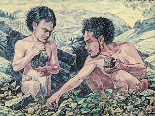
The sculpture, Ulumau Pohaku Pele, which translated to the "ever-growing rock of Pele," honored the sacredness of Mauna Loa and Kilauea as well as the goddess Pelehonuamea, the creator of these volcanic islands. According to Hawaiian tradition, people should be respectful when in the presence of Pele as "she embodies all things volcanic." Therefore, the sculpture shouldn't be touched, disturbed, or climbed on.

As we walked along the Sulphur Banks Trail, we made sure not to step off it after seeing this sign!


Another thing to be wary of!

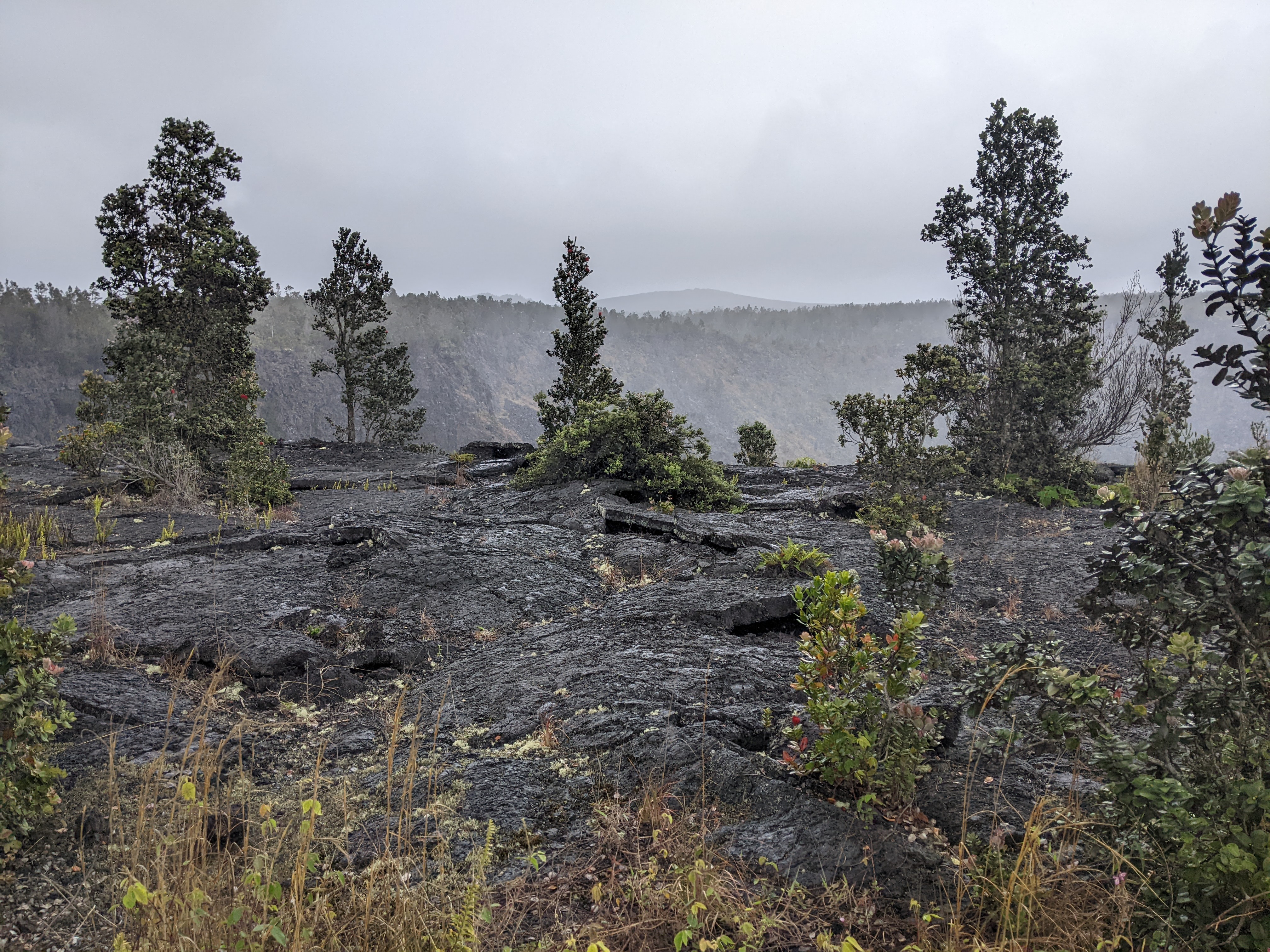
Sulphur Banks was on a terrace between the inner and outer caldera walls. The rocky cliffs showed how far the terrace had dropped when the summit collapsed. When Kilauea's summit collapsed 300 years ago, volcanic gases rose to the surface through deep faults and fractures as a result.

After the repeated loss of magma further collapsed along deep faults, these down-dropped blocks formed the 'stair-step' cliffs we saw around the caldera.


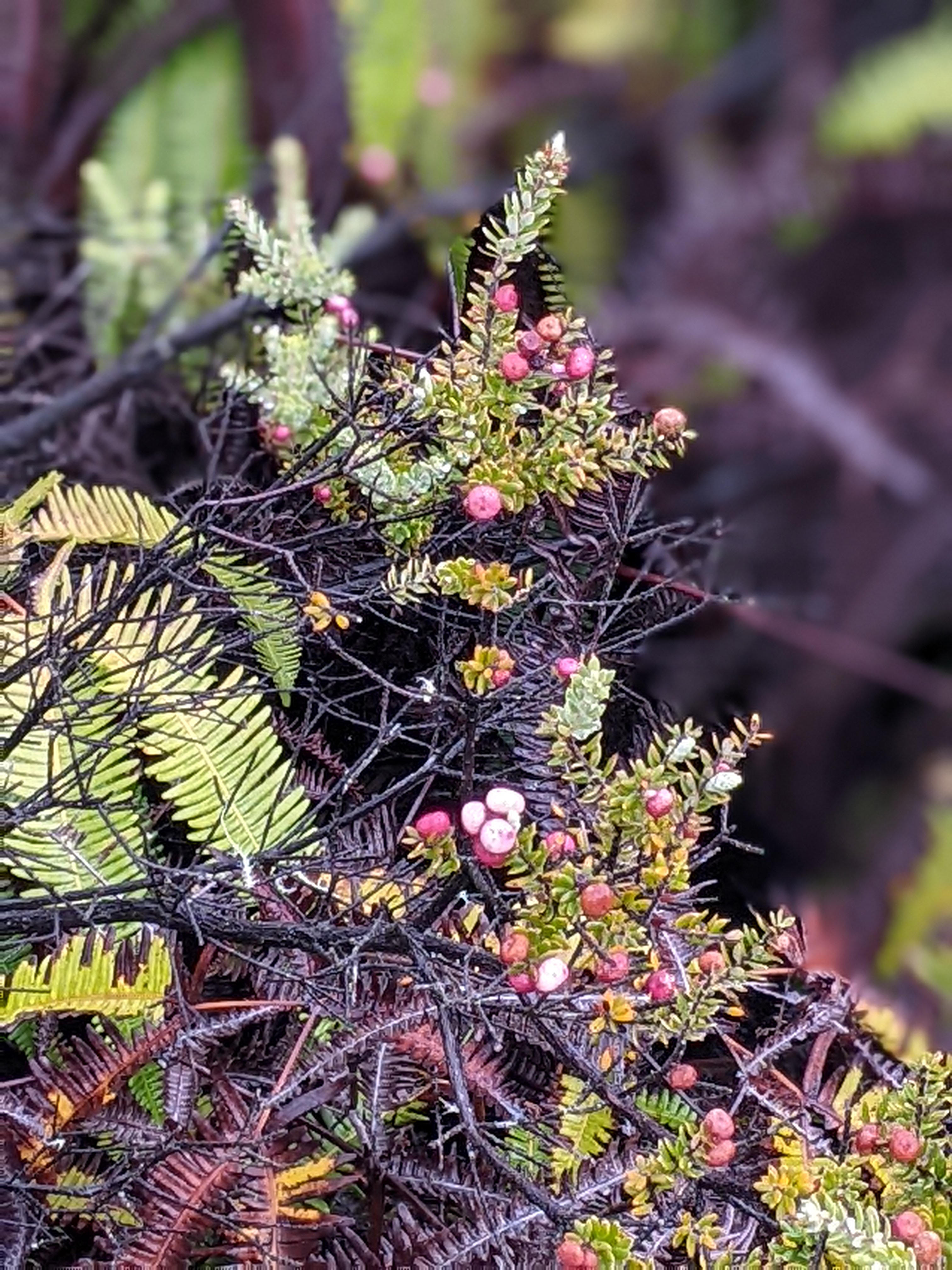
'Ohi'a trees grow abundantly here as they survive sulfur dioxide and have adapted to periodic exposure to harsh volcanic gases.


Next post: I wish I could say it was a change that we took a very long drive back to the central Big Island town of Kailua via Pahoa, Lava Tree National Monument, Kehena Black Sand Beach, MacKenzie State Recreation Area, Star of the Sea Church, Ka'u Coffee Mill, Hawaiian turtles at Punalu'u Black Beach, Na'alehu, and the US southernmost point of Ka Le!
Sulphur and other hot gases released from the magma hindered plant growth but created a colorful landscape of corroded rock.

When volcanic gases rise to the surface and combine with groundwater, sulphuric and hydrofluoric acids form. These highly corrosive acids eat away rock, leaving steam-filled cavities and cracks hidden beneath dangerously thin crusts of ash.

When a tourist walked off the trail and broke through the thin crust in September of 2000, he suffered severe leg burns. The hole showed where he stepped into 205-degree steam. How important the Hawaiian proverb proved to be: "Watch your step ... and don't let things you see lead you into trouble."

A thermometer that measured the steam here ranged from 140 degrees when third-degree burns could occur in just 5 seconds to 212 degrees, water's boiling point at sea level.


Is it sulphur or sulfur? Both are correct as Sulphur Banks, as named by early 1800s visitors, is the British version and sulfur is the American spelling.

In 1922, scientists drilled two holes to determine how hot it was at Sulphur Banks. Burlap sacks were wrapped around wellheads and painted steel cables were covered with oil to protect workers and machinery from scalding. The temperature measurements remained constant at 205 degrees Fahrenheit down to the maximum depth drilled of 50 feet.

"Cooked" rock has produced colorful minerals here at Sulphur Banks as water can dissolve water over time and the addition of heat and acid at the Banks speeds up that process. When hot water vapor and acidic gases rise to the surface, they "cook" the pre-existing rock. That causes chemical and textural changes in the minerals that make up the rock, a process called hydrothermal alteration by scientists.


We liked how the wooden boardwalk weaved between misty, rocky vents stained with the almost psychedelic colors by tons of sulfur-induced steam that had risen from deep within the earth.

Birds once gathered here to forage on berries. This area was called Ha'akulamanu by Hawaiians which meant "a gathering place for birds." Flocks of nene or Hawaiian geese and kolea or Pacific golden plovers came to this thermal field where underlying heat prevented the growth of large deep-rooted trees. Birds flocked to eat native plants growing in cooler soil and drink fresh water around steam vents. Sadly, those birds are now rarely seen here as non-native grasses and other alien plants have taken over the area, making it tough for birds to forage in Ha'akulamanu. Due to increased vegetation or soil changes, fresh-water pools have also disappeared.

Two native orchids that were brought to Hawaii from Asia in 1945 grow in the park.


We proceeded to the nearby Kilauea Caldera Trail from the Sulfur Banks Trail. The first crater was 500 feet deep.


That was immediately followed by another deep crater.


Everyone stopped on the path to allow this bird room to pass. I discovered later from a ranger the invasive species was a kaligh or pheasant that had been brought in from Indonesia.


The rain and overcast skies didn't make it easy to see much from the Kilauea Overlook!


The nearby Kilauea Military Camp was established in 1916, the same year as Hawai'i Volcanoes National Park, as a training ground and recreational camp for sailors and soldiers. It was now open as a lodging facility for park visitors.


We drove on next to the Thurston Lava Tube where we read that a large river of lava had flowed in natural channels of their own making. Walking toward the lava tube entrance, we entered a dense tropical rainforest with the most beautiful variations of green that had been enhanced by the recent rain.

'Ohi'a lehua trees formed the forest canopy and light green fronds of hapu'u or tree ferns dominated the understory. There was a diversity of life in the forest which receives over 100 inches of rain a year.


Kahili ginger was a destructive weed that chokes out native plants by birds who feast upon and spread its seeds.

Unlike tropical rainforests on continents, most of Hawaii's native species are found on or near the forest floor where they are especially vulnerable to alien invaders. Rangers are forced to remove wild pigs and non-native plants from this and other imperiled habitats within the only tropical rainforest in the country.

Can you imagine seeing through the crust when a lava tube would have been active with glowing lava traveling along the floors at temperatures exceeding 2,000 degrees F?!

The heat would have melted the ceiling and inner walls to form stalactites from molten rock. Once the eruption ended, it would have taken about a year for the tube to cool down and for the new underground passage to be colonized by insects and spiders.

The short stroll through the gigantic lava tube was artificially lit.

We next followed the Crater Rim Trail.

This was one of three species of 'ama'u ferns that grew in the park. The young fronds are often tinged red to block the sun's harmful rays. The red dye is made from the trunk and new fronds.

Hawaiians used to line the inner walls of their grass huts with the sword-shaped leaves of 'uki, this native sedge. Leis and dried flower arrangements are often made with 'uki seed heads.

In the belly of the crater was the Kilauea Iki Trail, a hardened lava lake that was formed after the 1959 eruption when Kilauea Iki erupted for five weeks. The lava fountain that formed the cinder cone surrounding the crater reached 1900 feet, the highest ever recorded in Hawaii. The lake took more than 30 years to completely solidify.

Though desolate, the 4.5-mile-long trail looked pretty exciting but we didn't have time with everything else we still wanted to see in the park. The people hiking the faint footpath were guided by ahu or stone cairns.

Pilo, a member of the coffee family, had bright red or orange berries which are relied upon by the Hawaii Island thrush to spread its seeds. The berries are also used by some as a laxative.

The view from the Kilauea Iki Overlook made us think we wouldn't have been surprised to see a tyrannosaurus rex pop up from the lava floor!

Steven and I had hoped to view active lava erupting while in the park. Our only chance was to walk along a closed highway to reach Devastation Point.

We overheard a private guide tell his group that the lava had spewed up taller than any building in the entire country to cover the land here!


As exciting as it would have been to witness the lava erupting from Devastation Point, that was left to our imagination as we only saw blue-gray smoke from the sulfur dioxide and whitish steam in the drizzle.

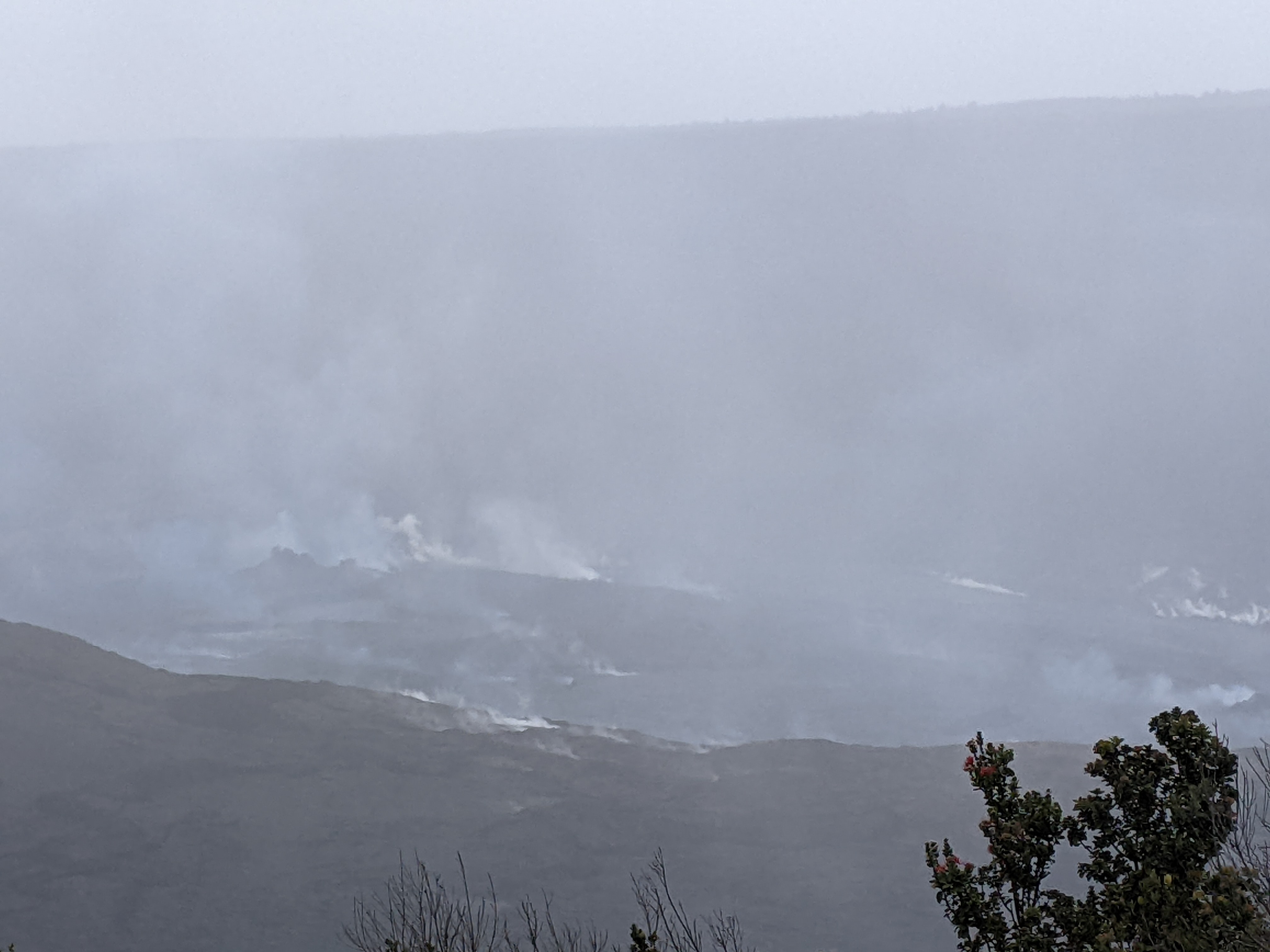
I'm not sure the four-mile walk was "worth it" for these views but hope springs eternal for what we might have seen more.

Possibly the most scenic road trip on an island packed with them was the Chain of Craters Road that winds down almost 19 miles and 3,700 feet to the southern slopes of Kilauea. Driving the 36-mile road meant the chance to view deep craters and other spectacular volcanic features such as yawning pit craters, lava trees, lava molds, forested cinder cones, and lava flows from 1969, 1973, 1974, and as recently as 1979. First up was a view of the lava that remained from the 1974 lava flow at Lua Manu Crater, one in a series of pit craters that had formed when the lava in an underground reservoir vacates, leaving a hollow crater to collapse in on itself but without any interruption.

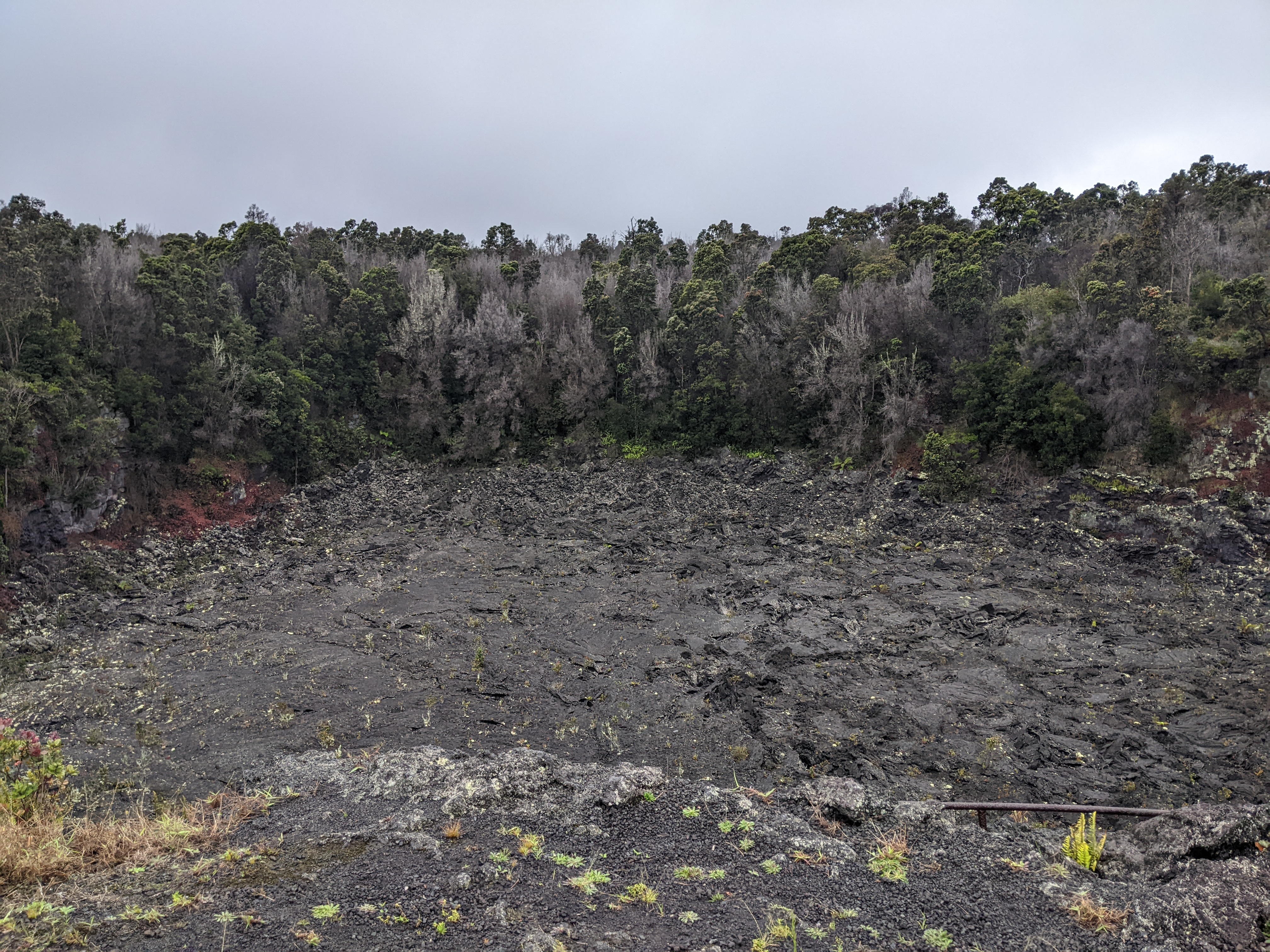

A short distance later was the very impressive Puhimau Crater which meant "forever smoking." We were lucky to see faint plumes of steam on the far side of the crater, as heated water vapor emanated from cracks in the earth.


A short detour to the Mauna Ulu Eruption Trail took me to the 1969 eruption fissure while Steven stayed in the car. The so-called trail was nothing like I had seen before as there were no markings to lead the way and all the terrain looked very much alike. I remembered being distinctly scared for a bit not being able to find my way back to the car as there were no signs or paths or people to follow.

You could understand why this barren landscape was the perfect training spot for lunar landings.

Much further south, rivers of lava made their way to the coast.

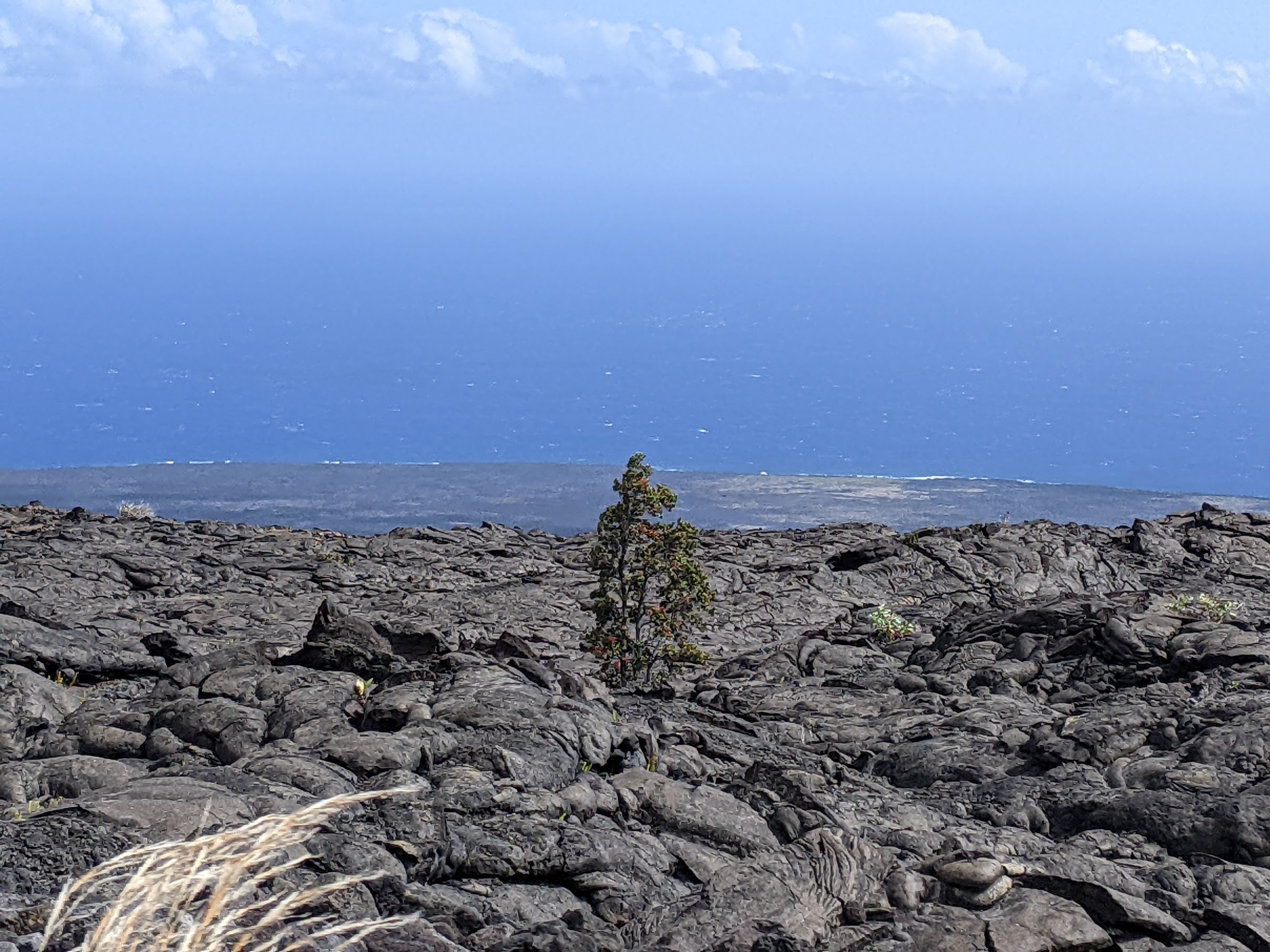


These were the smoothest piles of lava I had seen - they looked like cow patties or mud pies one made as a child!

Near the bottom of the road was the beginning of the trail to the Pu'u Loa Petroglyphs which roughly translated to "hill of long life." A sign said that the stories and memories of the native Hawaiian people were preserved within Pu'u Loa. The Long Hill was home to a unique and spiritual collection of petroglyphs or rock carvings that were a record of the history and culture of the native people who have used this site for hundreds of years. The site, the largest collection of petroglyphs in the state, was a testament to its cultural and scientific significance and was a revered and sacred site to Hawaiian 'ohana or families. Their unique traditions and ceremonial practices have been continued here in the hope their children can be blessed with a long life.

The journey to ke ala kahiko or "the path of the old ones" was one of Hawaii's revered cultural landmarks. I read that the trail to Pu'oloa had felt many footprints, from the ali'i or chief to the kanaka maoli or native resident.


Hawaiians have learned to survive on this harsh volcanic land and the sea by living a sustainable lifestyle through conservation and trade. Although the mountain and the sea provided ample pigs, fish, and other sources of food, there was minimal soil and fresh water on this lava-covered lowland. That made the growing of Hawaii's staple food, the 'uala or sweet potato difficult.

The mahi'ai or native farmers built pits and carefully stacked rocks in the sheltered corners of lava flows to cradle the valuable soil and moisture necessary to grow the 'uala. The simple sweet potato mounds became their gardens which the community depended upon.


This was the only clump of lantana flowers we saw on the entire hike to the petroglyphs.

As ancient Hawaiian culture lacked a written language, their petroglyphs provided a glimpse into the life experiences, struggles, and successes of the early Hawaiian people. While some of the petroglyphs could be recognized as human forms, animals, or canoes, others were more abstract with their meanings sacred or only known to their creators.

As changes occurred throughout Hawaii, they led to variations in petroglyphs, tools, and techniques. Pohaku or rocks were traditionally used to make petroglyphs with a sharp stone used to peck precise impressions into the lava surface. A blunt stone was used to create a bruised image. Most recent mapping projects confirmed there were more than 23,000 diverse rock carvings here at Pu'u Loa!
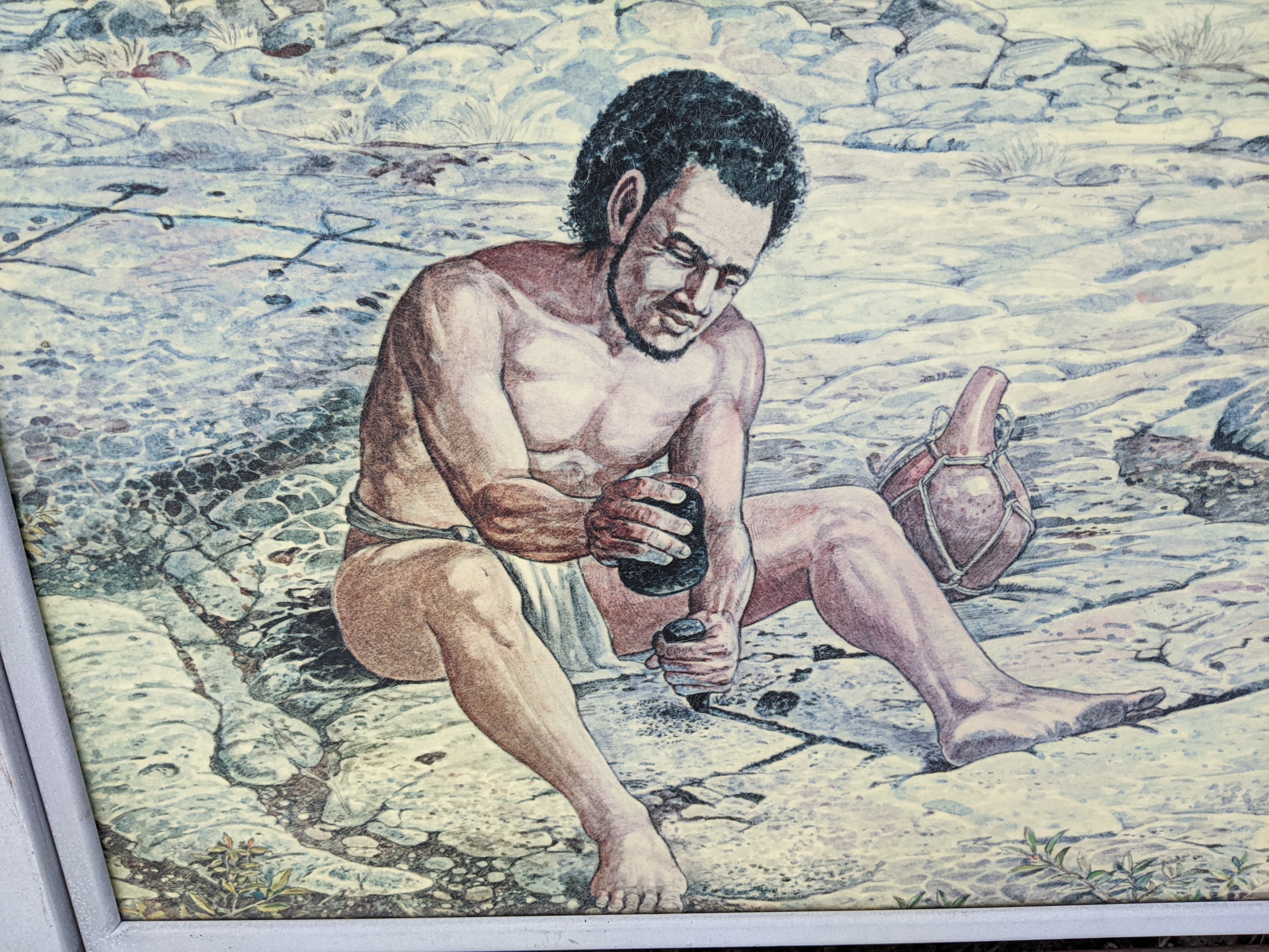
The petroglyphs had been carved into the thin, fragile crust of the 400-700-year-old lava flow.


The name Pu'u Loa embodied a kaona or "hidden meaning," that of the hill of long life. Native Hawaiian families with genealogical ties to these lands still come here to place their child's piko or umbilical cord in the hope that Pu'uloa's mana or spiritual guiding energy might bless their child with a long and prosperous life. A single child's piko is placed in each puka or hole. Of the over 23,000 petroglyphs here, about 16,000 were piko-related carvings.

Each piko puka design was as unique as the individual who created it with some carved deep, some shallow, and others more extravagant. The petroglyphs united generations of Hawaiian families past, present, and future.


I joked with Steven wondering who had had the unenviable task of counting all the petroglyphs?!


As we explored the rugged coastline, it was almost like feeling the ocean's awesome energy as waves pounded the seacliffs below. How much longer can the fragile Holei Sea Arch withstand the face of such unrelenting power?

The sea arches along the Puna coast were remnants of a once continuous sea cliff where lava had met the sea. But once the lava cooled, it immediately began to erode. Then the combination of wind and water pounded and fractured the cliffs, carving out sea caves. Waves eroded the caves' headland to form sea arches.

Posted finally on May 23rd, 2022, from my brother's home in my native Ottawa, Canada's capital, where we came for several days to reconnect with family and friends whom we haven't been lucky enough to visit for far too long because of Covid. I was ready to "publish" the post two days ago until a major storm came through the capital region and knocked out power to hundreds of thousands of people.
I never heard before about petroglyphs in the lava before. Thanks for the information. Janina
ReplyDeleteWeren't they phenomenal?
ReplyDelete