Showing posts with label Lassen. Show all posts

Thursday, September 10, 2020

6/19: NE California: Feather River Scenic Byway to Lassen Volcanic National Park

Oops, I goofed. I realized this morning I had completely omitted this post about our drive north from Berkeley through the jaw dropping Feather River Scenic Byway and the hydrothermal areas in the southwest portion of Lassen Volcanic National Park! This post should have come before the whimsical animal sculptures in Cassel and both our hikes at Lassen on 6/20. Sorry for this one being out of sequence!

On our way north from Berkeley, we crossed the Richmond Bridge across the San Francisco Bay and were surprised to find that instead of having to stop and pay the toll fee, we saw a sign saying that we'd be sent a  bill in the mail. I don't know whether it was because of not wanting  drivers to interact with toll workers and exchange cash during Covid-19, whether it was a cost-saving measure or what the reason was. The end result was it certainly sped up traffic.


As we were in no hurry to get to Lassen Volcanic National Park in northeastern California and we had two nights in the area, we took Highway 70 north of Oroville through the Plumas National Forest as it was a 'dotted' or scenic road on our AAA map. It was a great choice as the drive through the million-plus acre forest in the Sierra Nevada Mountains was spectacular. I didn't realize until later the road was actually called the Feather River Scenic Byway - no wonder it was accorded 'dotted road' status by AAA!


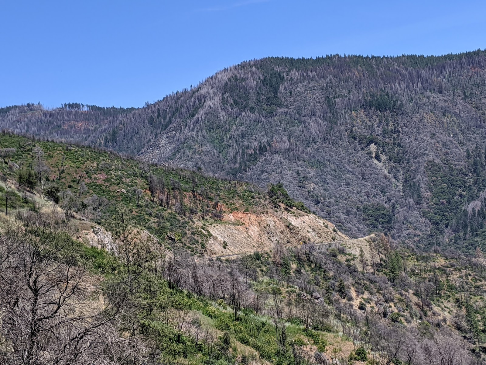

I read later the Middle Fork of the Feather River was one of the first nationally-designated Wild and Scenic Rivers. No doubt that was what also contributed to the road through the deep canyons being considered a 'dotted road.'


The Pulga Bridges over the North Fork of the Feather River were a feat of engineering marvel. One was for highway traffic, the other for trains. Pulga, btw, is Spanish for flea. I wasn't too happy when I realized I had caught the passenger side mirror in the shot but didn't crop it out for obvious reasons!


This was one of several tunnels carved through the mountains.


Another one, a mile later, was called the Grizzly Dome Tunnel!


If you like to fish, I imagine Rock Creek would be a perfect place to cast a line.


The Historic Stornie Bridge over the Feather River was opened in 1936.


A few minutes later, we crisscrossed the river again over the Historic Tobin Bridge, also built in the same era.


IF you ever find yourself in northern California and want to spend a couple of hours taking in some breathtaking scenery, it would be very hard to find anything more spectacular than this Feather River Scenic Highway, aka Highway 70! 


Since our hotel for the next two nights would be a fair drive from the northern entrance of Lassen Volcanic National Park, we made sure to take advantage of entering the park at the southern entrance and seeing the sights there in the late afternoon.


Because of Covid-19, the visitors center was closed but the sign outside told us that most of the trails were open but there was lots of snow. We were even lucky that the park was open at all because it's closed because of hazardous road conditions from late October to mid-June and it was only the 19th of June!


With this beautiful backdrop to gaze at, we took out our camping stove and made some hot dogs for a light and quick dinner so we wouldn't be famished before seeing the park's hydrothermal features as it would be too far to return to this part of the park the next day.


According to an exhibit made possible with support from Lockheed Martin and NASA, every rock we would see at Lassen originated from volcanoes. Lassen's most recent active volcanic center began to erupt about 825,000 years ago. Continuing volcanic activity still feeds Lassen's numerous 'hot water' systems including Sulphur Works, Little Hot Springs Valley, and Bumpass Hell. These otherworldly areas have become habitats for microbial life that were able to adapt to high temperatures and extreme acidity. 


NASA scientists think Lassen's hydrothermal areas might resemble the early earth or be similar to the environments on other planets and moons, including Mars! Did you know that astrobiologists - a field of study I'd never heard of before this - study hydrothermal habitats in Lassen to understand the origins and evolution of life in a planetary context?


The area around the park's Sulphur Works area included steam vents known as fumaroles, mudpots, and boiling springs which we generally more associated with Yellowstone. We certainly smelt the rotten-egg odor permeating the air which was indicative of hydrogen sulfide gas. A sign indicated that deep within the earth a series of pockets of partially molten rock had formed the active Lassen 'magmatic system.' Heat generated from the magma warmed the groundwater to a boil, causing it to bubble and steam upwards in cracks at Sulphur Works and other hydrothermal areas in the park. 


Prior to the purchase of Sulphur Works by the park in 1952, the Supan family operated the Sulphur Works Inn which included a bathhouse built over steam vents, overnight cabins, and a dining hall.

All of the park's hydrothermal areas, which included Sulphur Works, Bumpass Hell, and Devil's Kitchen, were connected to the same volcanic boiler, and formed what was described as the "most striking hydrothermal system in the Cascade Range."


This vat of bubbling mud contained the perfect mix of ingredients to create mudpots: heat, gases, water, volcanic rock, minerals, acids and heat-loving microorganisms called thermophiles too small to be detected by the naked eye. When the thermophiles consume some of the gases, they help convert them into sulphuric acid. The acid in turn breaks down the rock to form clay which mixes with water to form, you guessed it, mudpots!


I was glad we got to visit Lassen in mid-June because mudpots change seasonally. If we'd been there in late summer when there's very little precipitation, the mudpots would have been dry so we'd have seen mostly steam - not nearly as exciting in my mind as these gurgling cauldrons! 


We read that researchers from NASA and universities were working together in the park to study microorganisms that thrive in water too hot for humans to touch. They can tell us about the first organisms on earth as well as the potential for life to have existed on Mars. or other planets in the solar system. I figured out by then the science that explores for life elsewhere in the universe is called astrobiology.


As we drove north along the park highway, we got great views of some of the park's mountains. This was 9,087 ft-high Mount Diller.


A lovely panorama:


We could see how Brokeoff Mountain got its name from this viewpoint at 7,000-foot elevation!


The highest part of the scenic highway was at 8,512 ft. elevation. As we have been living in Colorado for years, fortunately the high elevation had no effect on either of us. 


Emerald Lake:


The next viewpoint was Bumpass Hell. One of the few trails in the park that was closed because of snow conditions was one that led from here. We were disappointed as we'd really hoped to hike that one the next day because it led to many fumaroles and mudpots. It got its colorful name when a man named Bumpass fell into one of the boiling mud pits, severely injuring his leg. He, not surprisingly, then referred to the spot as Bumpass Hell!


Brokeoff Volcano aka Mount Tehama was at an elevation of 11,500 feet but we were admiring it from a lower elevation on the highway. 


Still almost totally covered with snow and ice was Lake Helen.


A few miles further on was Lassen Peak Trailhead. Though it was 6:45, there were a couple of people just beginning the 2,000 foot hike to the top. That was not one we had any desire to head out on regardless of the time of day as it went straight up!


I couldn't tell whether this group of hikers were taking a rest before going up or taking a much needed break before their final descent.


A scenic boulevard: Nowadays tourists take the park road for granted but back when Lassen Volcanic National Park was established in 1916, the park's scenic features, expansive views, and volcanic landscapes could only be reached on foot or by horseback. When construction began in earnest in 1925 on this scenic byway, it was timely. That was the year Henry Ford's ten millionth car had rolled off the assembly line and road touring was becoming an American pastime. The number of park visitors jumped from 142 in 1924 to 2,200 in 1925 after the road was built.

As with any of the national parks, the main design challenge for the road was how to balance access to scenic features and maintaining the park's pristine wilderness integrity. The full 30-mile road through the park was completed and formally dedicated in 1931.


King's Creek Meadow was another of the idyllic spots in the park. As it was early evening and there was little traffic by then, I'd hoped to catch a glimpse of some animals but I didn't spot anything at the foot of Lassen Peak.


The part of the park known as Devastated Area was the result of the 1915 volcanic eruption of Lassen Peak. On May 19th and May 22nd, boulders, mud, and hot gases rained down more than two miles from the peak which cleared a wide swath through surrounding forests. US Forest Service officials stated at the time that more than five million board feet of timber had been knocked down! The extent of the devastation was enormous. 


We still had a fair drive to our hotel in the small but bustling town of Burney located about 45 minutes north of the park's northwest entrance so didn't dillydally any longer seeing more of the park's sights that evening. We knew we'd spend a chunk of the next day exploring the area's sights by that entrance. This day had been nothing short of fantastic with a very enjoyable walk around part of Berkeley, followed by a drop-dead gorgeous drive through the national forest and then capped off by lovely Lassen. It's almost impossible to think of a more blissful day.

Next post: Truly, it will be about Burney Falls State Park as I promised at the end of the last post!

Posted on September 10th, 2020, from Hudson, near Tampa in Florida whee we've come for a few days in between stays at the state park up on the state's Panhandle. It bears repeating that Steven and I hope that that you and your loved ones stay safe, stay healthy, and stay connected.

Tuesday, September 8, 2020

6/20: Near Burney, CA: Lassen Volcanic National Park's Chaos Crags and Jumbles!

After being drawn to the massive, whimsical animal figures made from spare parts in a junkyard in Cassel in northeastern California, we drove 35 miles south to Lassen Volcanic National Park, the reason we'd come to this area. The park lies at the crossroads of the Cascade Range to the north, the Sierra Nevada Mountains to the south and the Great Basin desert that we'd driven through from eastern Nevada. We had certainly timed our visit just right as, the weekend before, it had been the first national park in the state to fully open back up during the coronavirus. That was quite a feat when you consider the 30-mile-long highway through the park is normally impassable due to snow from late October to mid-June. No wonder, then, there was a 15-minute wait to enter the park that had one of the largest plug dome volcanoes, Lassen Peak, in the world!

For a period of many thousands of years, 10,457-foot high Lassen Peak had been quiet but there were many eruptions between 1914 and 1921, with the largest being in May of 1915. Hot Rock derived its name that year when local businessman and photographer B.F. Loomis reported it was too hot to touch after it had just been ejected from the crater of Lassen Peak. There were quite a few other rocks in the immediate vicinity that presumably were ejected at the same time.


A plaque further on marked the route early pioneers took in 1852 over Noble Pass which linked the Humboldt-Nevada Road with the town of Shasta in northern California. During the 1850s and 1860s, several thousand emigrants used the Nobles' Emigrant Trail in their migration from the eastern United States. Although the wagon tacks had long faded, it was inspiring knowing we were standing on one of several emigrant trails that led settlers and gold miners to California. Especially after the discovery of gold in 1848, the push to reach California was strong. But there were few trails leading to Sacramento Valley, and those that did, were very dangerous.


In 1851, gold seeker William Nobles stumbled on a more direct northern California route, ending in Shasta. Realizing the commercial importance of his discovery, Nobles lead a party of Shasta businessmen along the route. On their return, they exclaimed, "The mountains are easy of ascent ... (and) watering places ... and the grass abundant." The Nobles Trail carried thousands of settlers west. Eighteen miles of the Nobles Trail ran through what was to become Lassen Volcanic National Park.


Further on were the Chaos Crags, six lava domes believed to have been pushed up more than a thousand years ago. The Chaos Jumbles was the name given to three volcanic landslides that occurred 350 years ago, likely from an earthquake, when one of the domes collapsed. Steven and I didn't walk far off the road to see any more of the Jumbles as they looked like ankle-breakers for sure!


In the northwest section of the park was Manzanita Lake, a relatively young lake compared to those formed by glaciers thousands of years ago. The lake was created about 350 years ago when the steep northwest face of Chaos Crags broke away, crashing and spreading for miles. The avalanche choked off Manzanita Creek, backing off its waters and creating the lake. Plants and animals unusual to other areas of Lassen thrive in this lake. Special to the lake are wild rainbow trout that grow to record sizes, more than twenty inches long, and spawn up Manzanita Creek, which feeds the lake. 


This fellow was one of the more unusual characters we'd come across in a while as we began walking around the lake.


We caught some great views of the Chaos Crags from the trail.


The plug dome volcano at Lassen Peak formed when the lava was too thick to flow great distances. A steam blast shattered Lassen's plug which created an avalanche of melted snow and rock down its east side. Until Mount Saint Helens erupted in 1980, Lassen was the last volcano to erupt on the US mainland. 


From the lake, we wandered over to the visitor center. There, we read a sign that honored the legacy of Loomis, whose enthusiasm, talent and dedication, helped bring this national park into existence. In 1926, he published The Pictorial History of the Lassen Volcano to spark awe and understanding of Lassen's historic eruptive events. 

In 1927, he and his wife built the Loomis Memorial Museum in honor of their daughter and Seismographic Station to showcase Loomis' photographs and monitor ongoing volcanic activity. Loomis wrote that in 1924,"I climbed to the top of Lassen Peak six times ... taking pictures ... I realized that if the mountain should blow off while I was looking into the crater, I would not be here to tell the tale. But for all that I never experienced the feeling of fear. For I was there to take pictures, and the pictures were the principal object of my thoughts." In 1929, the Loomises gave the museum complex to the park to serve as its primary visitor center.


Retaining the right to live on the museum premises, the Loomises built a home and art shop where they spent their summers selling photos, helping visitors, and enjoying the park. Loomis died in 1935 and his wife in 1953.  


Across from the museum was the Lily Pond Nature Trail that we hiked next. The trail started at Reflection Lake. 


Though these trees had been scarred by fire, conifers tend to grow new inner bark to cover their 'wounds.'


This was a thicket of Yellow or Pacific Willow which was typical of lake edges and other wet locations. I never knew before this that individual willow trees were divided into sexes and that the pussy willow produce the pollen-bearing or male flower catkins.The female or seed-bearing plants produce the cotton-like willow down we've all seen blowing around in the mid summer.


Lily Pond was one of several depressions below the normal water table in the Chaos Jumbles. As in other wet places along the trail, the water attracted many aquatic insects, frogs, and birds. Though difficult to spot in this photo, we did see water plants with large heart-shaped leaves called Cow Lilies. 


Lodgepole Pine trees had relatively shallow root structures unlike deciduous trees that send their roots deep into the ground in search of water. I was intrigued by the different types of lichen growing on the trees here and what we'd just observed at Manzanita Lake. Lichen, one of the first plants to adapt to and live under harsh conditions, was also growing on nearby rocks. Once lichens were fairly common in cities but they're rare nowadays because of smog. 


This was one of the most recent avalanches that originated in the Chaos Crags. These rocks were a type of lava called pink dacite, the main component of Chaos Crags and Lassen Peak. We noticed how stunted and sparse the trees were here compared to just a few minutes earlier. It was amazing that anything grew, I thought, in such rocky terrain. 


In the distance were the Chaos Crags, the dacite volcanoes that were rapidly pushed up through vents as lava plugs about 1100 years go. 


This  historic stone building was constructed in the 1930s by the Civilian Conservation Corps (CCC) using local volcanic stone for use as a staff residence. As the Discovery Center, it has been converted for educational programs. The CCC also built many of the trails and roads in the park.


The mountains of Lassen Volcanic National Park have been a sacred place of healing and strength to American Indians for more than a thousand years. The Atsugewi, Maidu, Yana, and Yahi tribes settled in the mountain foothills and spent their summers in camps in the high country. They fished, hunted, and gathered their foods and also worshipped, raised children and buried loved ones here. Descendants of these tribes still lived near the edges of the park and remain connected to this land. 

I was glad that Steven and I had made Lassen our first stop in our discovery and re-discovery of some national parks in the Pacific Northwest. 


Next post: We left Lassen in the mid afternoon for McArthur-Burney Falls Memorial State Park about 45 miles back north again close to where our hotel was located in Burney. 

Posted on September 8th, 2020, from our last couple of days on the other side of the country here at Grayton Beach State Park on Florida's Panhandle before we spend a few days in the central part of the state. As I've noted before, please stay safe, stay healthy, and stay connected during these very trying times.