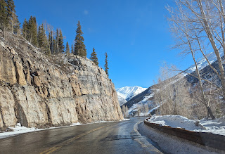
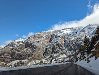
Forty miles north of Durango in southwest Colorado where we'd stayed for the night on our way home from our month's escape to Phoenix were The Needles, part of the Colorado's famous Rocky Mountains.
If you've ever wanted to know what Purgatory was like, you only need to head outside of Durango where you'll discover the Purgatory Ski Resort! 12,700-ft. tall Engineer Mountain surrounded the resort.
Thankfully, driving through Colorado's southwest mountains was less challenging in the early days of spring even when at the summit of Coal Bank Pass at 10,640 ft en route to the town of Silverton. A common sight in the mountains was barriers that could be put across the roads when dangerous conditions prevent onward travel.
Snowmobile tracks in the pristine snow:
Summiting 10,700-ft. high Molas Pass in the San Juan Mountains:
Nestled in the valley was 9,318 ft. high Silverton fewer than 50 miles from Durango, and inhabited by only 600 year-round residents. In 1874 after the Civil War, miners returned and established Silverton as a legal town which attracted miners to its various mining camps for many years. Gold and silver were discovered in this area in the late 19th century. The once booming boomtown is now a National Historic Landmark District located within 15 miles of seven of Colorado’s most famous 14,000-ft. peaks. Though Silverton's history is rooted in mining, it's a true mountain town today loved by sports enthusiasts.
It would be fun to return one day to southwest Colorado and climb aboard the Durango & Silverton Narrow Gauge Railroad.
What's up with Victorian-era houses so often painted in pastel colors?!
The building on the left was the Grand Imperial Hotel. When it was completed in 1873, it was the largest single-standing structure south of Denver.
A fun way to use old skis in the ski town!
The previous day, Steven and I had driven through the spectacular Monument Valley in northwest Arizona and southeast Utah, one of the US' most famous scenic drives. But Colorado wasn't going to be outdone - after all, it had the renowned Million Dollar Highway also known as U.S. Route 550. The 25-mile stretch of highway between Silverton and Ouray in southwestern Colorado was originally constructed in the late 19th century as a wagon trail to transport miners and supplies to the area's rich gold and silver mines.
Leaving Silverton, we saw the sign that indicated the chain law was in effect for trucks made us hope we wouldn't encounter a lot of late winter snow!
The highway climbed up and over Red Mountain Pass, reaching an elevation of over 11,000 feet. The road was narrow and winding, with sharp curves and steep drop-offs, making it a challenging drive for even the most experienced drivers. Not surprisingly, there were very few put-puts like Steven's small car on the highway.
Depending on whom you ask, the Million Dollar Highway came by its name because that was what it cost to build back in the 1880s; that its fill dirt contained a million dollars in gold ore; because it was a toll road and it cost a million dollars to use it; or, the story I like best, its million-dollar views, of course!
No stopping and standing here as signs warned we were in an avalanche area for the next half-mile!
The scenic and treacherous mountain road ran through the heart of the San Juan Mountains.
Were we relieved to see the 'End of Avalanche Area' sign!
However, our relief was short-lived as, about two minutes later, we saw another 'Avalanche Area' sign!
The term 'snowshed' may be new to some readers - it's used to collect snow on top and allow people to safely pass underneath.
Since my second leg operation last June, I've been on oxygen at night and sometimes check levels during the day. Driving at these 10,00 and 11,000 ft. heights, it dropped to the low 80s on the highway - the lowest in months.
The road's narrow lanes, hairpin turns, steep cliffs, and notorious steep dropoffs have earned it a reputation as one of the most dangerous roads in America. There were no guardrails because, in the winter, the snow is simply plowed off the side of the highway!
Men had to be lowered on ropes from the canyon rim to blast the quartzite walls with charges of dynamite. The toll booth's location at Bear Creek Falls above the Uncompahgre River Canyon made it impossible for anyone to get around without paying a $5 toll per wagon team and $1 for each head of livestock.
The first graveled state auto road and bridge over Bear Creek Falls opened in 1922.
Fortunately, the barrier was up which meant we were able to proceed to Ouray at the end of the Million Dollar Highway.
The small community was named after the last Ute chief but nicknamed the 'Switzerland of America' as it's situated in a river valley at over 8,000 ft. and surrounded by the snowcapped San Juan Mountains. We almost expected to hear yodeling echo from the hills!
In 1983 the former mining town was designated a National Register Historic District encompassing 331 structures. Its well-preserved Main Street featured the elegant Beaumont Hotel, the chateau-like Elks Club, the Wright Opera House, and many handsome storefronts. Quiet, tree-shaded streets were lined by well-kept Victorian homes in one of Colorado’s best-preserved mining towns.
When Men’s Journal released its list of the 50 best vacation destinations for 2024 they dubbed Ouray the Number 1 must-hit destination. A myriad of factors from geographic range and cultural diversity to the number of city and state parks, culinary distinctions like Michelin awards, unique attractions, and how easy it is to get around each respective destination were used to cull the list. It also weighed the overall monetary value of a visit and an “adventure” score. What a well-deserved coup for tiny Ouray to be selected Number One!
Both Monument Valley and the Million Dollar Highway had been a tremendously exciting drive home from Phoenix, so much better than the ho-hum interstate system would have provided! I urge you to consider taking either or both scenic byways if you can.
Not far from Ouray was the 20-mile-long Blue Mesa Reservoir, Colorado's largest lake located entirely inside the state.
We were incredibly lucky to drive along Hwy. 550 at the beginning of April as only two weeks later the bridge across the reservoir was closed after cracks were discovered on the bridge. The closure has already created huge headaches for commuters and sightseers between Montrose and Gunnison: either driving north to Interstate 70 for an additional 354 miles, requiring approximately six hours of travel time; or taking US 160 to the south for an added 331 miles and nearly seven hours of travel time. High school students are now taking the ferry to school!
The reservoir, part of the Curecanti National Recreation Area, is a haven for boaters and campers. After we bought our first trailer about twenty-five years ago, we came to Blue Mesa for a 'shakedown trip' to learn about the ins and outs of trailer camping before heading out on the open road.
Posted on April 27th, 2024 from San Francisco where we're visiting our son and his expanding family - they're expecting their third child in mid-July! Tomorrow we head to Japan, our first stop in about a two-month trip to Asia. We'd originally planned to visit the region in early 2020 until Covid and then 'life' forced it to be rescheduled until now. Take care of yourself and your loved ones.
Next post: Tokyo, here we come!


