A scene at a farmhouse just outside Salina, Utah where we'd stayed our first night en route to San Francisco to meet our first granddaughter, Max:


The plaque was dedicated to Stephen Tyng Mather who was responsible for laying the foundation of the National Park Service and establishing the policies under which its parks were developed.


The Pahvant Mountain Range in central Utah:


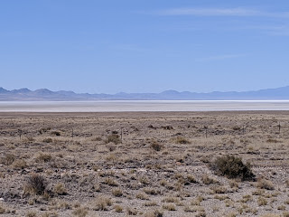
As we continued our drive west, we reached Sevier Lake Salt Flat across from Death Canyon. We'd passed a sign indicating no services for the next 83 miles so sure hoped we wouldn't run into any car issues! As it turned out, only a handful of cars passed us going the opposite direction the entire time.


We didn't detour off-road to learn why this was called Skull Rock Pass in the 20-mile-long San Francisco Mountain range in western Utah!

We certainly could have chosen a faster and more direct route to San Francisco along interstates but had decided to take the more interesting route as we were in no rush and wanted to see more of the country. Taking the slower route would also allow us to stop at Great Basin National Park just over the Utah border in eastern Nevada, one of the few national parks in the continental US we hadn't yet seen. One of our 'goals' we set for ourselves once we came home from our abbreviated trip to Asia in mid-March had been to explore as many of the national parks we could. Another 'goal' I suggested to Steven was that we tour as many of the state capitol buildings on upcoming road trips that we could. Over our decades of doing road trips throughout the US, we'd stopped at quite a few state capitals but had never kept track of which we'd seen or missed when traveling through states.
Back to Great Basin now! The vast region of sagebrush-covered valleys and narrow mountain ranges was named for its lack of drainage. As its streams and rivers mostly had no outlet to the sea, water was collected in shallow salt lakes, marshes, and mud flats to evaporate in dry, desert air. Though called the Great Basin, i.e.singular, it wan't just one basin but rather many basins that were separated by mountain ranges running north to south.
When we stopped at the park's Visitor Center, located outside the park just north of the small town of Baker, we read an exhibit that said we were looking at the Snake Range located in the Great Basin park. The range's geology had evolved over millions of years. 550 millions years ago, a warm, shallow, inland sea covered the region. That was when the exposed layers of quartzite, shale and limestone we would see in the park had been deposited.
The tallest visible peak from the Visitor Center was the 12,771 foot-high Jeff Davis Peak. Wheeler Peak, nestled behind Davis, was taller but couldn't be seen from this vantage point.

On the left of the photo was Eagle Peak but it looked more like a pimple than a peak from here!

On the left was Pyramid Peak and just beside it to the right was False Pyramid Peak.

For thousands of years, Snake Valley has been home for many people. Everything needed to survive - water, materials to build homes, and land for cultivation and grazing - could be found in this beautiful location. Remains of a Fremont Native American village that dated to 1100 AD had been found near Baker. Modern Indian tribes recognize them as their ancestors. In 1885 Mormon missionaries from Salt Lake City traveled through Snake Valley looking for promising farmland. By the 1870s, several farms and ranches had been established in the valley. The town of Baker was named after an early cattle rancher. After a Basque sheep rancher bought the Baker ranch in 1914, the community was known as Basque Town.


Because of Covid-19, the Visitor Center was closed. Its restrooms were only open on alternate days - was I 'relieved' that we happened to be there on an open day! This was the first time we'd cracked open our Coleman stove since our tent camping days well over a decade ago. Luckily, it came back to us like it was yesterday!

Most park visitors come to Great Basin to tour the extensive Lehman Caves located near the eastern entrance. They were closed because of the virus but fortunately the Wheeler Peak Scenic Drive through the park was open so we embarked on that after lunch.


The views at the Mather Overlook were fabulous. Its panoramic views allowed us to get a great look of the park's mountains and also its valleys. However, at an elevation of 9,300 feet, it was downright chilly in mid-June.


The end of the road brought us to Wheeler Peak Overlook which was at almost 10,000 feet elevation. On the 12-mile drive, we'd gained 3,400 feet in elevation. Though we started the drive looking at pinyon-juniper woodlands, we ended up in deep forests of Englemann spruce and Douglas fir. Just below the summit of Wheeler Peak, the ice age persisted until recently as a small, one-of-its kind Great Basin glacier.


We read that the Great Basin was a "repeating chorus" of basin and range, basin and range, running mostly north to south. The Snake Range that we were in was the tallest of the basin's eastern ranges. In the range were eight species of conifers, the most found in the Great Basin mountains.


We could tell by the fire scars on the trunks of several mature trees that the gaps in the forest had been created by a lightning-caused fire. Though we knew fire often causes extensive damage, it was important to remember that fire was a natural process that helped maintain diversity in plant and animal habitats. By helping to release nutrients into the soil the fire renewed and invigorated this aging forest.


I was really drawn to the colors in the rocks on the trail!


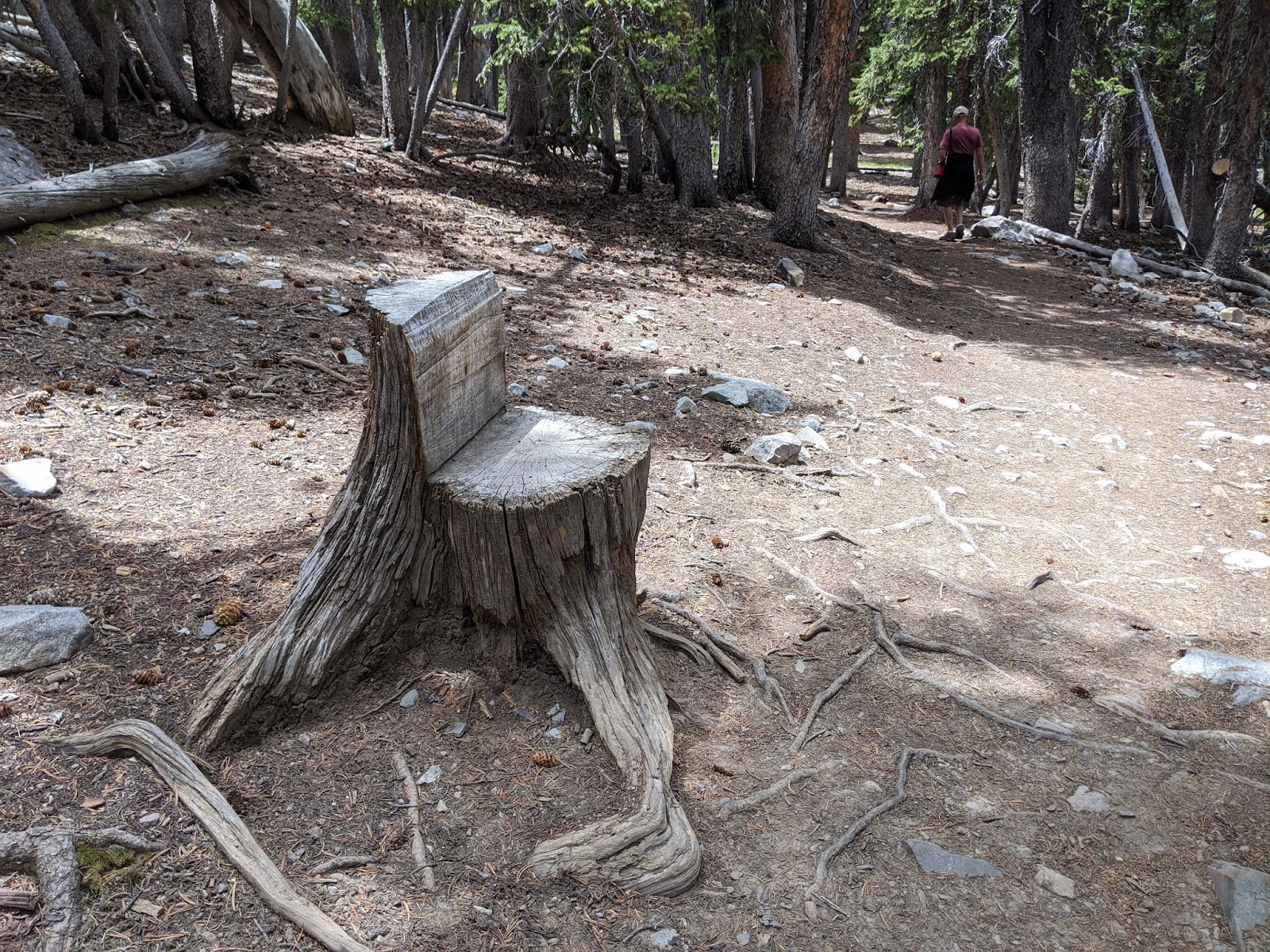
Janina: You would have loved this seat!


We looked forward to hiking the Alpine Lakes Loop Trail next so we could discover the diversity in the park's high elevation back country. Two shallow lakes in the shadow of Wheeler Peak occupied shallow depressions that had been left behind by retreating glaciers. Both lakes were fed by snow melt and occasional summer storms. To reach Stella Lake, there was an elevation gain of 400 feet past a forest of Engelmann spruce, aspen and pine trees.


Though hiking at 10,000 feet elevation was more than we'd done for a while, it didn't seem so bad once we had reached Stella Lake as the view was gorgeous.


As we continued our hike, coming across the deer was a real treat especially since we could enjoy them with nobody else around.


We could see by the presence of the snow, we were certainly hiking at an ever increasing elevation.

Gail: Thanks to our almost daily walks, I had a newfound appreciation for listening to birds when hiking. This forest glade was one of the most perfect spots to spot them as we could hear them all around us.


I was pretty tickled when I spotted a second bird after standing still in one spot for a good 15 minutes or so, Gail! For some reason, this glade was the only area on the entire trail there were any birds we heard.


A mile further on was Teresa Lake, a clear mountain lake surrounded by dense spruce trees. Because both lakes were so shallow and freeze nearly to the bottom in the winter months, there weren't any fish in either.


See, here's proof we really did hike up to 10,250 feet! The temperature had been for hiking except when strong gusts of wind came through and chilled us to the bone.

This rock would have looked so nice in our front yard!

Having had no expectations of our time at Great Basin National Park and not knowing how Covid-19 might impact our visit, Steven and I had been open to anything and everything in the park. We were frankly quite thrilled we could take that amazing drive through the park. Then, to be able to do both hikes after preparing a hot lunch was the icing on the cake for us that day! When planning this month-long road trip in the middle of the pandemic, we knew we'd have to play things easy come, easy go. Our visit to Great Basin couldn't have gone any better - what a great start to the trip.

Next post: More hiking later that same day at Charcoal Ovens State Historic Park outside of Ely, Nevada!
Posted on August 13th, 2020, from Chicago where we're visiting our cuddle bug Clara, our second granddaughter, for the first time! Please stay safe in these troubled times.
Outstanding topography.As much as I love the Ottawa Valley and all it offers their is nothing like mountains. I wish I was there with you hiking the trails.
ReplyDeleteJohn,
DeleteHaving grown up in Ottawa and now living in 'beautiful Colorado' as the state slogan calls it, I find Steven and I also take for granted the majestic mountains in our own state. But, get us on the road, and we make sure to hike among the mountains elsewhere!
Hug that grand-neice for me!
ReplyDeleteI sure did, Andrew, and hope, too, when we visit her again, hopefully in November!
DeleteHiking up to an elevation of over 10,000 feet .. impressive you two !! What beautiful mountainous terrain ! xo Lina xo
ReplyDeleteEven with Steven's asthma, the hike to the lovely mountain lakes wasn't too strenuous fortunately. Love and hugs right back at you!
ReplyDelete