From our hotel on the Columbia River in The Dalles, Oregon, Steven and I decided on the spur of the moment to change our itinerary and take a day away that we'd planned to spend in Yellowstone National Park and devote it instead to Mount Rainier National Park. As the latter was one of the few national parks we hadn't visited in the US, and we were relatively close at only three hours from the park's southern entrance, and especially Steven was game for the very long drive, we headed out at 8:30!
We chose to take the very scenic Vietnam Memorial Highway northeast toward the city of Yakima and then west from there to the park. The highway took us through a large swath of the 1,130,000- acre Yakima Indian Reservation, home to the Yakima or Yakama Indian Nation. The reservation was granted to the Yakama in a treaty signed in 1855 by Governor Isaac Stevens of the Washington Territory and representatives of the Cayuse, Umatilla, Wallawalla, Nez Perce, and Yakama tribes.
Although the treaty called for a period of two years to allow the various tribes to migrate to, and resettle on, their new reservations, Stevens declared Indian lands open for white settlers just twelve days after the treaty was signed. After a four-year-long uprising known as the Yakama War ended in 1859, the Yakama 'accepted' their reservation. In addition to the Yakama, some Paiutes and a few members of other tribes now live on the Yakama Reservation.
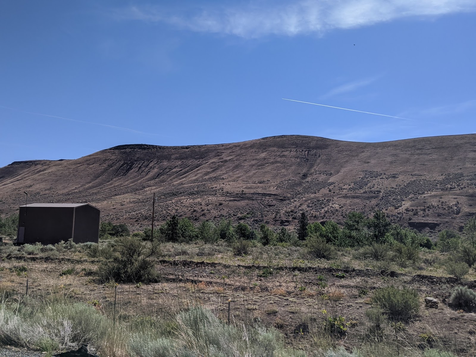
The area we drove through could hardly have been more desolate with very few homes and not one business visible from the road. I wondered how the 6,300 people managed to eke out a living and what educational and health resources they had access to.
As we approached Yakima, fruit orchards were in abundance.
About 20 miles west of Yakima was Rimrock Lake. We were thankful the local highway department had contained rock slides from entering the highway as we drove up 4,437-ft.-high White Pass.
According to a Road Guide of Mount Rainier National Park prepared strangely by Dartmouth College in New Hampshire I just discovered while writing this post, "Mount Rainier is the tallest of the fifteen great volcanoes, from Mount Garibaldi in British Columbia to Lassen Peak in California, that make up the backbone of the Cascade Range. These peaks, part of the thousand-volcano Ring of Fire that surrounds the Pacific Ocean, are known to geologists as stratovolcanoes - steep sided cones composed of thousands of layers of lava and ash erupted during their million-year lifespans."

After entering Mount Rainier National Park from the Stevens Canyon Entrance on the southeast, our first stop in the park was at Goat Rocks Lookout. This view of Mt. Rainier had to be one of the most spectacular views we'd seen anywhere over the years and that's saying something, considering we've traveled to over 100 countries!
We stopped briefly at the 95-ft.-high Silver Falls.
We read that Mount Rainier, towering above the surrounding terrain like an island in the clouds, creates its own weather. Though a cloud on the summit may seem harmless from where we stood, there could be an intense, localized blizzard wreaking havoc for climbers. At other times, the pattern may be reversed with climbers halfway up the mountain emerging from dense mist to a glittering world of sunlit ice.
This close to Puget Sound and the Pacific Northwest, Mount Rainier is a magnet for moisture-laden storm fronts. With its huge mass and elevation, the mountain forces the air to rise steeply. As it cools, record precipitation often falls on the slopes.


Though we didn't have a huge amount of time in the park, we wanted to make sure not to miss a trail called The Grove of the Patriarchs. That was because old-growth forests in the Grove comprised some of the richest and most productive ecosystems on earth! These dense, coniferous forests on the park's lower slopes and valleys reached an elevation of 2,000 ft. to over 6,000 ft. The Grove was described as one of the finest examples of lowland old growth forest in the Pacific Northwest.

Some of the ancient trees were over 500 years old when Columbus landed in the New World in 1492! The trees were so immense they reminded us of being back in King's Canyon and Sequoia national parks in California a few years ago.
As we looked up into the canopy, we knew these tall trees were hosts to about 200 different kinds of plants including mosses. liverworts, and lichens often only visible on a fallen branch. Animals living in the canopy were just as diverse with many birds, insects, and even mammals.
We could see why the emerald-green water of the Ohanapecosh River (Ohanapecosh means "clear stream") has made it one of the most beautiful streams in the park. The river originated from snowfields and inactive glacial ice several miles upstream on the east side of Mount Rainier.
The Western Redcedar was of great importance to the Northwest Native Americans. They created from the bark, mats, baskets, rope, roofing, etc. The straight-grained wood was easy to work with stone tools and fire. Durable, insect- and water resistant, Western redcedars became totem poles, dugout canoes and structures. Medicines were made from buds, seeds, twigs, leaves and also the bark.
The Douglas Fir was one of the largest and most abundant trees of the lowland forest. These magnificent trees can attain a height of 250 feet and can last up to a thousand years. These fast-growing trees thrive in open areas created by landslides, fires, and floods. The tree was named by David Douglas, a Scottish botanist who walked and canoed over 6,000 miles in the Pacific Northwest in 1825-26 while searching for new plants.
The Western Hemlock is a
densely needled tree described as an elegant conifer that stretches 200 feet
high and thrives in the shade of mature forests. Its scaly brown bark is
thinner than that of the Douglas fir.
Steven and I joked that there should have been a red light/green light system to allow easier passage across the swing bridge because up to 25 or 30 people would cross at a time from one side which created quite a long line if you happened to be on the other side like we were!
We were lucky, that because of Covid-19, there were far fewer visitors in the park than normal. I'd hated to think how long people might somehow have to wait to cross the rive on that swing bridge on a 'normal' day! It was one of only three swing bridges in the huge park.
Other rivers in the park weren't as clear because they originate in Mount Rainier's active glaciers.
These had been the root
systems of two giant trees that had grown so closely together but had fallen in
opposite directions during the winter of 1970. The trees flourishing in this
area had shallow, intertwined, and spreading root systems. When one tree was felled
by the wind, its roots may have pried up the other tree in the opposite
direction.
Below these giants were moss-covered rocks and a rich understory of vegetation, sword fern, salmonberry, violets, foam flower, vanilla leaf, oak fern, and many, many more, according to the Dartmouth guide.
Even though many of the tops of the trees had died, the trees still lived on. These ancient trees have survived a thousand years of winter storms, volcanic eruptions, floods, and fires.
Even with the ongoing health crisis and signs galore about 'safe hiking,' it was quite disconcerting to see only about a dozen of the 60 or 70 people on the trail wear masks or even attempt to social distance.
These were twin Douglas
firs, each 1,000 years old. Though their centers were rotten, the outer 9-10
inches were solid wood. One had lost its crown to the wind and the other’s
crown was dead. Though barely enough foliage remained to provide food to keep
these trees alive, they still managed to survive!
With thousands of people visiting these trees each year, we read a sign that indicated their (and our) trampling have however helped destroy the small plants, compact the soil and expose the roots.
Steven and I had hoped to continue driving through the southern section of the park on the Stevens Canyon Road from the Stevens Canyon Entrance west all the way to the Nisqually Entrance on the park's southwest. However, as the road was closed at Box Canyon, it meant taking a huge detour, retracing our steps and driving south out of the park to the town of Packwood and then west to the town of Ashford to reach the Nisqually entrance. That added a good hour or so onto our drive just so we could visit another section of the park!
Once we were finally back in the park again, we stopped briefly at the Longmire Museum, one of the oldest structures in the park. Originally the park headquarters, it was built in 1916.
It hadn't always been so easy to reach Mount Rainier. The park's early visitors arrived by horse or carriage over rough, often muddy roads. The arrival of cars in 1907 and improved roads brought simplified access to the mountain. Mount Rainier National Park was the first national park to experiment with cars! This service station, constructed in 1929, was critical to the first motorists.
Across from the museum and service station was the Trail of the Shadows, a loop trail around Longmire Meadow. James Longmire was a pioneer from the East, an explorer of the West, and a local mountain guide who successfully climbed Mount Rainier at the age of 63. On that same journey, he located mineral springs in this meadow that became in 1890 the Longmire Medical Springs Resort, an equivalent of a modern-day spa.
The alleged healing power of the mineral springs attracted many people to soak in the warm water and drink from the soda springs that were rich in sodium bicarbonate or baking soda as they were prescribed as an antacid!
Deer Ferns:
This was the only remaining cabin of several built in 1898 by Longmire's eldest son built along the trail in a hope by one family to establish the first settlement in what is now Mount Rainier National Park. The Longmire dream, though, was thwarted by more modern businesses that grew around the meadow because of the park's popularity.
Water flowing down the nearby stream and water rising up through the mineral spring both originated high above the meadow from snowmelt and rainfall. This enclosed spring was known as Iron Mike and its reddish pigment was referred to as mineral paint.
Lady Fern:
Dull Oregon Grape:
Mushrooms and mosses grew on the surface of a nurse log, recycling nutrients and water contained within the decaying wood.
I didn't get too close to the Skunk Cabbage to smell the plant!
Sword Fan:
I wish I had gotten closer to the Vanilla Leaf plant, though.
Some of the meadow's mineral springs!
The Western Hemlock tree towered over the forest.
Skunk cabbage and Devil's Club have lasted for centuries as valuable medicinal sources, tools and occasional food sources for Native Americans.
The Shadows hike had been fabulous with great view of the meadow, ideal weather, informative signs telling us what plants were which and far few fewer people than our earlier hike. I remember clearly thinking at the time it was like being in a rainforest with the mammoth plants and plentiful ferns!
Though it was 3:30 by then, we headed further into the park, hoping to see Carter Falls. But, as it meant crossing this rather treacherous looking dry riverbed, we abandoned the idea and drove on toward Christine Falls.
It had been really frustrating all day trying to find a number of the park's attractions because of the abominable signage or lack thereof. I remember commenting about that to one of the park's rangers who seemed equally upset after they had implored management to make improvements to little avail. Generally, Steven and I only knew of something to see when we saw a lot of cars parked along the side of the road as there was so indication of what viewpoint was coming up!
Because of its location just beside the road, Christine Falls caused quite a traffic jam so we knew we'd arrived at the falls but it was no thanks to any sign! After parking, we walked over to the viewpoint for another spectacular view under the road.
What a tremendous feat of engineering for the bridge to be built over the falls.
Hard not to be gobsmacked a little further on by the view of Mount Rainier at Ricksecker Point! The lookout was named for the engineer who designed and surveyed the park's southern road.
Seeing these OMG views, we were so glad that we'd driven the extra two miles to reach this point, despite the lateness of the hour.
The view of Nisqually Glacier from Reinsecker was also nothing short of phenomenal. In 1912, the glacier reached almost as far as the current highway bridge. Like the Nisqually, Mount Rainier's 26 named glaciers are in constant flux, melting back or advancing up to three feet a day.
In for a penny, in for a pound, we figured, as we drove to Narada Falls even though it was getting so late in the day and we had a very long drive back to The Dalles in Oregon.
Luckily, it was only a short trail to the 168-ft.-high falls. What made these falls quite special was the hard, andesite lava rock that created the steep drop.
As the trail to the bottom of the falls was partly shaded, snow still covered portions of it which made it quite muddy.
We were so close to the falls, a fine mist was falling which made my hair curl on the spot!
As it was already 5, we reluctantly turned around at Narada Falls as it was a 3.5 hour drive 'home' to our hotel. There was so much more to see at Mount Rainier but we left very satisfied by what we did see as it had been such an unexpected treat to visit the park at all that day. Perhaps some day we can return and see more - who know?!
With late afternoon clouds rolling in to obscure the summit of Mount Rainier, it looked like a perfect time to bid the fabulous mountain adieu.
Even though it had been a 13-hour-long day, our day trip to Mount Rainier had been worth every moment. The glorious sunset views back in The Dalles were the perfect ending to a perfect day!
Next post: The Dalles Murals and more of the Columbia River Gorge.
Posted before sunrise on October 10th, 2020, on our last day here at Grayton Beach State Park on Florida's Panhandle this year. After leaving home two months ago exactly, we're heading home tomorrow. But, as is often the case with us, it will be anything but a direct route! Our homeward journey will take us north first to Chicago to see our daughter, Natalie and her family, before stopping in three more state capitals.


Absolute "OMG" views of Mount Rainier and the towering majestic trees that populate its National Park. And of course, always love to see your smiling faces ! Happy Canadian Thanksgiving to you !! xo
ReplyDeleteSteven and I were totally gobsmacked by all the beauty at Mount Rainier and we only saw a small part of the stunning park!
DeleteHappy Thanksgiving to you and the clan! XOXO back at you
I have to see this in person. Janina
ReplyDeleteCombine a trip to Mount Rainier with your Columbia River Gorge vacation next year! You won't regret any of it, I promise you.
ReplyDelete