Earlier in the day, Steven and I had left Dubois, Wyoming, en route to Gillette so we could visit Devil's Tower National Monument in the far eastern part of the state. We'd first spent time at the quite fascinating Big Horn Sheep Center and then driven through some of the state's exquisite scenery to reach the beautiful and peaceful Hot Springs State Park in Thermopolis before reaching the small town of Worland.
In 1800, Charles Worland dug an underground stage stop here on the old Bridger Trail. The dugout grew into the city of Worland drawing pioneer men and women to the area, and dreaming that Big Horn River water would create a new way of life. Miles of irrigation canals were dug so that the formerly parched land became an oasis and making Worland known as the Jewel of the Big Horn Basin. Pioneer Square honored the area's early setttlers. I read that there was a nearby drinking fountain that had artesian mineral water from the Bighorn Mountains we'd just passed through but we didn't see it, unfortunately.


When I heard that, I immediately told Steven how it would be neat to see the other 66 Toth works that were part of the Trail of the Whispering Giants. Doubt that will ever happen but fun to dream about what a road trip that would be!

In front of the town's Washakie Museum and Cultural Center was a 25-foot-tall Columbian mammoth. Over 165 million years ago, more than 100 dinosaurs lived in the soggy tidal flats of the no-longer-existing Sundance Sea. IF we had had more time, it would have been intriguing exploring the Red Gulch Dinosaur Track site in the Sundance Formation in the eastern Big Horn Basin.

We were happy that the museum required visitors to sanitize their hands upon entering.

Scientists once thought a sea covered the entire Big Horn Basin during the Middle Jurassic period. They expected to unearth only marine fossils in the Sundance Formation but instead discovered footprints which proved that the area hadn't been totally underwater. It was amazing that this single fossil finding could change our understanding of our past!

After people first settled into this region around 15,000 years ago, they lived a mobile lifestyle, hunting game and gathering seasonal plants until about 200 years ago. The Big Horn Basin held many clues to the story of their continuous and successful existence. To remain within a day's walk of food, water, or other necessary resources, prehistoric bands would have packed up and moved to a different campsite 50-100 times a year!

The bands and family groups traveled a familiar territory, revisiting campsites from season to season and year to year, finding shelter in the natural landscape, and also in a variety of constructed dwellings. These easily constructed shelters were thought to be seasonal shelters and were found in forested areas of the lower foothills, near valleys where game animals wintered.

Scientists don't always agree with why wooly mammoths disappeared from the Big Horn Basin. Some surmised that humans were good at killing the mammoths and if too many females were killed before they could breed, the species would have eventually died out. Another supposition is that 13,000 years ago the Big Horn Basin was a good place for mammoths to live but that at the end of the Pleistocene era, the area became too dry to support the beasts.


The conical-shaped Soapy Dale Peak Lodge was originally located around 8,500 feet in the Absaroka Mountains on the western edge of the Big Horn Basin. It contained about 130 poles that had been cut from aspen, fir, pine, and spruce saplings. As it was decaying and in danger of collapse, the structure was carefully dismantled in 1985 and moved to the museum so it could be conserved. Each of the lodge's poles was numbered and its location was 'mapped' with photos. Then the fragile logs were removed and protected for their journey down the mountain. Scientists believe members of the Shoshone tribe built the lodge in the mid to late 1800s. Tree ring dating was used to determine the age of the structure.

Lodges were used as temporary shelters; whenever the structure was needed, fresh branches and brush were added to the pole framework. Animal hides, bark slabs, or grass mats provided more protection from the elements.

Places where rocks were easily found made good sites for setting up tipis as a ring of rocks arranged around the base of a tipi helped anchor the animal hides.

Caves and rock overhangs were an easy solution to get out of nasty weather. These natural shelters could be used for a few hours or several weeks as needed.

The museum had been named in honor of Chief Washakie, a revered leader of the Eastern Shoshone Indians. Washakie (1804-1900) sought peace with white settlers but he was also a fearless warrior, unafraid to defend his people and lands. Working as a scout for the US Army, he even fought with US soldiers against other Native American tribes. Washakie believed he and the Shoshone should make the best of what they couldn't change, thinking it best to aid early trappers and settlers instead of fighting with white pioneers.


Though Worland was a small town, the museum had been very impressive and we'd only taken the time to see a very small part of it. Steven and I were glad that we'd taken the time to stop in Worland to learn more about the region.

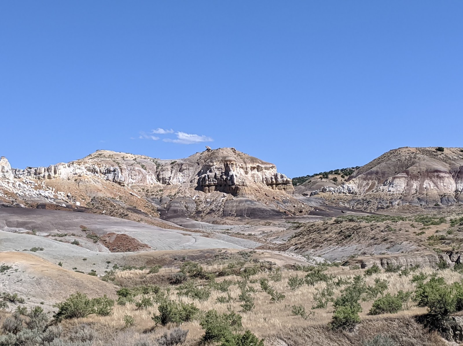
What spectacular scenery we encountered as we headed further east from Worland to Tensleep!


These next shots were of the Tensleep Canyon as we headed east to Buffalo on the Cloud Peak Scenic Byway:


Next post: A long-awaited visit to Devil's Tower National Monument the next morning for Steven!
Posted on December 17th, 2020, from our home in Littleton near Denver just a couple of days before we leave on another road trip, this time out West through some of Utah's national parks, Nevada's Extra Terrestial Highway, and on to Las Vegas, Yuma, and Tucson before a couple weeks in hopefully warm Phoenix until mid-January. We'd so hoped to be in San Francisco for Christmas with two of our children, their spouses, and our seven-month-old granddaughter but the state's lockdown has sadly prevented our seeing any of them. Steven and I hope that you and your loved ones continue to be safe and connected during this horrific coronavirus.
No comments:
Post a Comment