
Just ten minutes after leaving Ingonish at the entrance to Cape Breton Highlands National Park in far eastern Nova Scotia, Steven and I reached Green Cove, a coastal headland where rocky bluffs and shallow coves became the norm along the park's eastern coastline. It was immediately apparent that the plants living near the cove had a difficult struggle because of their proximity to the mighty Atlantic.
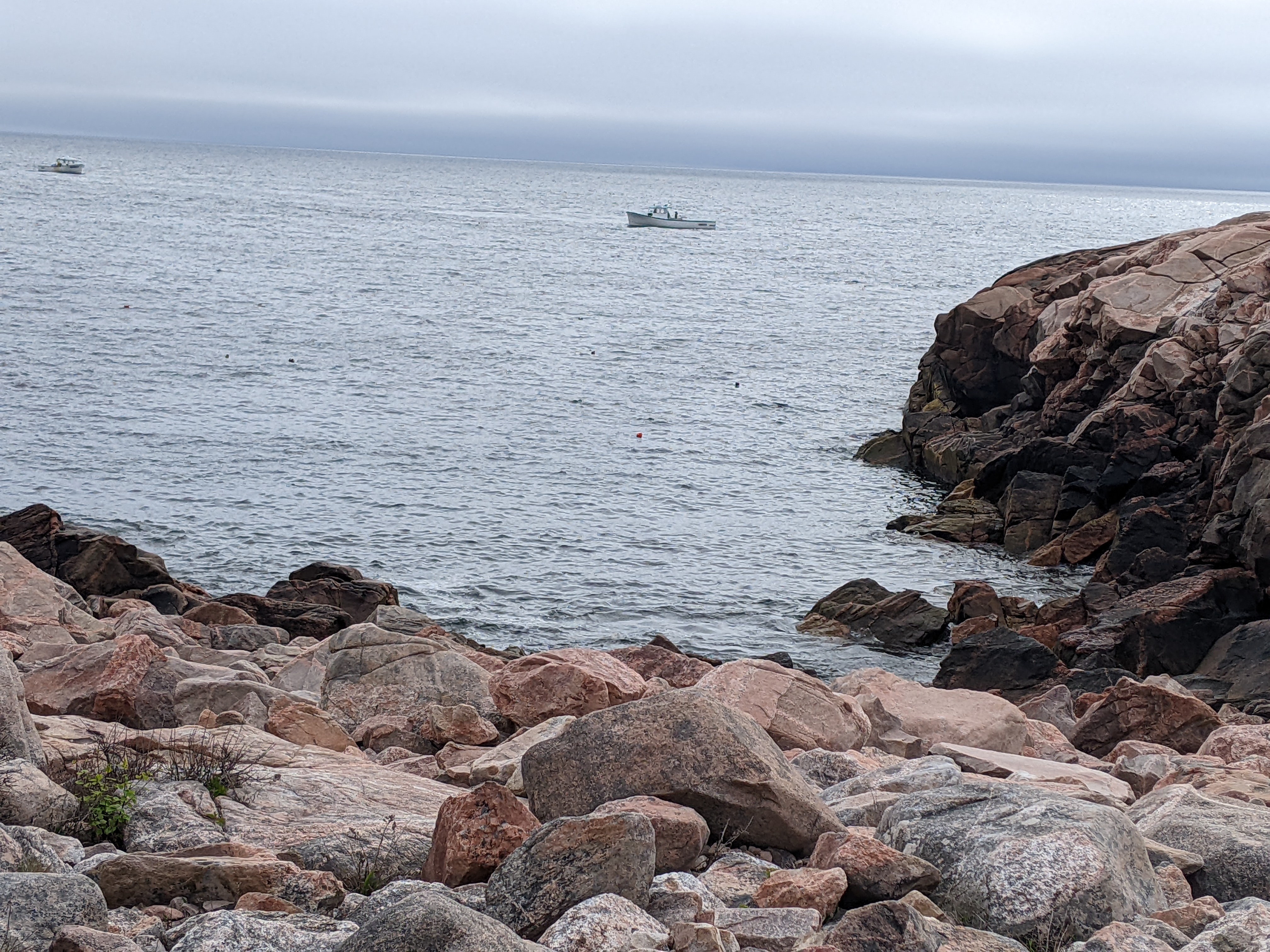
The waves crashing against the headland kept the soil too thin to support most plants as some soil collected in sheltered areas. We only spotted a few clumps of white spruce that had weathered the elements. The constant winds, full of salt spray, had resulted in the trees' windward side drying out and the salt killing the exposed roots. The twisted and stunted trees were known as Krummholz or 'crooked wood.'
Smaller plants have adapted to life adjacent to the ocean's salty spray with dense mats of black crowberry growing low to the ground which decreases evaporation. The bayberry's thick leathery leaves and the common juniper also decrease evaporation and resist salt spray's effects. Plus, the juniper's needle-like leaves lower water loss by their small surface area.

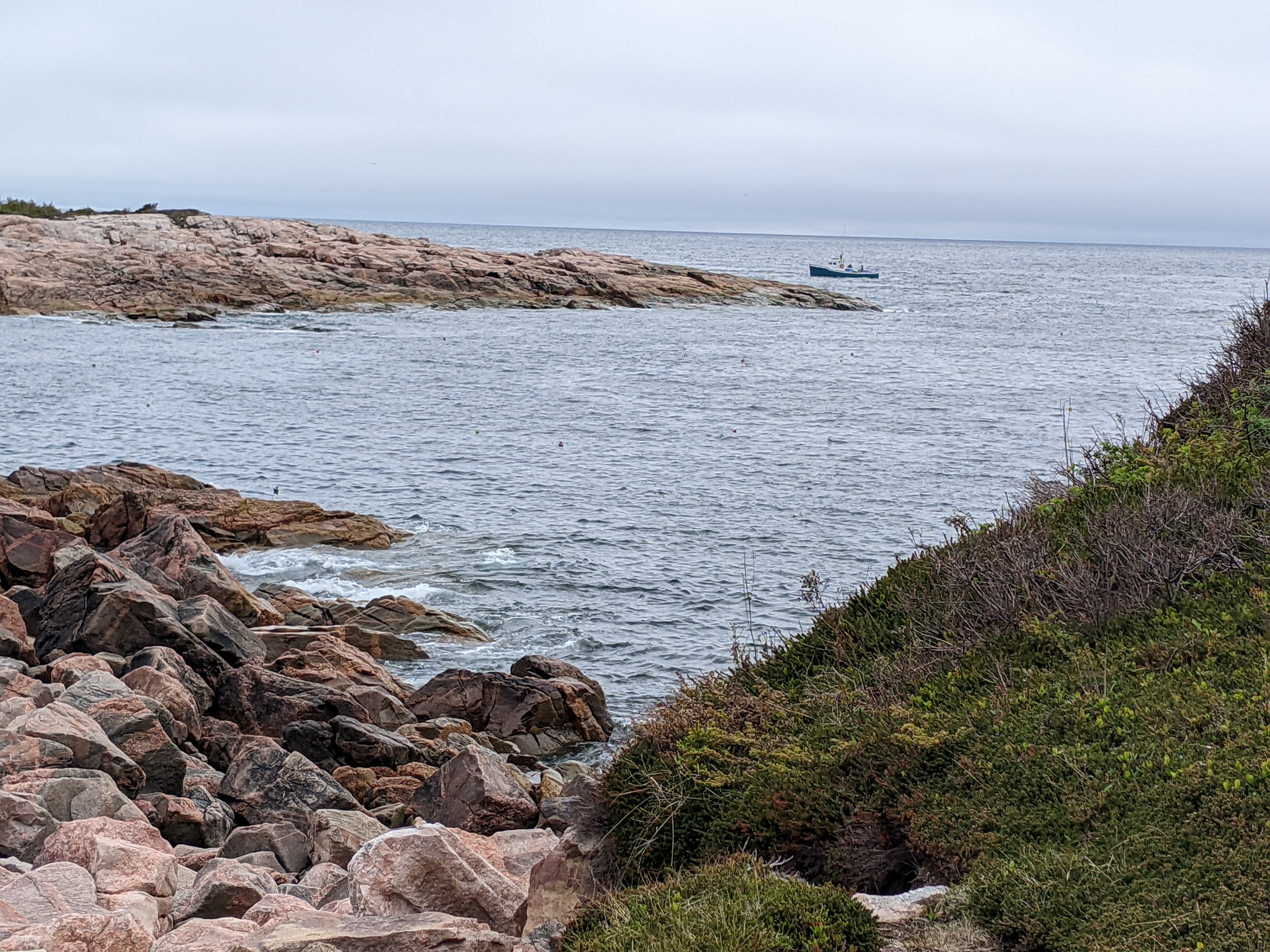
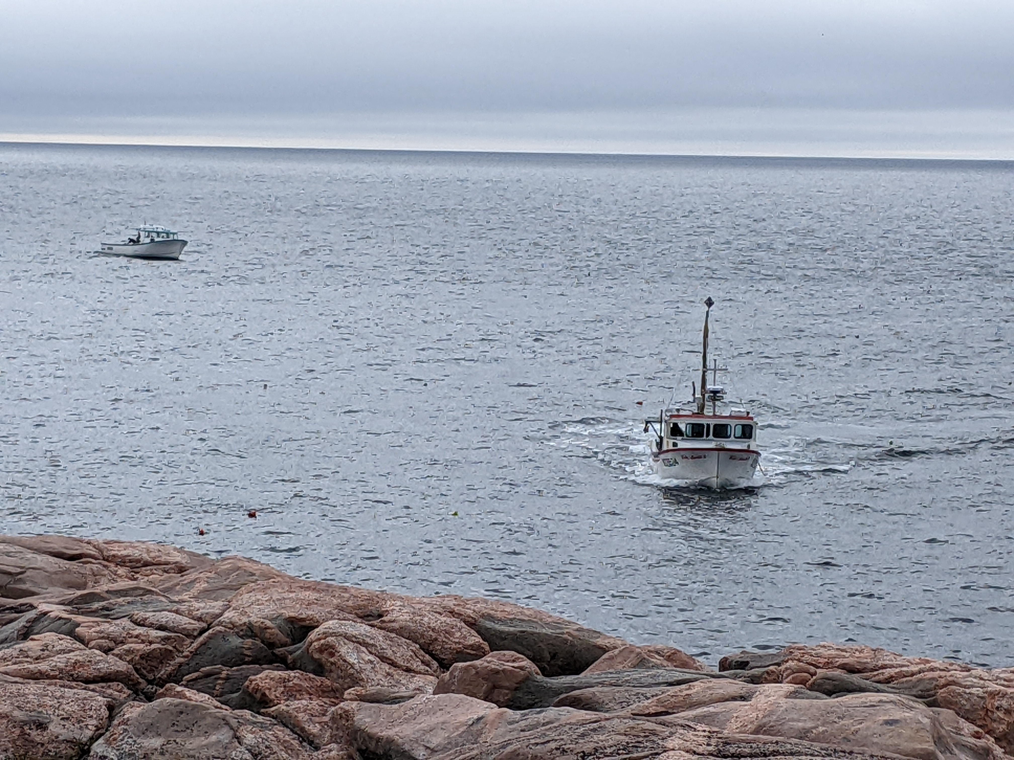
It was incredibly peaceful watching for a while the fishing boats bob up and down in the waters close to shore.

About half a dozen boats weaved among each other as they circled their traps, what kind they were Steven and I didn't know.
Further north along the trail was Dingwall Harbour, a small fishing village.


At Cabot Landing Provincial Park, we learned that after Genovese native Giovanni Cabota aka John Cabot received a royal warrant from King Henry VII to pursue a westward route to Asia in May of 1947, he landed here in Cape Breton's Aspy Bay 35 days later.

You can see why the park wasn't called the Highlands for nothing!

I must admit to feeling a little confused by the plaque in the park indicating that Cabot and his son 'discovered the continent of America' in 1497 as it's more commonly said that Christoper Columbus discovered America a full five years earlier in 1492. Of course, neither is correct as there were plenty of people who were already here.


Although sources can't pinpoint with any degree of certainty where Cabot landed, he made landfall on Canada's east coast and 'local tradition' records this spot as that landfall. From that first official voyage came Britain's subsequent claims in the New World and the start of the British empire.

Before continuing on to Meat Cove, the northernmost spot on the island, we stopped at Capstick, the last bit of civilization before the pavement ended for the next five miles.


Views looking back and onwards as we detoured north of the Cabot Trail ...


We wondered if the hamlet visible ahead was Meat Cove.


Can you imagine how dreamy this drive must be in the fall with the trees in all shades of red, gold, and orange?

I forgot to mention in the previous post that many of the signs here in Cape Breton were bilingual. They weren't in English and French as we were accustomed to in the rest of Canada but English and Gaelic. Here was one such example.

With just half a dozen homes, do you call Meat Cove a village, hamlet, burg, or what?!


Whatever the correct term, the scenery as we approached Meat Cove was divine.

The drive to Meat Cove was an example of the journey being extraordinarily special but not the destination as there was nothing in Meat Cove - no opportunity to buy a bottle of water, a snack, a postcard, another souvenir, anything at all.

People wanting to find a quiet place to camp would be hard-pressed to find one with more solitude. Steven and I used to be huge campers but this chilly spot in the middle of nowhere would not entice us.

After returning to the Trail's paved road, we headed west around the tip of the peninsula toward the Gulf of St. Lawrence.


If we squinted our eyes really tightly we could almost see Beulach Ban Waterfall nestled in mountains that arose 400 million years ago when oceans and glaciers entered this valley before retreating.


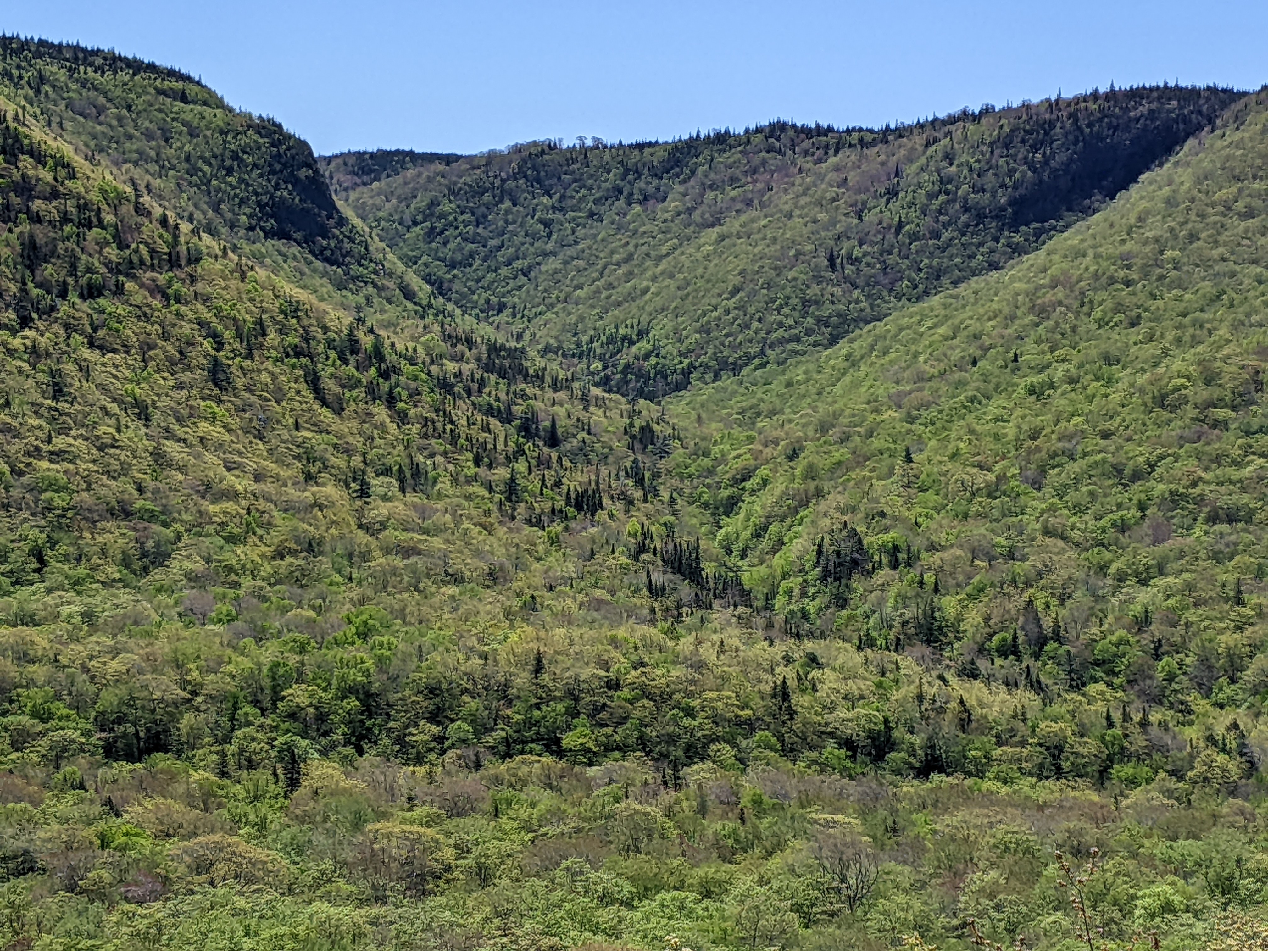
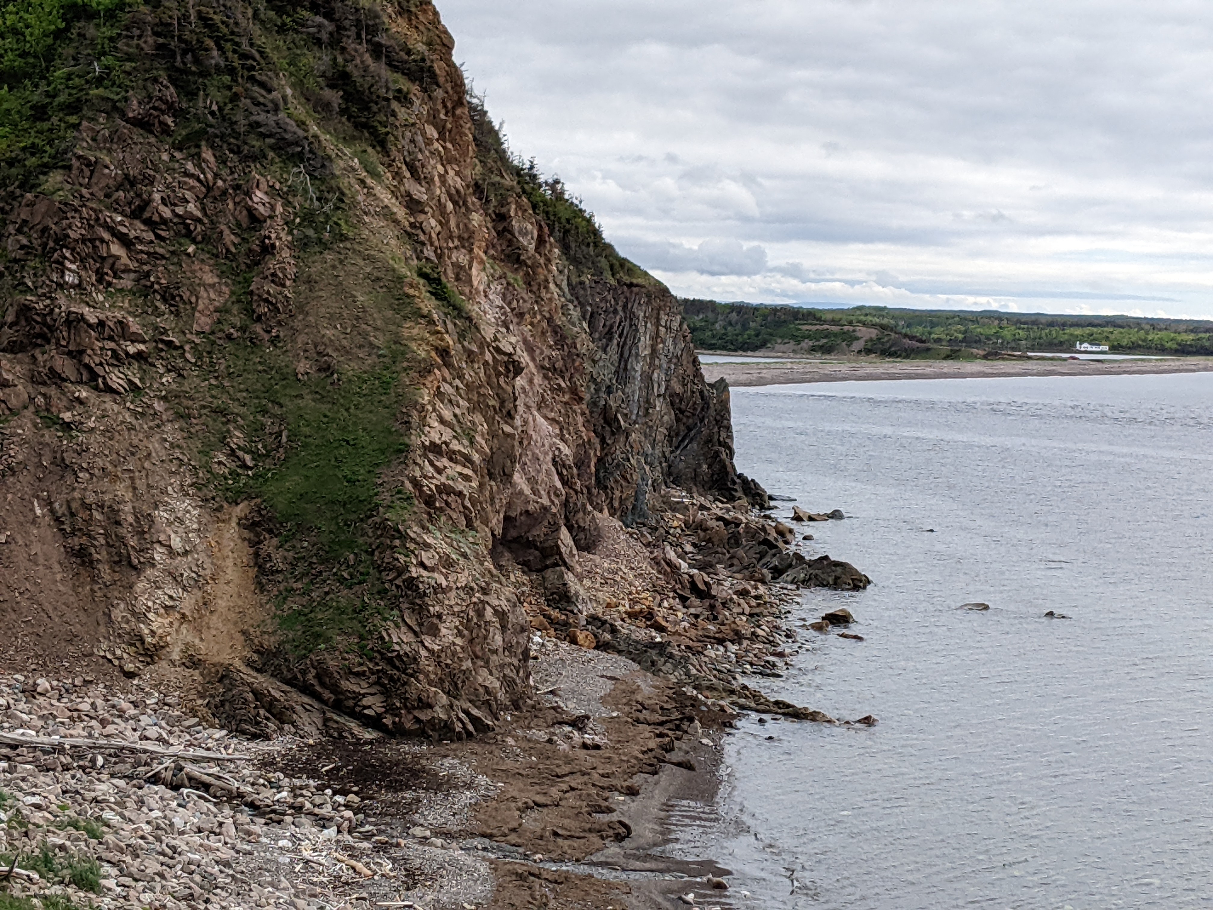
Aspy Fault was once covered by sedimentary rocks that have eroded away from melting glaciers to form the Aspy River Valley. Nearby were igneous and metamorphic rocks that were more resistant to erosion. This contrast of hard and soft rocks in the valley shifting as continents collided and shook the earth made Aspy Fault especially impressive.

Remarkably, Aspy Fault extends under the ocean all the way to neighboring Newfoundland and even to the edge of the continent. It was quite possible that the fault may have been connected to European faults like Loch Ness' Great Glen Fault!

I read that the Aspy Fault cut a deep crevice 25 miles toward the southwest into the heart of the Cape Breton Highlands. I was surprised to learn that Cape Breton Island hovered near the equator, albeit 300 million years ago, when it was in the middle of the newly formed supercontinent, Pangea! Not to get too technical, but the collision of continental plates that formed Pangea also contributed to the movement that made Aspy Fault.

A sign warned us we might have to wait 8 minutes because of the road construction. True to form, we only had to wait 30 seconds which made us laugh!

The largest old hardwood forest in all of the Maritimes was here at Grand Anse Valley in one of the most protected areas of the national park.

The Scottish immigrants who settled this virgin forest in the early 1800s had been expelled from the highlands on the Isle of Skye. As an homage to the Scottish heritage of nearby Pleasant Bay was the Lone Sheiling shepherd's hut.
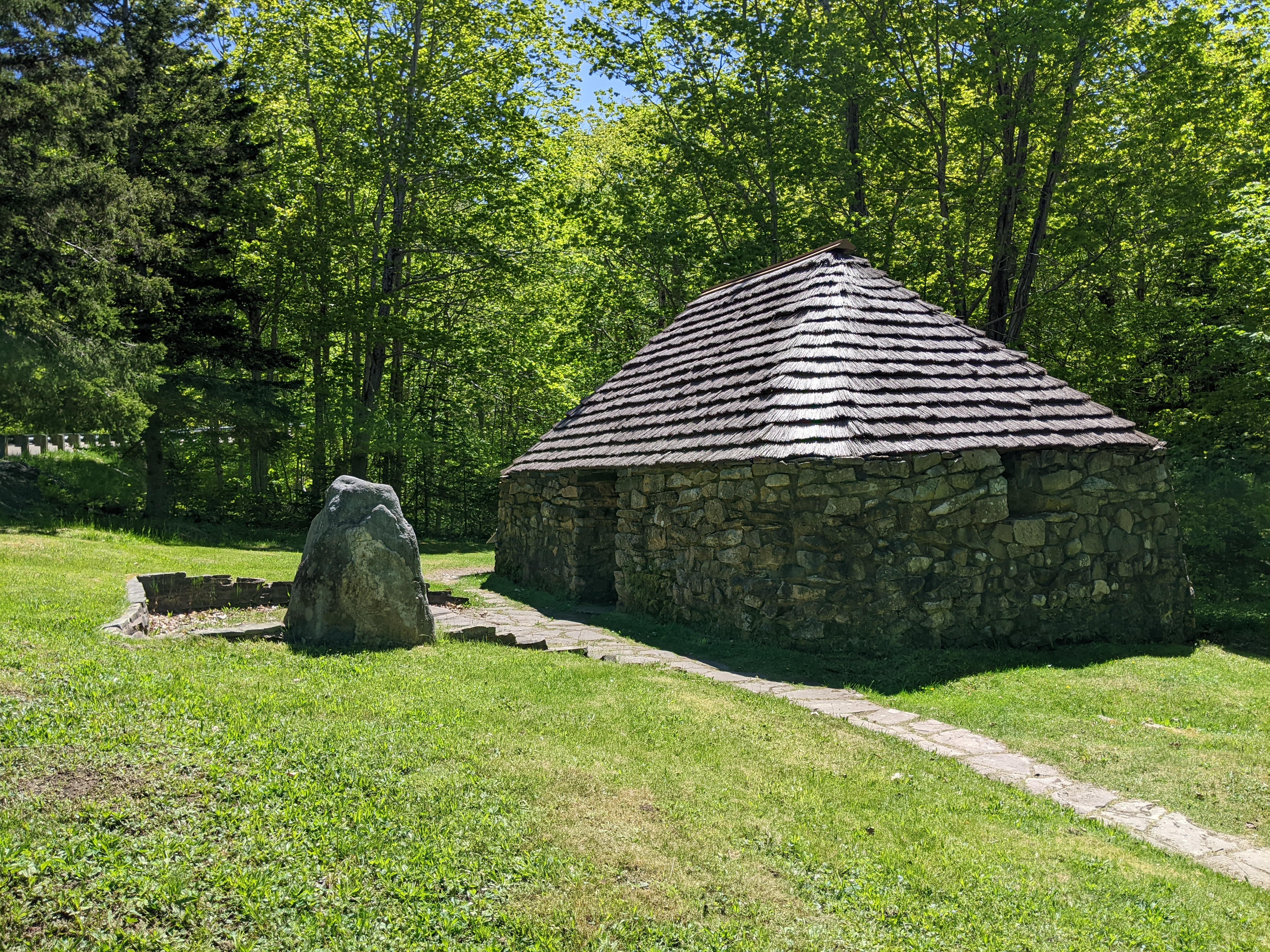
When tenant farmers or crofters in Scotland's western highlands grazed their animals on the hill pastures, a sheiling protected the crofter and often some livestock. During storms, the open end would be closed with peat sods. Heat, light, and smoke were provided by a peat fire.


As we walked along the MacIntosh Brook Trail, we learned the Mi'kmaq had lived off this land since time immemorial. Coastal areas were their home during the summer but they relocated to the forests during the winter where hunting, fishing, and the gathering of plants guaranteed their lifestyle.

We've hiked on all the continents but hadn't seen anything like these furry-looking needles before!


After I admired some of our friend Lezlie's art when we visited her stunning home in Chester, she suggested we stop in at the most unusual Timmons Folk Art Studio in Pleasant Bay. Steven took one look and said he'd wait in the car but I was intrigued to see more.


Ahoy matie!

The lookoff over Pleasant Bay was magical from every direction!


We joined others trying to catch a glimpse of pilot whales and saw what might have been three come up for air for just a moment.

I hope the others had more luck spotting fin, minke, and pilot whales who frequent the Gulf from early May until late November. Because harbour porpoises and white-sided dolphins are smaller, they are spotted less often.

A view from MacIntosh Mountain Lookoff to the Gulf:

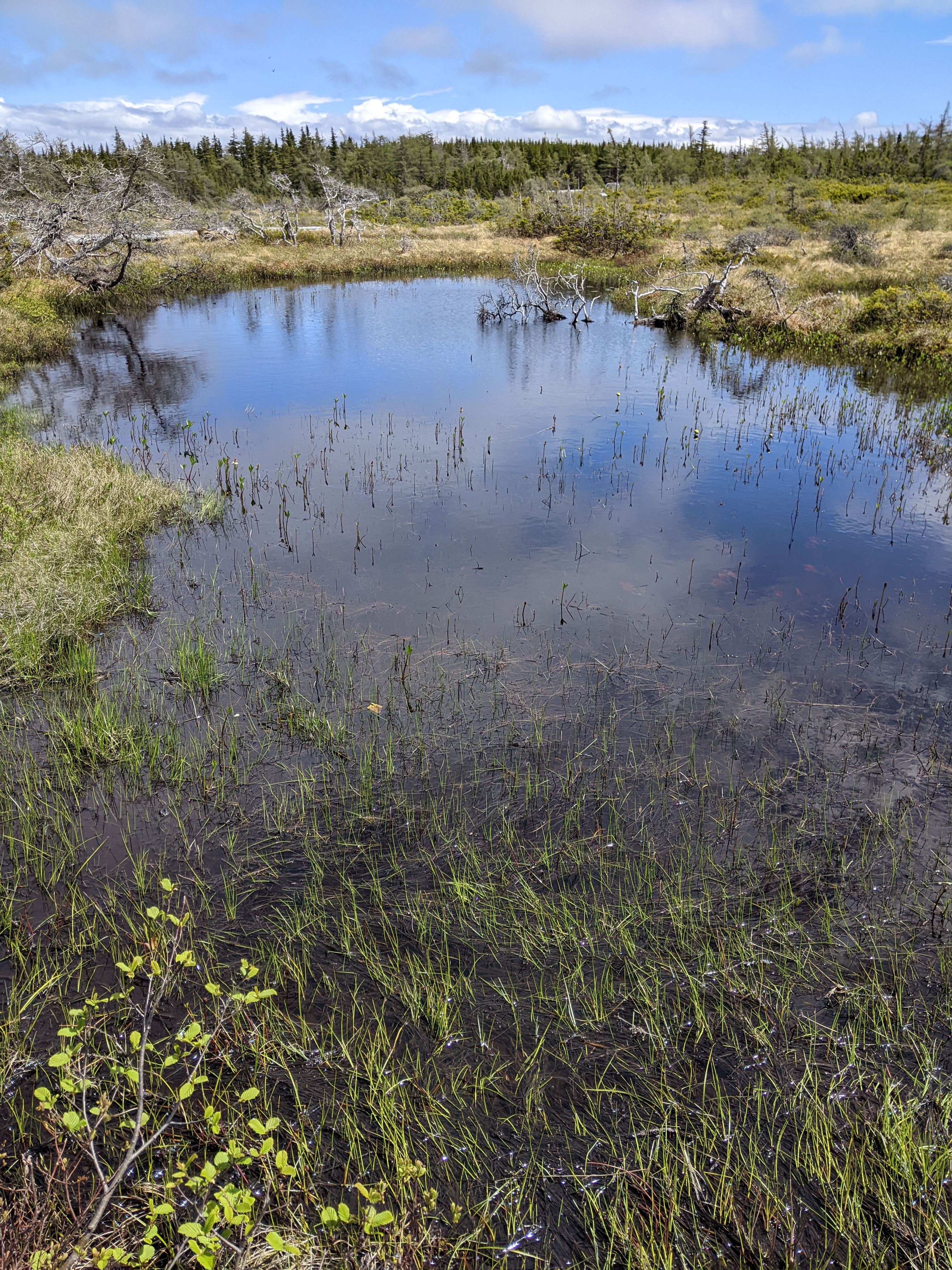
One of my favorite strolls in the national park was at French Mountain Bog which was located 1,350 feet above sea level on the highland plateau. It was so, so different than other areas of the park. As is typical of bogs, tiny sphagnum mosses carpeted the land everywhere we looked.

Bogs, fens, and other wetlands are giant sponges that soak up and retain runoff when rain is plentiful but gradually release the water during dry periods. In so doing, Mother Nature slows down flooding and helps preserve stream flow.

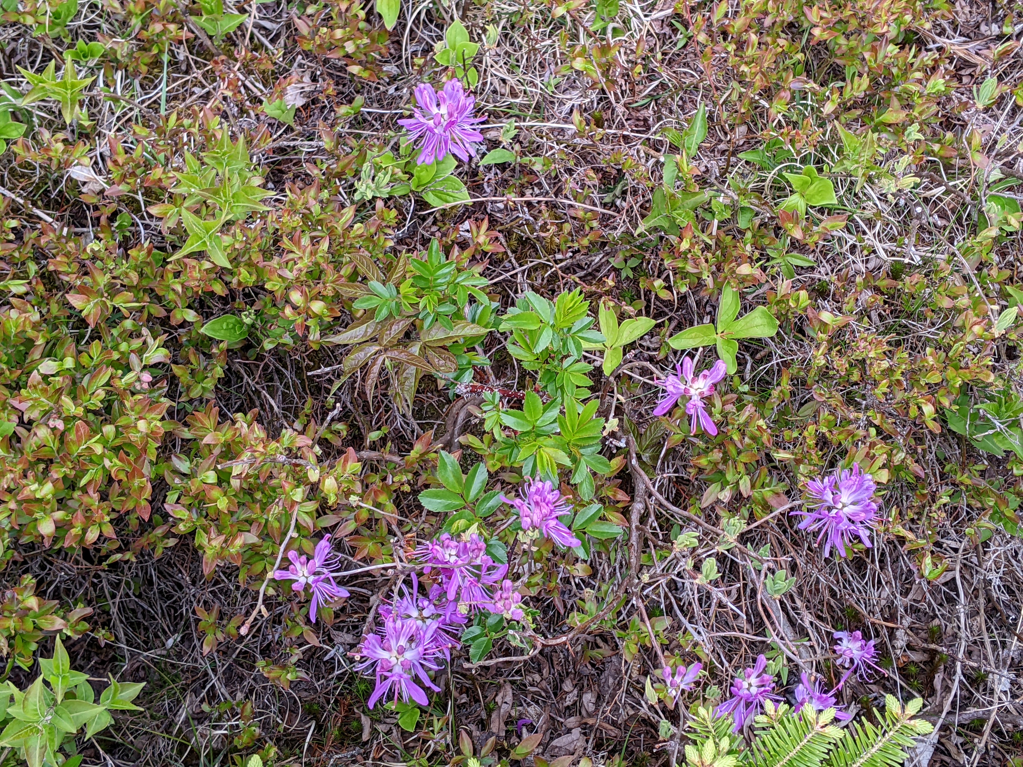
I had to ask another visitor what these flowers were. I wouldn't have guessed orchids.


A pretty view from French Lake Turnoff:

Fiddleheads on our next trail:


It wasn't until we reached the park's Skyline Trail that we were faced with needing to know anything about Moose Wisdom! After moose were hunted to local extinction by the early 1900s, Parks Canada reintroduced the beasts in the 1940s. When budworms killed off the spruce-fir forest, birch trees replaced the dead forests which were ideal for moose. As a result, the moose population exploded.

When moose ate the young birch trees, that halted the forest's regrowth. As part of a ten-year plan to monitor the forests without moose being present, an exclosure was put up in the fall of 2007. That meant smaller animals could enter the fencing but moose couldn't.

It was a little alarming to learn that the moose's eating habits had led to one-third of the national park's boreal forests being converted into grasslands. Even worse, there had been very little regeneration of the boreal forest. Grasslands have taken over, forever changing the park's landscape.

Moose had been kept out of the exclosure so recently planted seedlings could grow.


The goal of park staff was to stop the boreal forests from disappearing - that was happening slowly with the planting of thousands of balsam firtrees in the ginormous exclosure that was the size of nine football fields.

Outside the exclosure:

The difference was huge in terms of the number of trees inside and outside the exclosure.

Our first glimpse of Skyline Highway from the Skyline Trail:

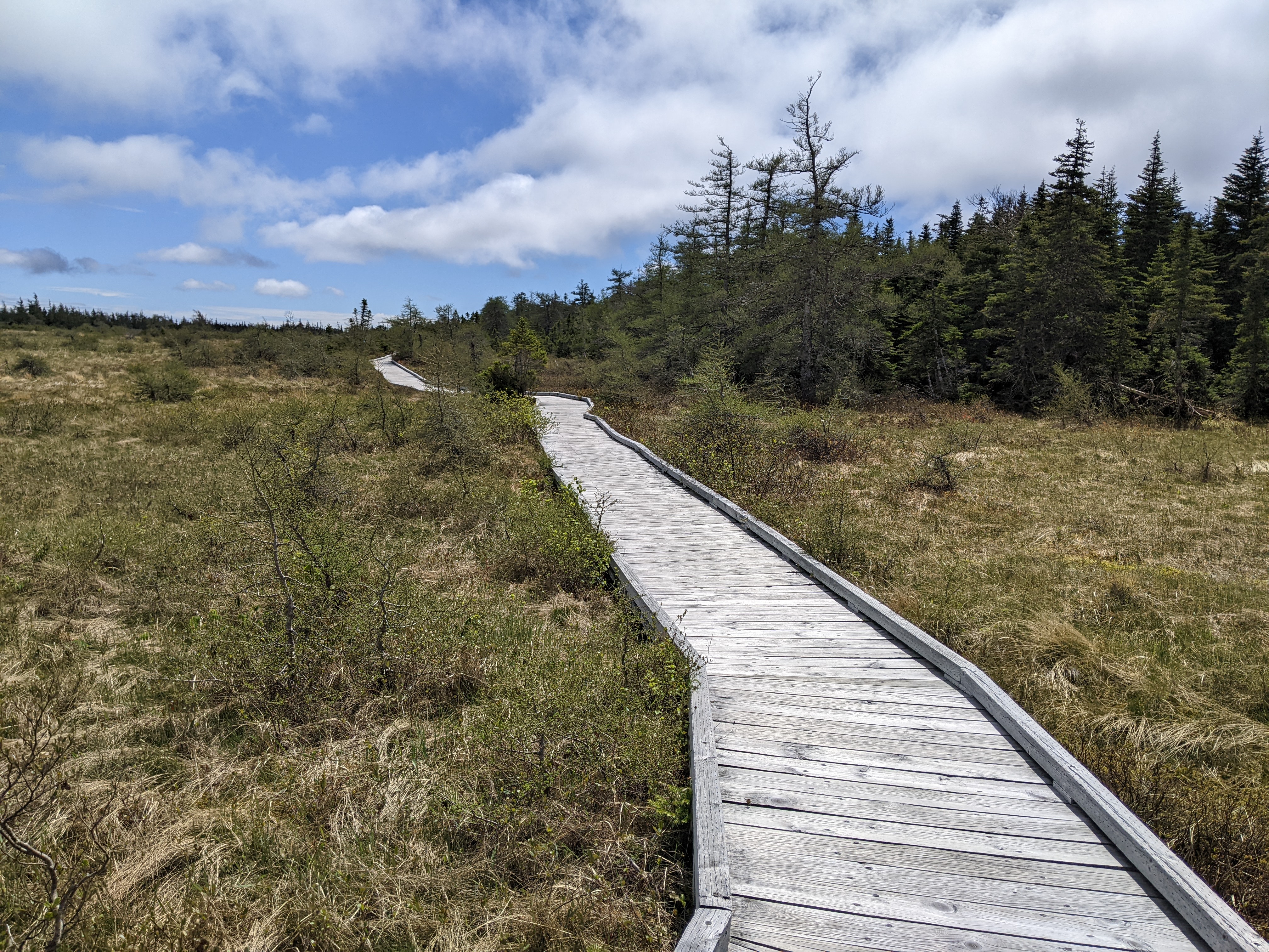
Further along the trail was a boardwalk that had been erected to permit hiking on the headland while protecting the fragile ecosystem. Park staff was committed to nurturing the fragile golden heather on a very severe windswept spot on the headland.

Overlooking the Gulf at the end of the trail unless we went a long way down and that wasn't happening that day! We admit to being a tad bummed there was no iconic red chair at the end of the trail as there had been at other trails in the park.

One of those OMG scenes!
Although I waited until there were no people around to take the shot, there had been a surprisingly large number of hikers for a chilly Monday in early June. I hated to think how much more crowded it would be later in the summer and was even more thankful for the boardwalk.

Darlene: You would have been in your element that day as just the Skyline Trail was more than five miles long!

One of the most beautiful drives we'd ever been on was the Skyline Drive as we headed southbound toward the Acadian town of Cheticamp as it was impossible to tell where the sea ended and the sky began.


If you like the motel's wild colors, just wait for a couple more posts when I begin writing about the Newfoundland portion of our trip!


There was no mistaking the Acadian presence on the map of the province! Cape Breton Highlands National Park, by the way, was the 'finger' on the far right upper corner.

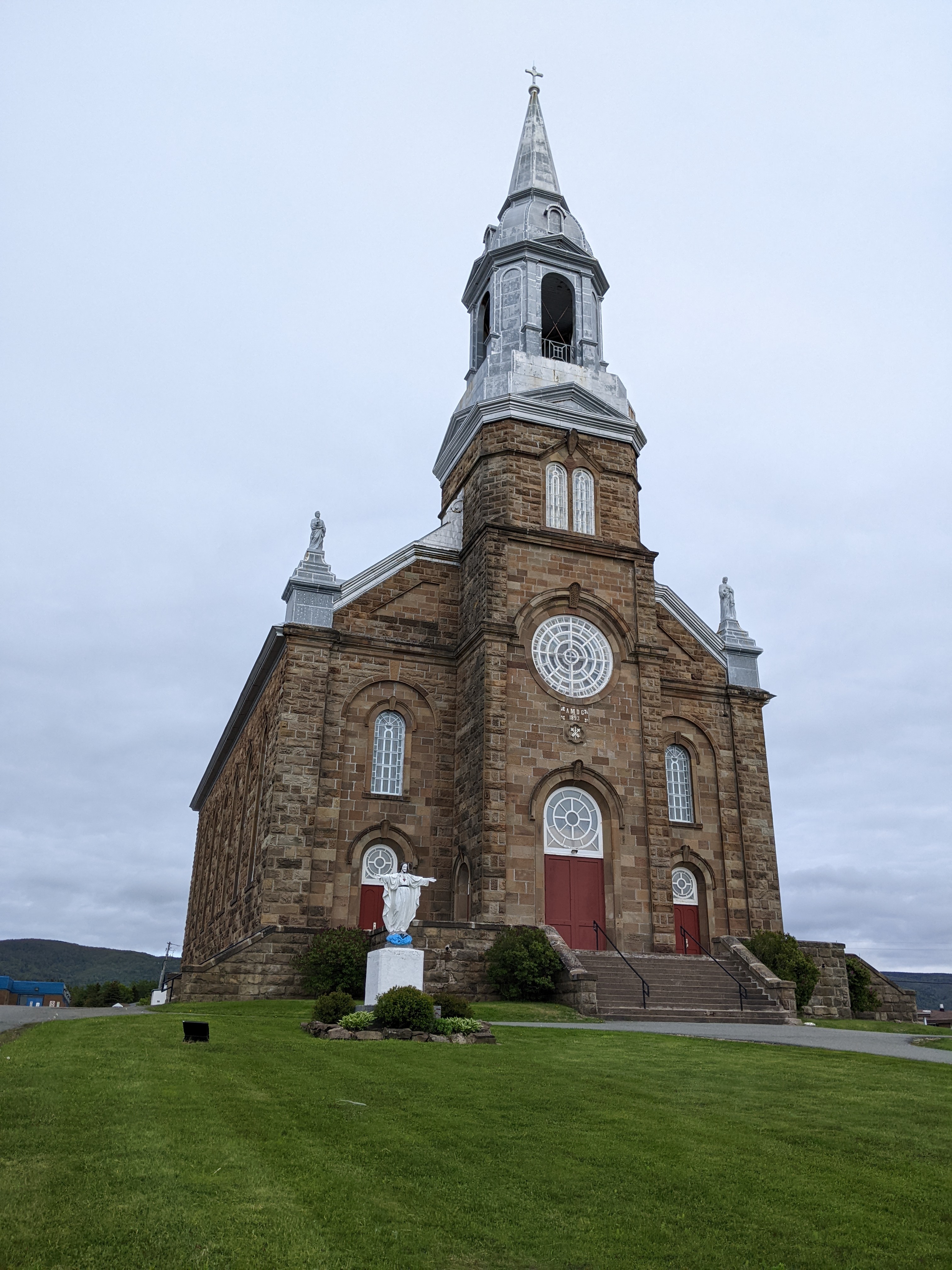
The distinctive French-styled St. Pierre Catholic Church had been constructed in 1893 and was by far the tallest building in town with its 164-foot-tall tower. With its commanding size, it could easily be seen up and down the coast.
The street signs were uniquely Acadian with the colors of the flag including the yellow star.


Cheticamp is known as the World Rug Hooking Capital, a craft developed centuries ago by Acadians. I can't tell you how excited I was when we arrived in the village of 1,000 well after 6 and found Les Trois Pignons still open. The building comprised the Acadian cultural and genealogical center as well as a gallery of tapestries that have been displayed in such august locations as the White House, the Vatican, and Buckingham Palace. One piece depicting US presidents was crafted using 7 mikes of yarn!

I made sure to support the local economy before leaving the shop!

Cheticamp Harbour:


Sunset after a picture-perfect day from our cabin in Cheticamp:

Next post: Beetling across the west coast of the island to Sydney to get the so-called 'short ferry' over to The Rock aka Newfoundland!
Posted on August 22nd, 2022, from home in Denver before I fly out to San Francisco for a few days to see our new grandson.
I love the hooked rug you chose and all the wonderful photos of a truly "divine" skyline trail !! xo Lina xo
ReplyDeletePerfect word you chose for the Skyline Trail and Drive, Lina! I actually bought several other smaller pieces there and then a small hanging at a restaurant in town. I'm 'hooked' on them.
ReplyDeleteGreat post and great pictures! Makes us want to book a trip!
ReplyDeleteNova Scotia was dreamy, Kellye, in so many ways. If you have time, I would recommend spending two weeks exploring all the nooks and crannies of the province as it's laid out with great driving trails that takes the chore out of devising a route! Thanks for reading.
ReplyDelete