Because the town of Bend in central Oregon is bordered by the Deschutes National Forest and the Cascade Mountains, there were countless recreational activities nearby. That was why we set out right away on the Cascades Lakes Highway, a 100-mile scenic drive through the forest, to view the mountains. Since 1988, the National Scenic Byway designation was critical to protect and sustain the natural state of this area's scenic qualities. The Cascades Lakes Scenic Drive, also known as the Century Drive because of its length, used to be a dirt road in the days of the horse and buggy. Kit Carson, John Fremont, and other early explorers once traveled this route.
When we stopped first at the Cascades Lakes Welcome Station, we learned that people have been living in the central part of the state known as the High Country for over 14,000 years. Beginning as animal migration paths, these trails were ancient pathways used by early inhabitants. The reasons for travel in the region were for food and water.

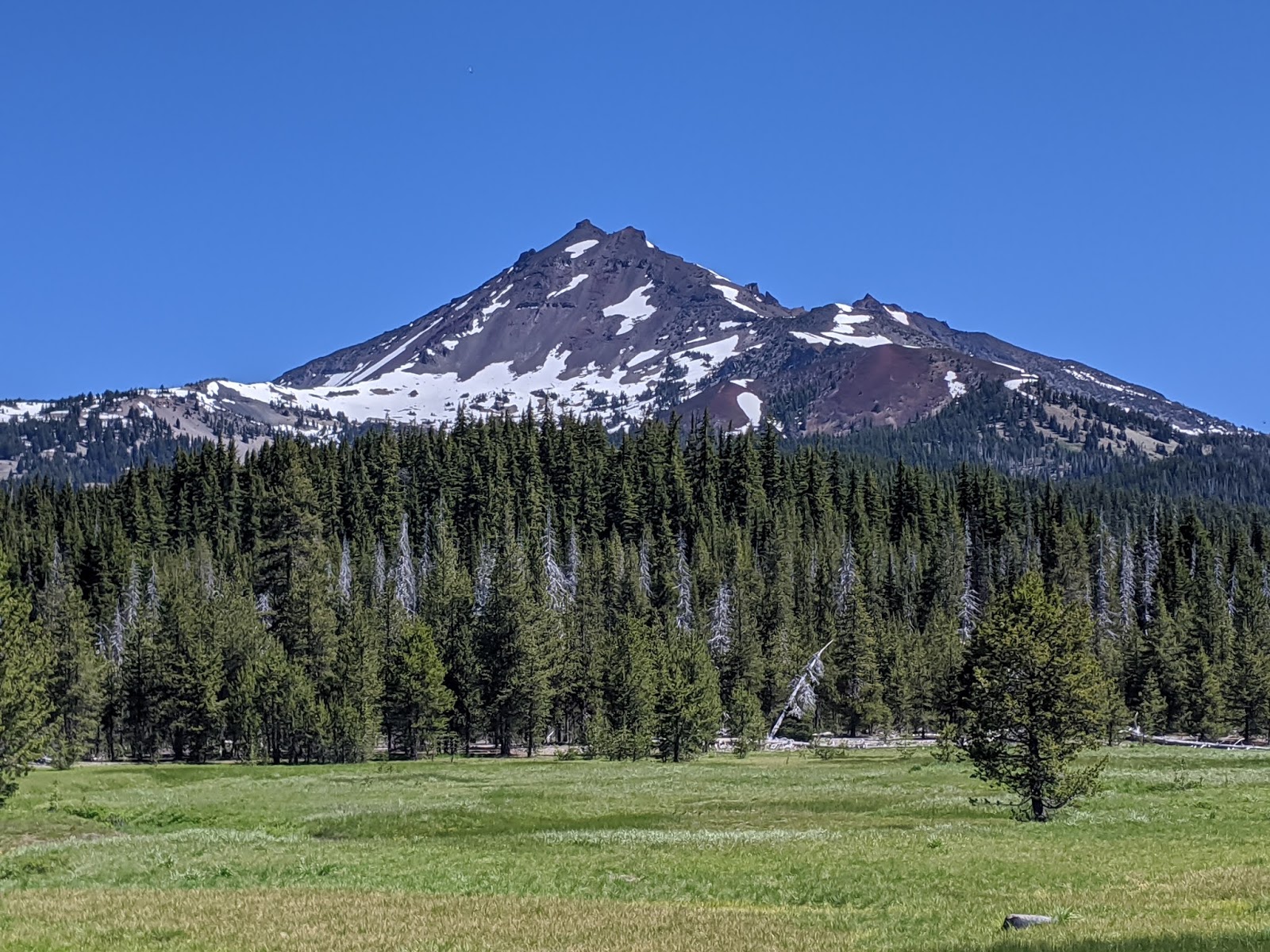
Not long after we began the drive outside of Bend and then climbed steadily into the national forest, we caught our first glimpse of the enormous cone of Mt. Bachelor.

With its dependable, dry powder and a 3,300-foot elevation drop, the mountain is home of the Pacific Northwest's premiere ski resort with the season running through June. If we had taken a lift up the mountain to the 9,065-foot summit, we would have seen 360-degree views of a volcanic mountain skyline. The landscape around Bachelor - dark lava flows, pale pumice fields, lofty domes, and deep chasms - was evidence of the fierce volcanic activity that shaped it.


We had an especially clear angle of Broken Top Mountain at Sparks Meadow with Soda Creek in the forefront.


How fortunate the people of Bend are to have such gorgeous vistas like this basically in their backyard!


Further on was Devil's Lake sitting at an elevation of 5,446 feet with a depth of just 9 feet. The Byway here was located on an old Native American trail. Apparently, the lake's emerald waters treated people to an eerie optical illusion with crystal clear water and a shallow white pumice bottom which made it seem that boats on the surface were floating in midair. Doesn't that sound incredible?!

In the mid-1960s, astronauts trained along the Cascades Lake Byway when they prepared for the Apollo missions to the moon. In 1971, Apollo 15 astronaut Jim Irwin placed a rock from a volcanic dome near Devil's Lake on the lunar surface, the ONLY rock from earth on the moon!


Fortunately there was a very pretty picnic area at Cultus Lake just a few miles further on the Byway so we enjoyed lunch and a stroll by the lovely lake.

Another idyllic spot we discovered along the Byway was Crane Prairie Reservoir with a magical addition of the mountains in the background for a perfect photo op. After eating, getting some exercise sounded great. It was hard to imagine a more beautiful location for a walk than here.


If this had been the 'old days' for us when we were camping with our for children, these sticks would have been ideal for cooking marshmallows!


Unfortunately, my phone camera doesn't have a great zoom lens so it didn't pick up what we thought were either cranes or ospreys that we spotted on the lake.

There were many more lakes we could have seen but we simply ran out of time to see Wickiup Reservoir, Twin Lakes or Davis Lake, that was formed by a lava flow cutting off a creek. We can always think of returning and hope to take advantage of these attractions but, looking at the 'glass half full,' we were more than content with what we had been lucky enough to see.

Steven and I know how mindbogglingly fortunate and blessed we are to travel this wonderful world even as recently as mid-March, and now, at a slower pace, a good chunk of America. That is why it has been profoundly disturbing seeing newscasts night after night full of the apocalyptic wildfires on the West Coast that began in California and have subsequently spread to Oregon. When we were in both states just three months ago, all we witnessed and marveled at was the exquisite natural beauty all around us in the state and national parks and forests. Our hearts go out to the people of both states whose lives are forever changed by the fires.
Next post: Lava Butte and Lava Ness instead of Loch Ness!
Posted on September 17th, 2020, from the charming capital city of Columbia, South Carolina that we've been so fortunate to visit for the last couple of days as we tour part of the Carolinas before heading back to the Florida Panhandle in ten days. It seems so many people are experiencing such horrific times now with the twin natural disasters of catastrophic wildfires on the West Coast and hurricanes causing monstrous flooding here in the Southeast. Then add in the the most divisive political climate this country has known in many, many generations, and the crippling coronavirus that almost 200,000 Americans have tragically lost their lives to. I fear for our country but fervently hope you stay well, stay healthy, and stay connected to those you love and hold dear.
What spectacular mountain vistas .. snow capped hills with pristine mountain lakes nestled at the bottom !! Like you , I can't help but marvel at nature's beauty, a beauty that can forever transformed in seconds by wildfires.
ReplyDeleteLina,
ReplyDeleteYou've mirrored my thoughts exactly - the vistas and varied recreational opportunities so close to Bend were delightful.