
North of our hostel in Rocky Harbour was Lobster Cove Head.

Views of Bonne Bay from Lobster Cove Head and ...

in the distance Gros Morne Mountain and Rocky Harbour Hills.

On the very right were the Green Gardens.

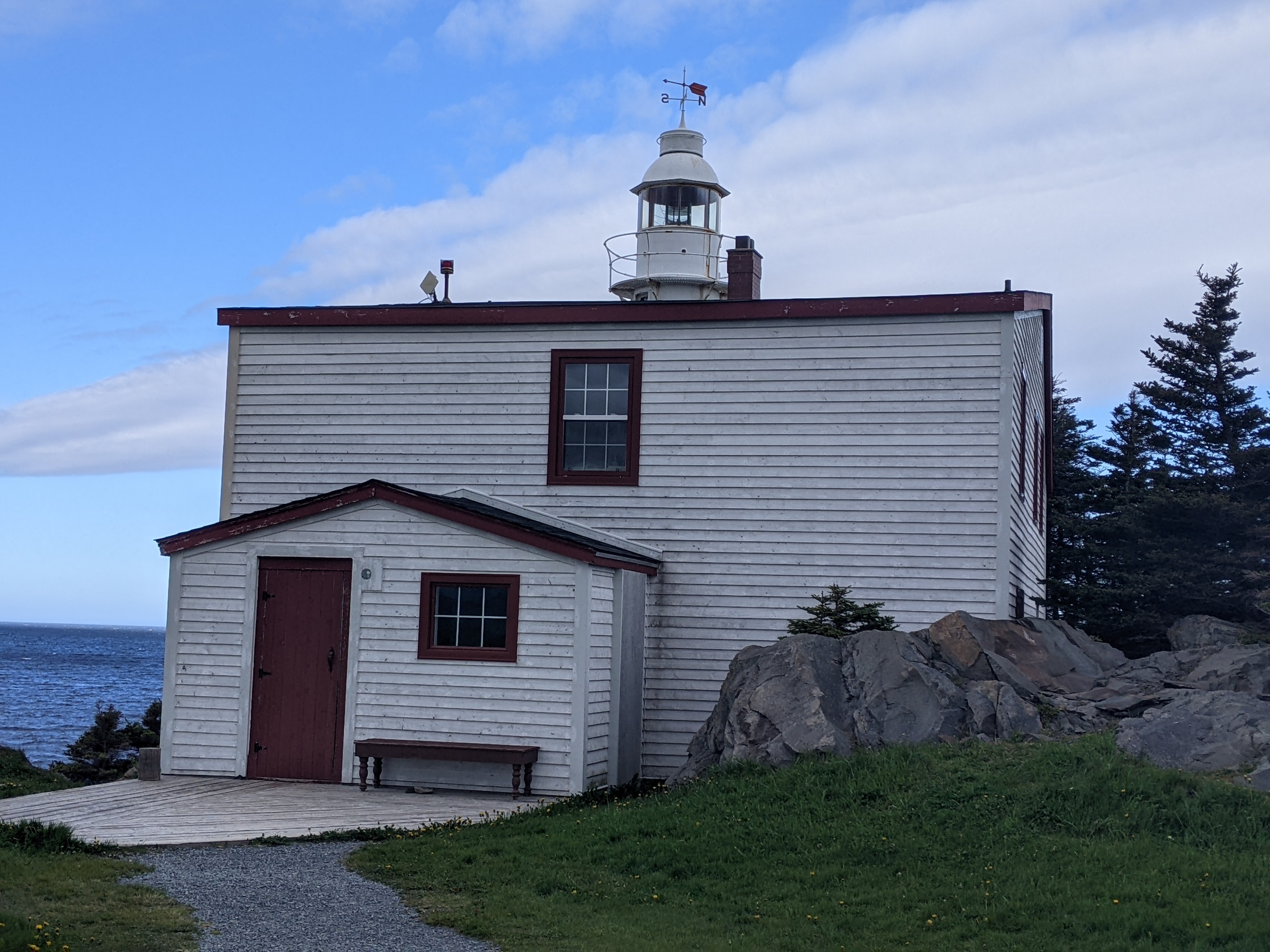
The location of Lobster Cove Head Light(house) wasn't just happenstance but intentionally chosen as the setting gave the light beam a 180-degree sweep north to south and out into the Gulf of St. Lawrence. The light could be seen over 12 nautical miles offshore in decent weather.


For more than a hundred years, this clapboard building wasn't just a home but also a workplace for the lighthouse keeper and his family. The families who lived in this windy cliff-top setting put in gardens, kept chickens and a cow, hauled water year-round from a well, and hunted caribou or traded with their neighbors. Some supplies were purchased but the families toiled hard to gather, grow or make much of what was needed to get by.
Keeper William Young and his family in 1914:

His descendant, George Young, was the last keeper circa 1966. I read that some Young family members still live nearby.

As much as we loved the views from the lighthouse, I had to admit the place was entirely too desolate for me for anything long-term.

The tower, over 25 feet high, rose above the treetops, but even the cliffs below were distinctly visible from the sea.

Although visitors weren't able to get close to the lighthouse, a path to the shoreline was a nice alternative.

A string of small communities once dotted this wind-lashed coastline that was now Gros Morne National Park. Drawn by abundant salmon, cod, and lobster, fishing families set down roots in the early 1800s in almost every coastal indent from here northward.

As winters on the exposed coast were so brutal, some families were spurred to move to more sheltered bays after fishing was done. Then, over time, more and more of the smaller settlements were inhabited only seasonally. Finally, with the creation of the national park in the 1970s, the last families were forced to relocate - some not happily - from the remaining communities, including here at Lobster Cove.

If we really used our imagination, we could spot some old potato rows from a keeper's garden.


Further north was the minuscule community of Green Point located in the national park.


Thank goodness we had brought cold weather gear as the winds were very strong that morning in the open expanse.


Not only were the cliffs at Green Point stunning to look at, but they also had an interesting history as they contained fossils of the graptolite Rhandinopora. They were 'colonial animals' that had lived in the ocean hundreds of millions of years ago and originally lived attached to the sea bed before evolving into planktonic or free-floating forms.

These rocks were originally flat with each layer forming in mud and organic debris settled to the floor of the ancient ocean. Younger layers were deposited on top of older layers. Tectonic forces tilted the rocks so that now the older layers were on top and younger layers were on the bottom.

I had to brace my legs in the stiff winds so I wouldn't fall. We had to steer clear of getting too close to the cliffs for fear of being tossed over!


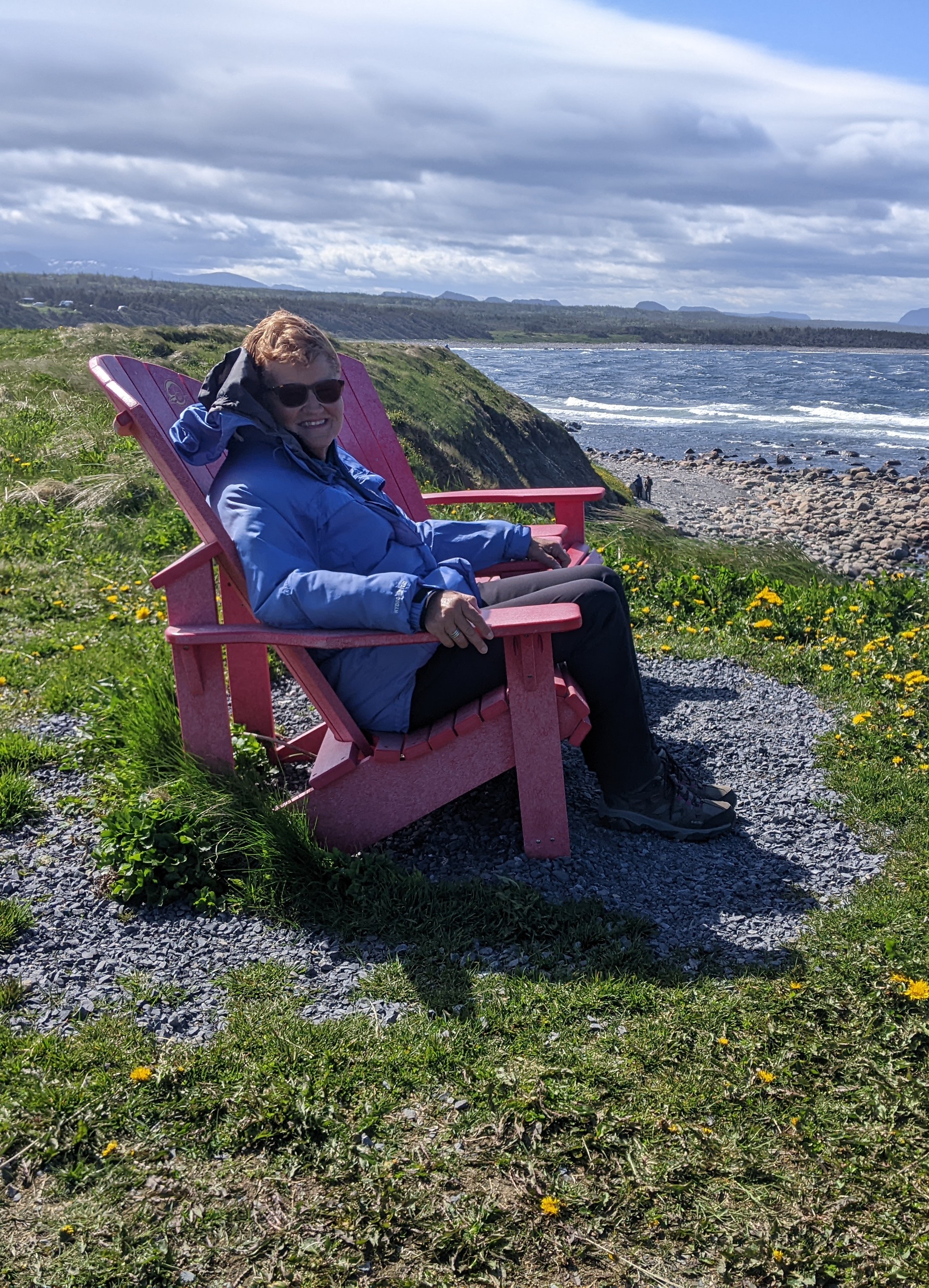
Overlooking the cliffs was one of the province's iconic red chairs to take in the stupendous views.
As we had plenty of time before our boat departure on Western Brook Pond, we backtracked several kilometers to Berry Pond Trail.

The trail took us through a dense forest and bogs that were typical of the park's coastal lowlands. We'd hoped to see some waterfowl and songbirds along the trail.

The term 'pond' had a connotation in Newfoundland that was sure different from anything Steven and I were used to as they were large bodies of water in this part of the world and not merely 'ponds' as we knew them.


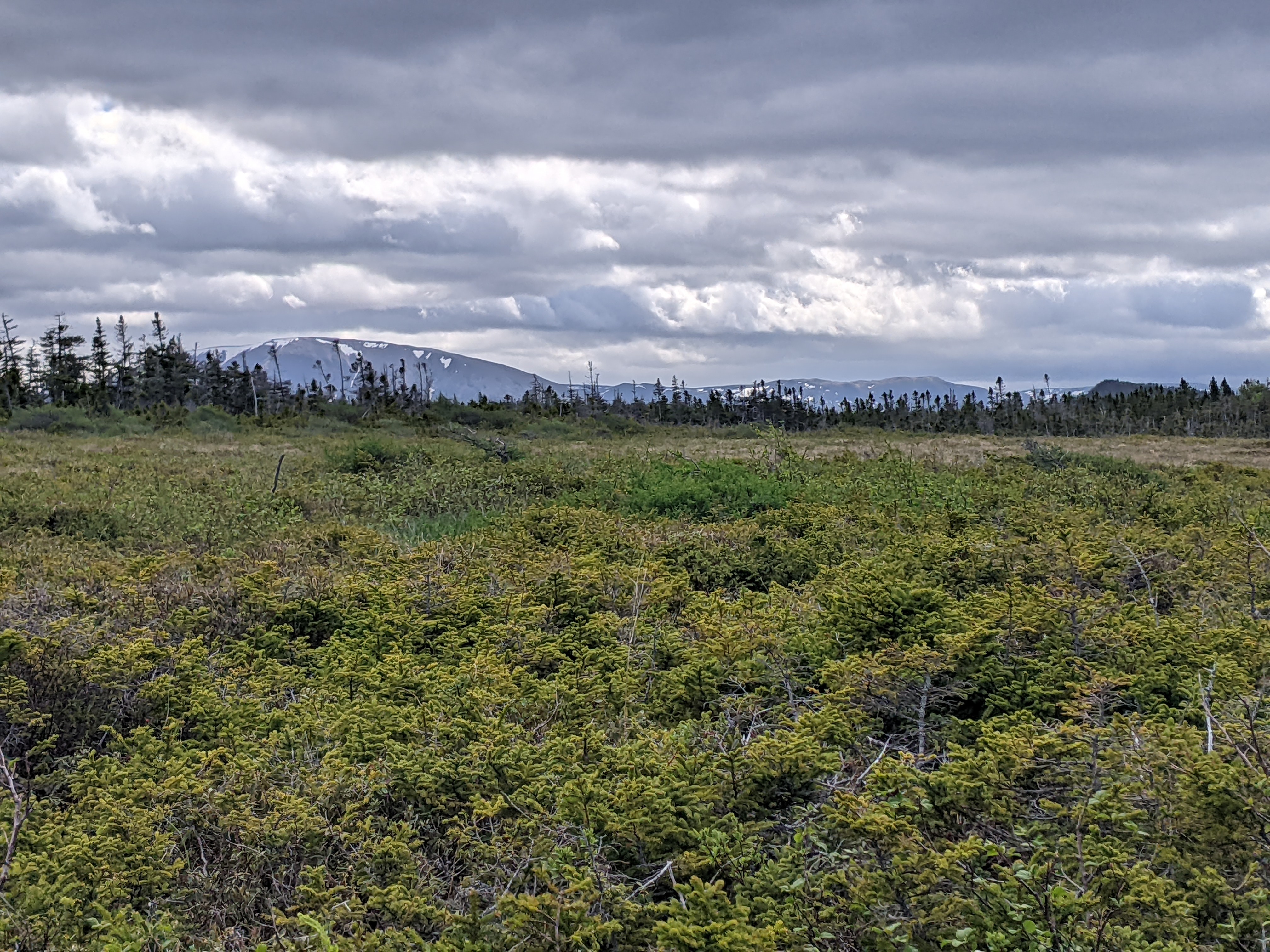

Snow-covered mountains in the national park:

We didn't see any birds but there were plenty of frogs!


Since we still had another 3km walk to reach the boat at Western Brook, we almost speed walked around Berry Pond so we wouldn't be late. That was a shame as we felt we didn't do this pond enough justice.

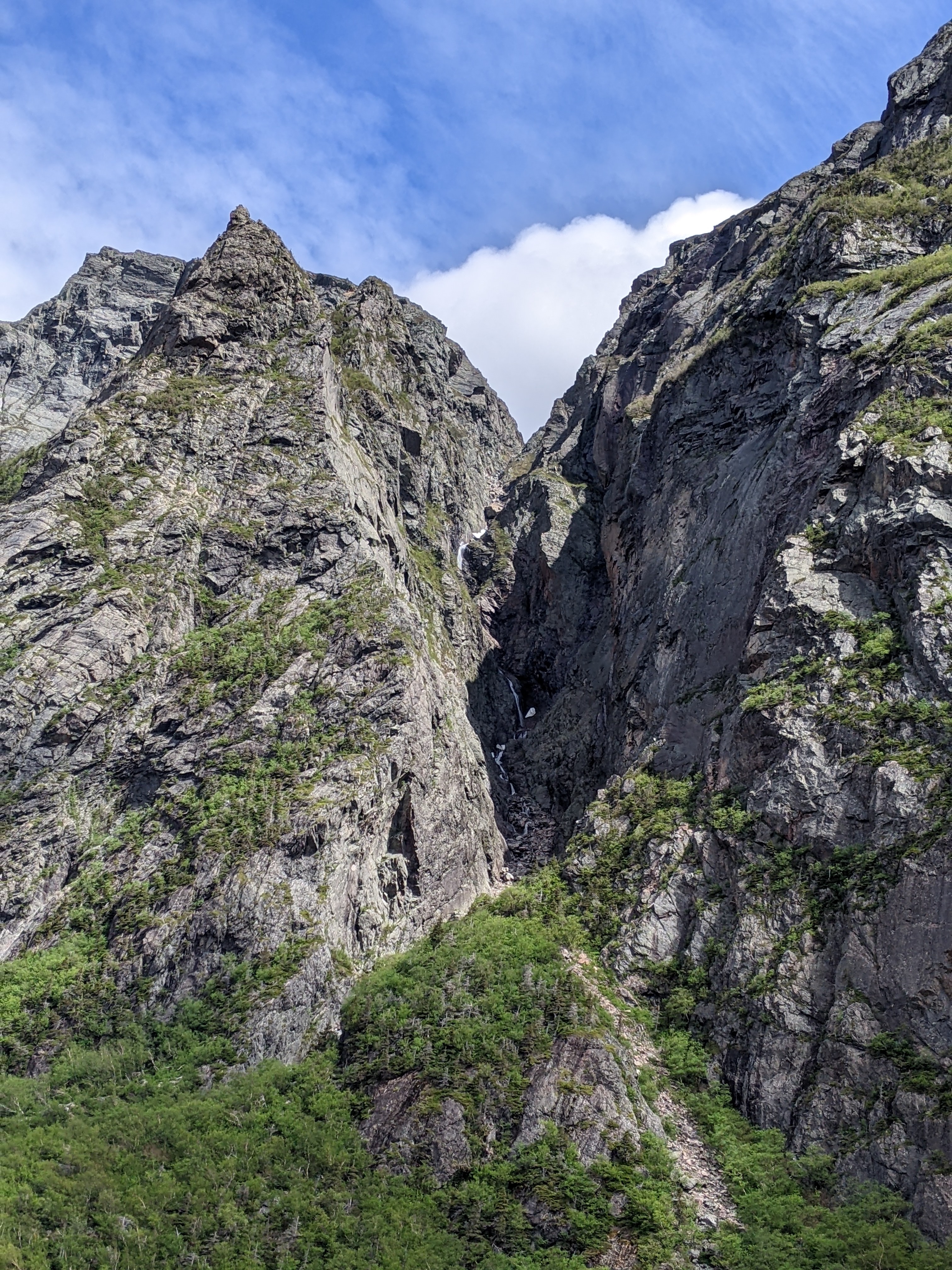
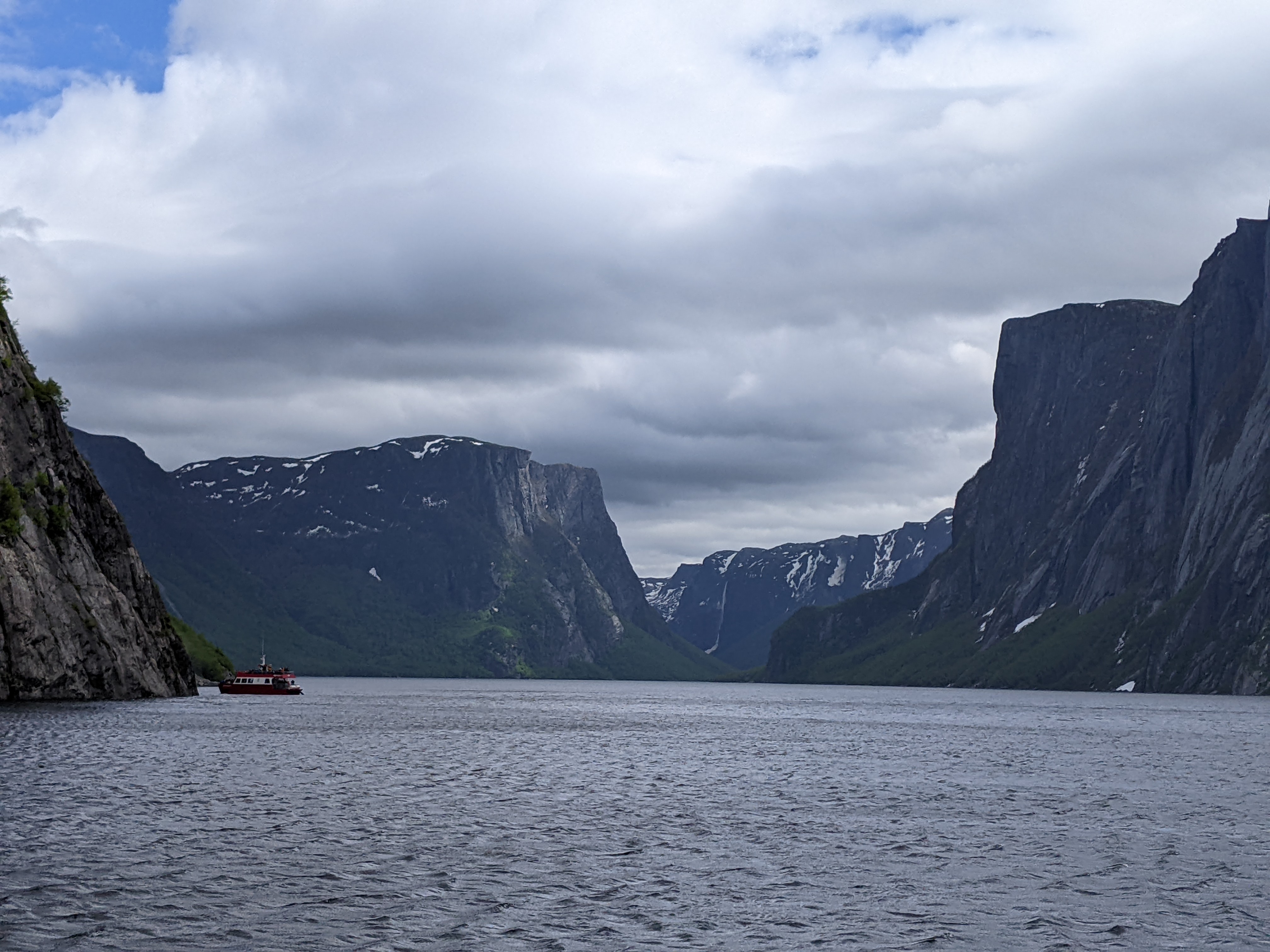
The trail to the shores of Western Brook Pond with the hugely impressive backdrop of the Long Range Mountains was a delight in and of itself without the lure of a long boat ride at the end. Along the way, we crossed bogs and forested ridges of Gros Morne's coastal lowlands.


The wind was so strong that waves whipped across Snug Harbour and even blew across the trail.

We learned that the tour boats used to be moored here at Snug Harbour until Parks Canada told the boat operator, Bontours, that they could no longer tow their boats across the bogs because of environmental concerns. Now, the boats had to be brought in pieces by Sikorsky helicopters and assembled in a boat shed by the pond!


After an exciting walk, we reached Western Brook Pond! There had been sustained winds for the entire trail which made the hike more difficult for everyone. We were in good enough shape luckily the wind didn't matter to us but it had to be awfully hard for those with mobility issues as there was no other way to reach the pond.

Remember the strong winds that day - they even resulted in getting everyone good and wet as we walked to the boats! There were so many people wanting to get out on the pond, two boats were needed even though it was early in the season.

Once we were all aboard, we were warned we would all get sprayed because of the high winds - I almost laughed, as how different would that be from what we'd already experienced on the hike to the boat!


The mountains' steep escarpment marked a crack or fault in the earth's crust that was created when continents collided about 400 million years ago. When the land on the far side of the fault was thrust up and over the land on this side, it resulted in the buckling of the lowlands' rocks.

The guide remarked that as the cliffs surrounding the pond could be seen from 48 kms away, they were like a beacon.


We know there are UNESCO world heritage sites scattered across the world - Egypt boasts the pyramids, Australia the Great Barrier Reef, Machu Picchu in Peru, and the list goes on. Newfoundland is blessed to have Gros Morne National Park, an amazing geological slice of the ancient world. The flattened Long Range Mountains were part of the ancient Appalachian Mountains.

When Britain's Prince Edward visited the park in 1987 and declared it a World Heritage Site, he said, "What the Galapagos are to biology, Gros Morne is to geology." That was no exaggeration as the park had a colossal geological heritage with remnants of the world's first supercontinent.

The guide explained that hunters and trappers used to hunt the innumerable moose and herds of woodland caribou that inhabit the mountains and migrate to the coastal plain in the summers.


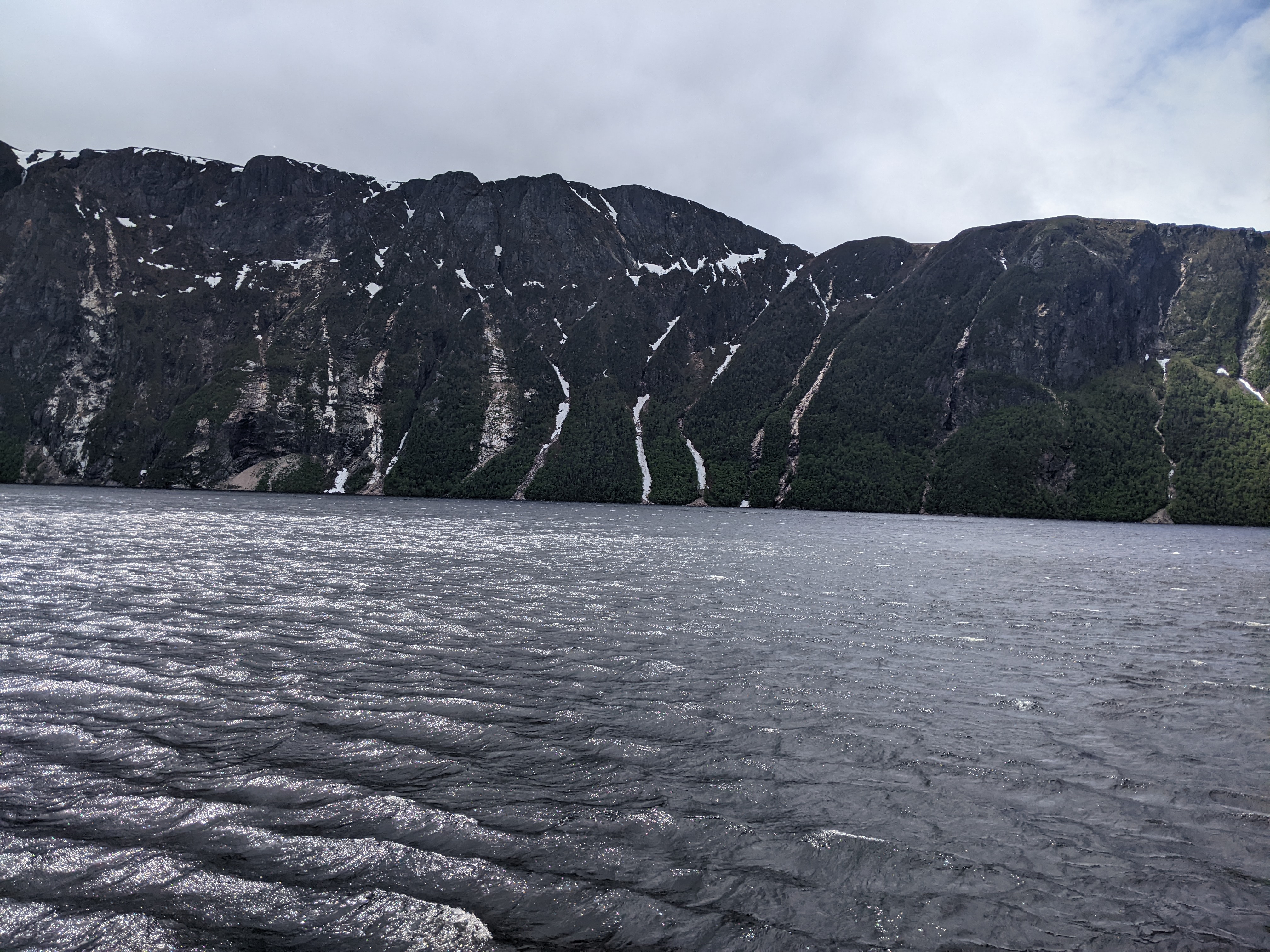


The Long Range Mountains used to extend as deep in the water as they are high which would have made them as high as the Himalayas!

The 'pond' was 575 feet deep at its deepest point and had far fewer fish than would be expected in a body of water this size because it had fewer nutrients.

I was still incredulous that this immense body of water was called a 'pond.'
The cliffs were made of granite.

The Blue Denim Waterfalls were so named because of the color when the sun hits them at a certain angle.


The pond was described as one of the purest lakes in the world with "resistant bedrock, a small drainage basin, sparse plant cover, and limited human use" giving Western Brook Pond some of the purest water on the planet.
Although the pond was oxygen-rich, its cold waters could only support a few slow-growing plants and animals. Scientists describe the pond's waters as ultra-oligotrophic which was Greek for "very low in nutrients."

It was fun trying to see characters in the rocks - here was the Tin Man of Wizard of Oz fame!


The trees bordering the pond were mostly birch although some spruce were scattered along the shore. Imagine how stunning these trees would look in the fall when they change to golden hues.

The guide mentioned the trees have been growing back through the rocks after a major rock fall. We could imagine the thunderous noise that would have made. The flow in the 1,900-foot-high Woody Pond Falls had doubled in size in just two days!


Woody Pond Gulch was home to lots of moose in the spring as there are about 3,500 in the whole national park. Just two moose were introduced into the park from Miramichi in New Brunswick in 1878 and more came later. There are an estimated 100,000 on the island of Newfoundland or three moose per square kilometer. The guide joked that there are no moose to be found in the hunting season, mind you!


Without the guide, we would never have seen a side profile of the Old Man in the Mountain - certainly old at 650 million years old!

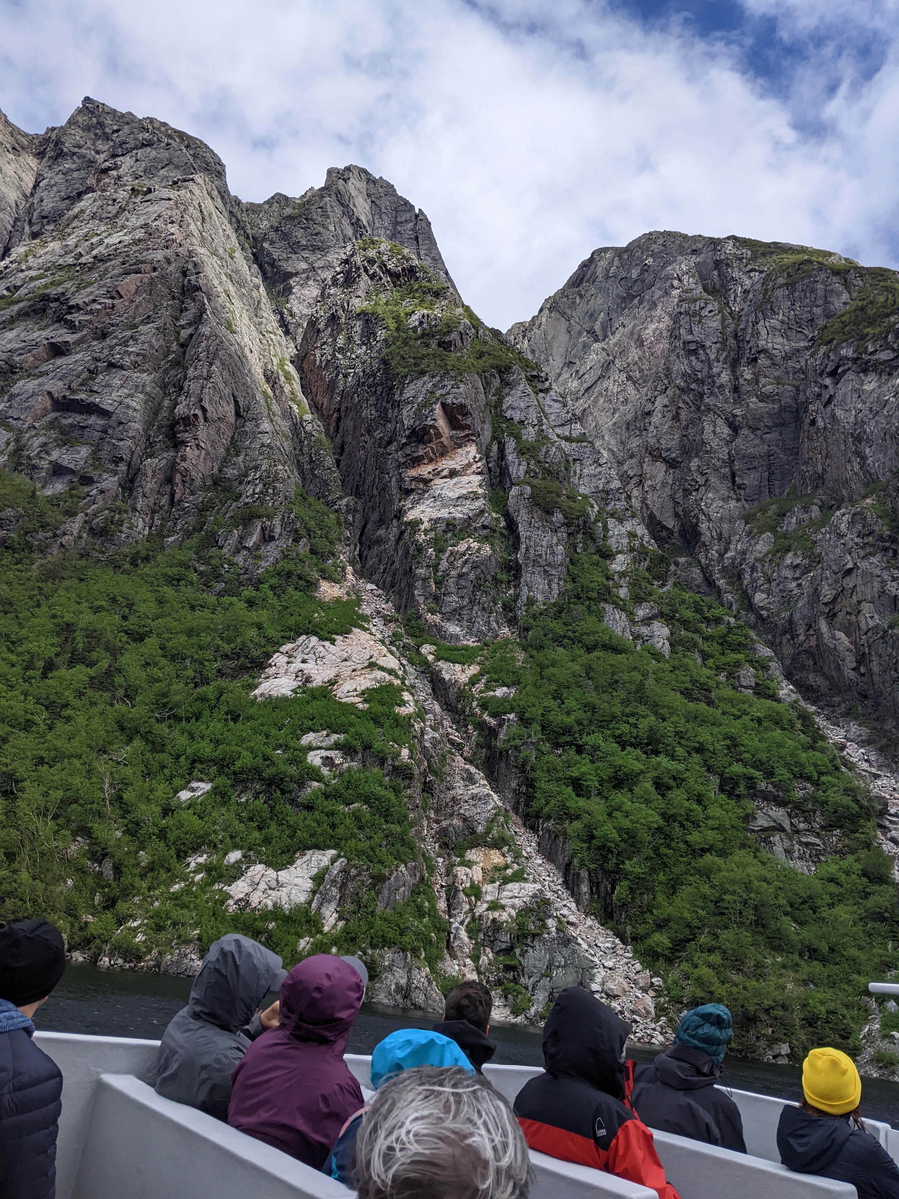
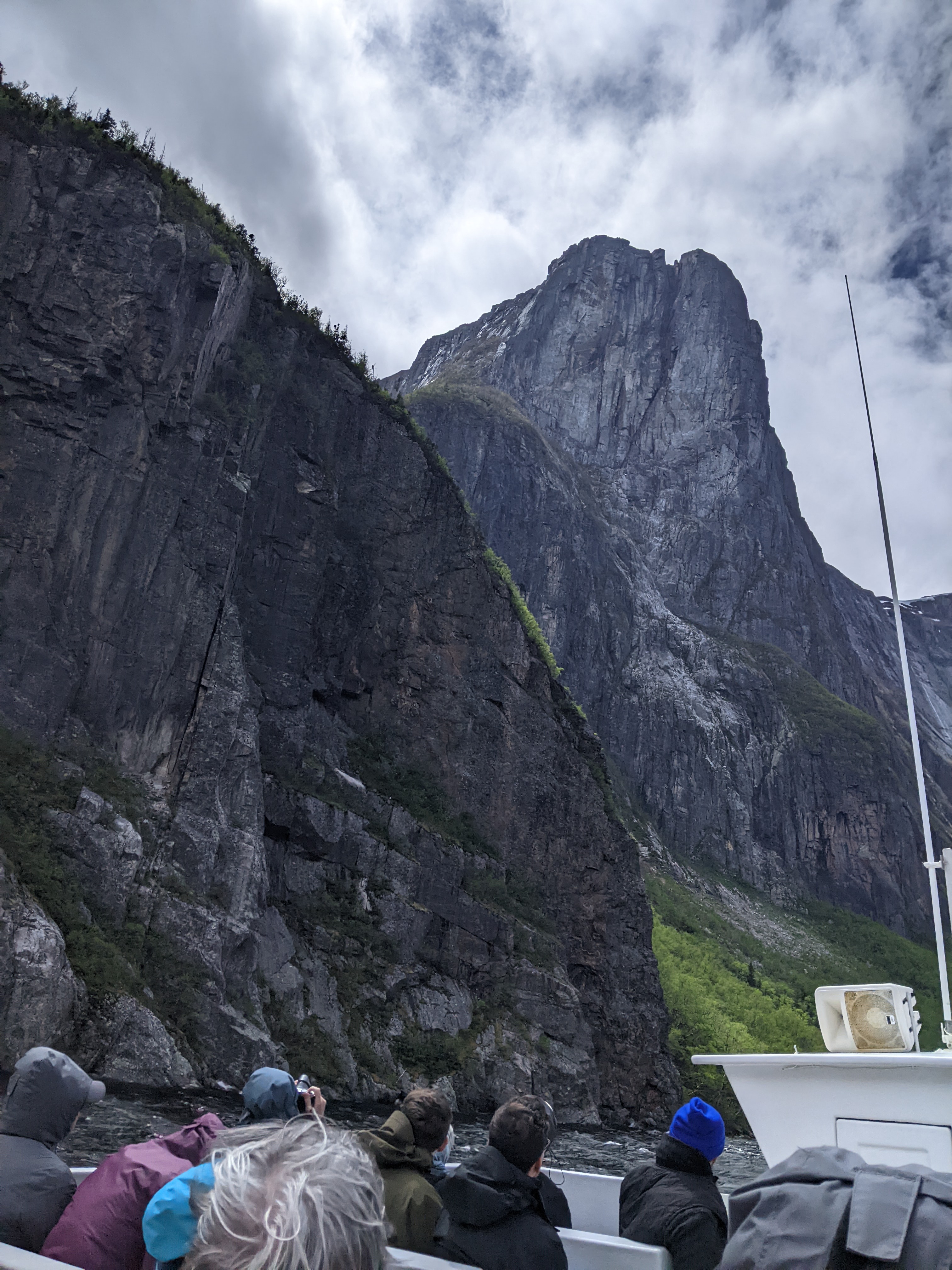
It would be awfully hard not to be gobsmacked by the views on the boat tour of Western Brook Pond but these next few images were the most spectacular in my opinion.


By the time the mighty falls reached the pond, they were a mere trickle.


My sincere thanks, Janina, for kindly giving me the hand-knitted hat as it came in very handy that day!

Far more adventurous folks than we could apply for a 3-day backcountry permit and hike in the valley from here.

The rocks in the center of the above photo had tumbled down the mountain in the previous two to three weeks.

Even though this was our turnaround point, our adventure didn't end there.

When Broke Off Cliff fell into the pond in 1911, it caused a tsunami.
I didn't catch the name of this, the tallest mountain in Gros Morne National Park - sorry!

There were negligible numbers of seagulls on the cliffs this far back in the pond.

The look of abject misery on the boat's lower level!


Before the 1970s, very few people were lucky enough to see Western Brook Pond as only locals fished in the brook or trapped in the forest. The pond's deep waters and violent storms instilled a healthy respect for the pond. Boat tours have opened the pond to public use. As this was one of the last wild, ultra-oligotrophic lakes in the world, extreme care has to be taken to ensure it lasts for future generations.


If you ever visit beautiful Newfoundland, I cannot urge you enough to make sure you also take a boat tour of Western Brook Pond as it was certainly a highlight of our experience.

The hike back to the parking lot on the gravel trail was just as windy but the views made us almost forget about the wind.


A pretty bench among to-die-for scenery but the wind didn't entice anyone to sit a spell.

Leaving the pond, we headed north to Broom Point, a small, sometimes seasonal fishing community since 1808. From 300 BC to 600 AD, families of Palaeo-Eskimos also frequently used this site as a base for spring seal hunts.


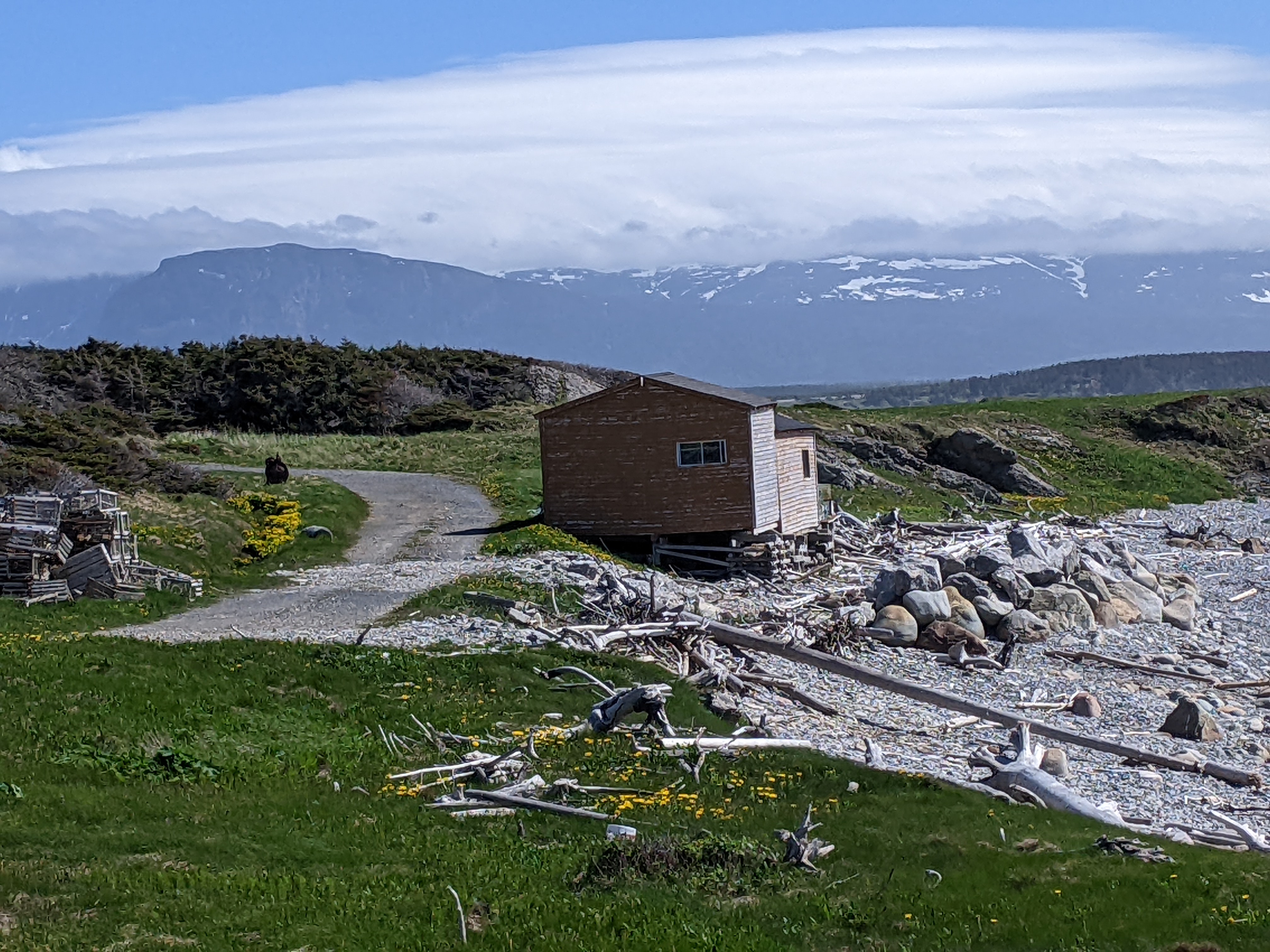
The Broom Point Fishing Premises was a traditional house and fish store with artifacts that had been used by local fishermen.

Flags of Canada, the US, and Newfoundland's official and unofficial provincial flags:


If our HOA would allow it, I'd love to have this cute trash and recycling unit we saw near our hostel back in Rocky Harbour.

Next post: More of Newfoundland's unique geology.
Posted on September 6th, 2022, from sweltering Denver although we're very fortunate the temps still aren't as excruciatingly hot and dangerous as on the West Coast.
Always love the colorful chairs facing the ocean.
ReplyDeleteI do, too!
DeleteWhat wonderful views!
ReplyDeleteGlorious, indeed!
ReplyDelete