
After leaving the town of Rocky Harbour where we'd been based for the last couple of days while exploring Gros Morne National Park, we headed north toward the tip of the Great Northern Peninsula. The lure to drive that far north before having to retrace our steps hundreds of miles south in a few days was the opportunity to visit L'Anse aux Meadows, the historic site of the first Viking settlement in North America.

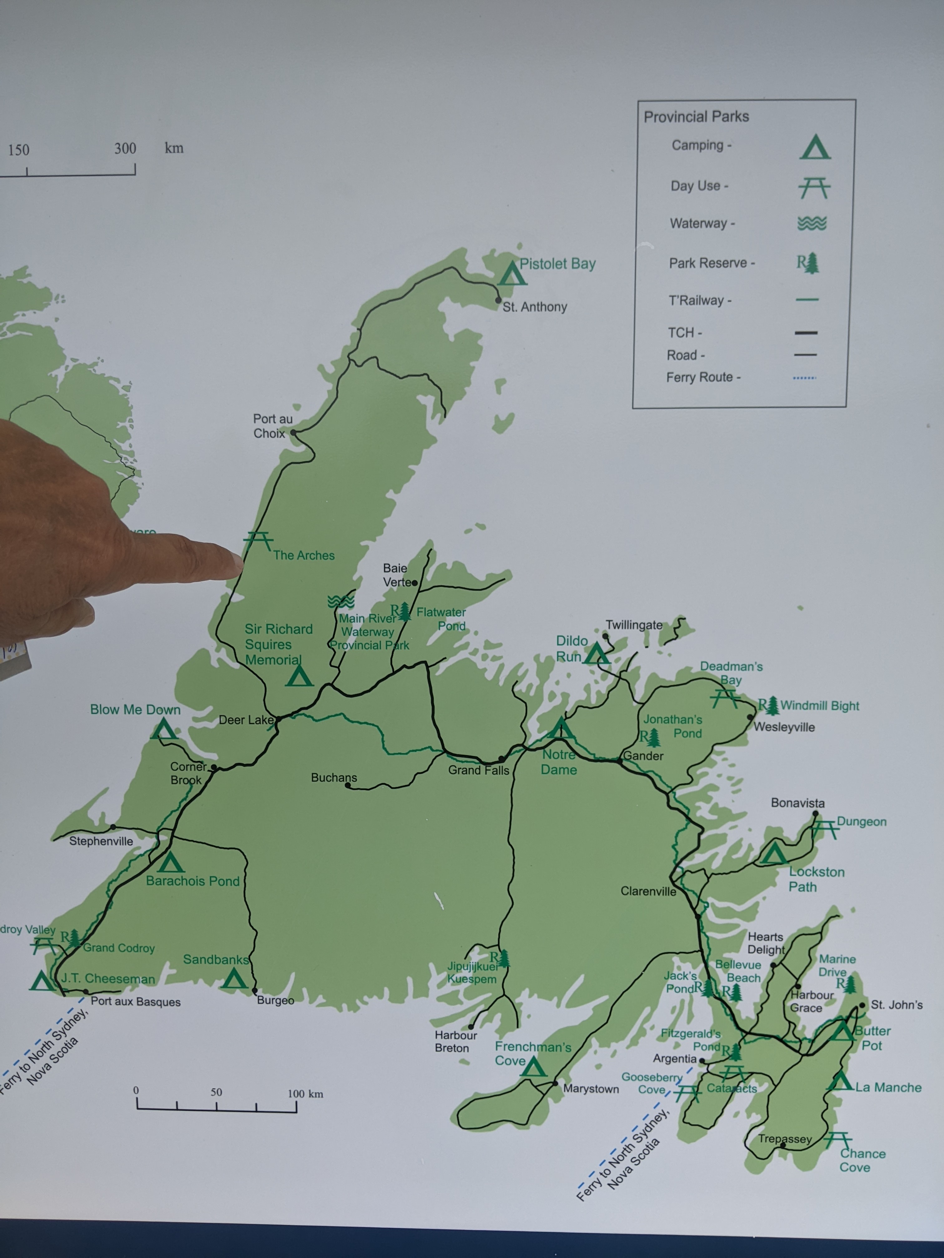
I wish I had found this map of the island of Newfoundland earlier as it provides the context of our trip to the great place. As you may recall, we took the ferry from Nova Scotia over to Newfoundland's southwest tip, Port aux Basques, and had been driving slowly up the western coast toward the tip of the Great Northern Peninsula, aka the finger! We would be then driving to the capital of St. John's on the southeast coast and then back west southwest a bit to catch the ferry back to Nova Scotia - a total journey of over 2,500 miles on the island!
St. Pauls (spelled with no apostrophe) was a small community on the west coast of Newfoundland which faced the Gulf of St. Lawrence.

Just outside the town of Cow Head, we passed telephone pole after telephone pole along the road that had been anchored in vast piles of rocks. I don't know whether it was because of unstable soils or extremely fierce winds. Cow Head's unusual name came about when a rock shaped like a cow's head was visible on the peninsula's southern tip.

The community of Cow Head which was also located in the national park consisted of two separate areas: Winterside, the mainland sheltered area, and Summerside, the fishing area. Both sites were linked by a narrow isthmus called the Sandbank locally.

As the names suggest, local families spent their summers fishing from the Head on the peninsula before returning to Winterside at the end of the season to spend the winter inland. This seasonal migration from winter shelter to summer fishing communities was a distinctive Newfoundland tradition that persisted on the Great Northern Peninsula until the late 1960s. After that, better roads, cars, and electricity made the seasonal migration unnecessary. During the province's resettlement program in 1968, residents moved permanently to Winterside.

Cow Head was located at the northern boundary of Gros Morne National Park.

We followed the Lighthouse Trail to Big Hill which was a favorite picnicking spot for local children.

Standing on the big rocks was a perfect opportunity for us to view the entire coastline of Gros Morne National Park and the fantastic view of the Long Range Mountains.


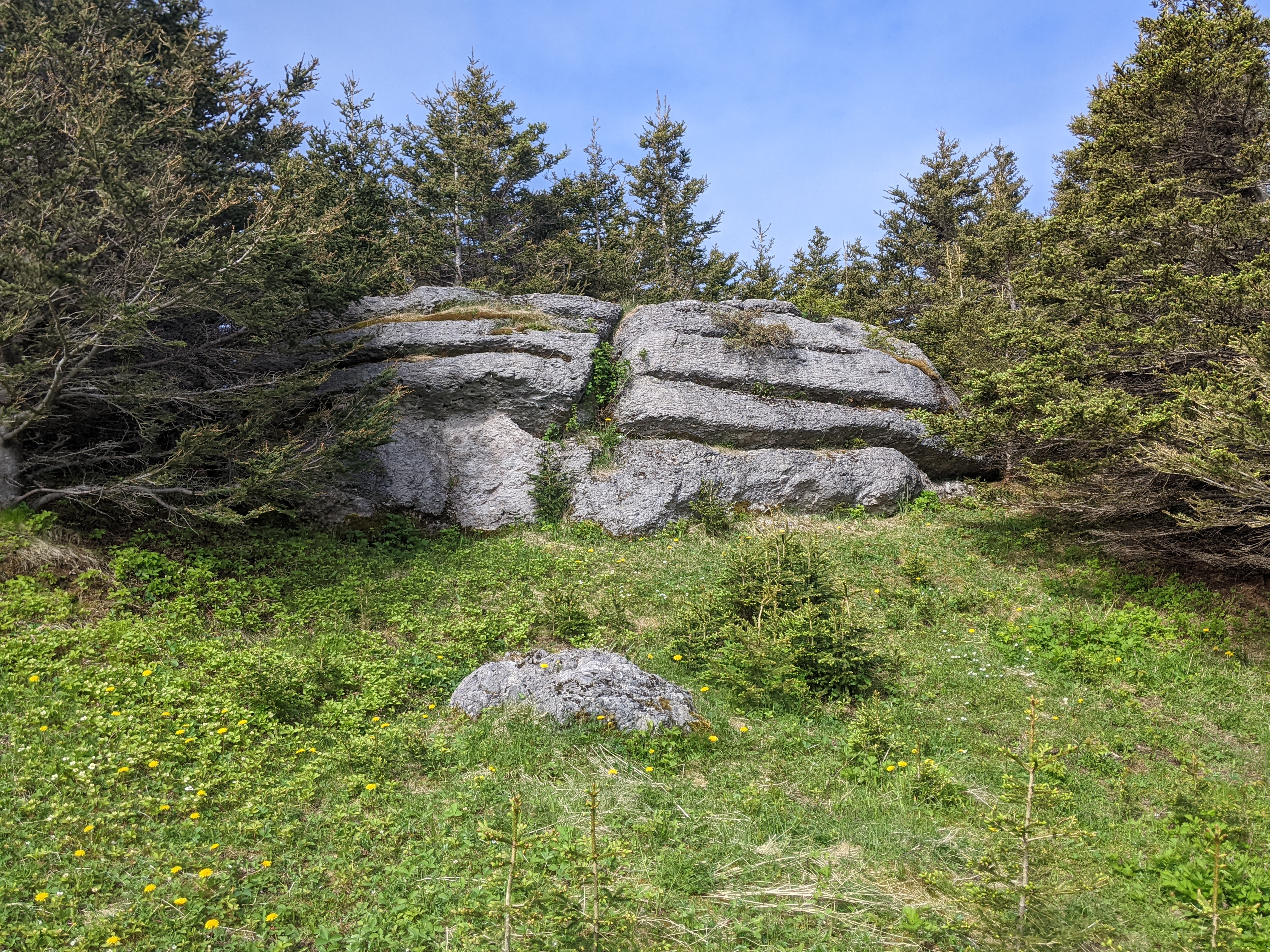
From the trail, we got a close look at Cow Head's famous limestone breccia which were unusual rock formations that provided evidence of underwater avalanches off an ancient continental slope.


The orange lichens growing on the rocks on the Cow Head Peninsula were unique to the province of Newfoundland and Labrador. Another feature to look out for was the tuckamore, spruce trees that were bent and entangled by winds on Newfoundland's coastal shores.


At the trail's end was a small Roman Catholic cemetery located in as idyllic a spot as one could imagine.

The Dr. Henry Payne Museum in Cow Head was the longest-running museum on the island's West Coast and honored Payne, a dedicated teacher for 25 years, a lay reader at the Anglican Church for 60 years, a Justice of the Peace, a field worker for the Co-operative Movement, and who also held positions on the local library board, school board, and parish council! Too bad the museum was closed so we couldn't learn more about the amazing man. The stop at Cow Head had been a perfect way to start our day.

Further up the coast was Arches Provincial Park, a geological formation that was formed over millions of years as a result of glacial action, wind, and water erosion, as well as other environmental changes.

Don't tell Utahans but I think this Newfoundland's Arches gave Arches National Park a run for its money!


We were so fortunate to see the arches as severe storms in the future will inevitably reduce the arches to rock pillars or sea stacks.


In Daniel's Harbour was Nurse Myra Beckett's Heritage House built in 1922 and home to the nurse for 68 years who served the fishing outports.

I joked with Steven the provincial flower should be the dandelion as I've never seen so many as all over the island! Guess that negates, Lezlie, any praise you thought I might have garnered from the tourist authority for my otherwise very positive posts on Newfoundland!

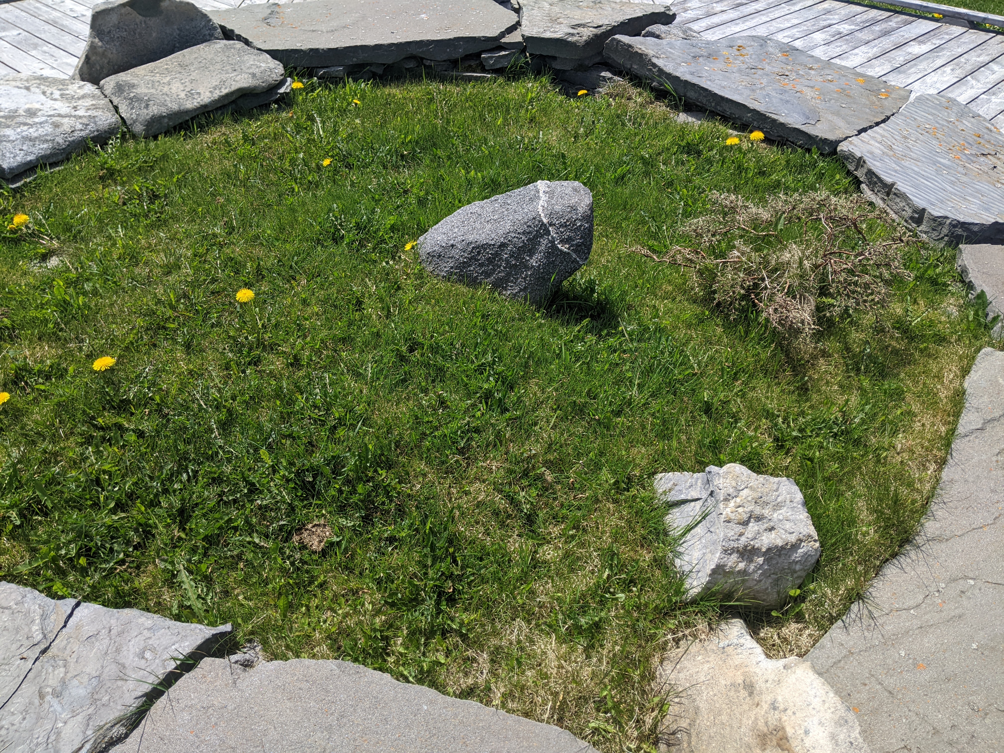
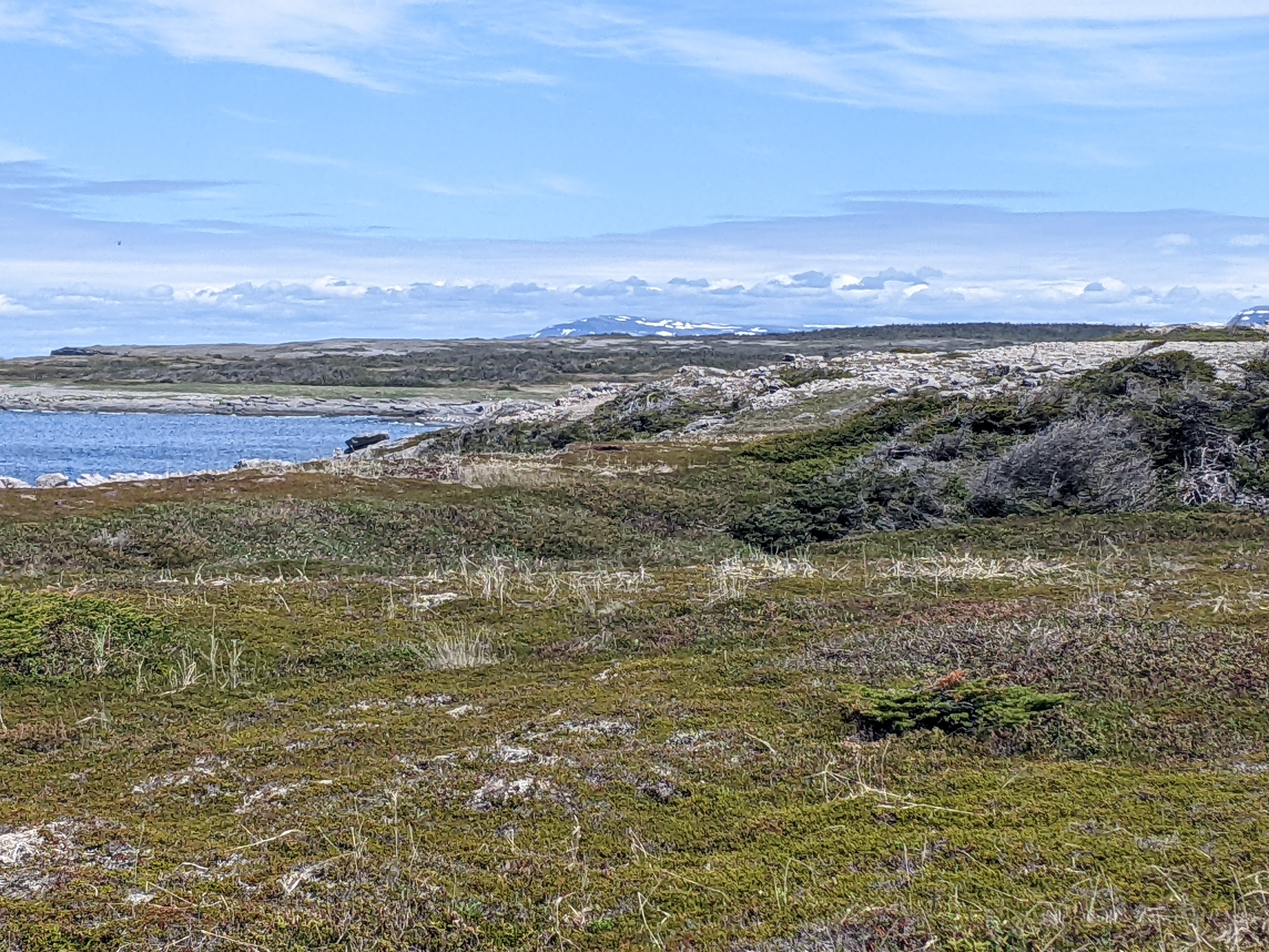
The Great Northern Peninsula swept northeast across mountainous, flat-topped barrens and ended in tundra strewn with glacial boulders north of the national park. Highway 430, aka the Viking Trail, ran along the Gulf of St. Lawrence the full length of the peninsula before finishing at St. Anthony, 260 miles to the north.
Something new to us lining the road were black patches of dirt or, sometimes, tiny flourishing vegetable gardens that belonged to residents of the nearby villages. Because of the nutrient-poor soil in the region, locals took advantage of fertile soil wherever they could find some.


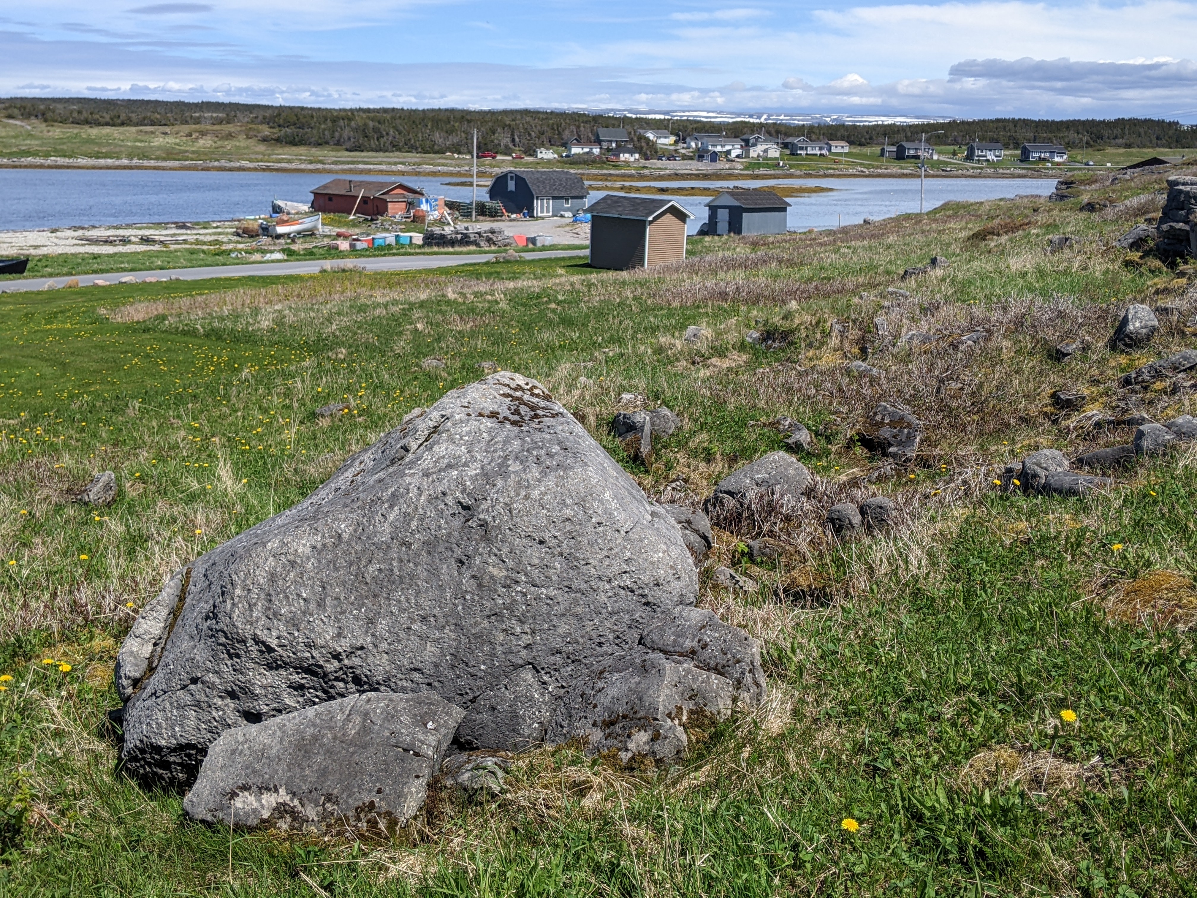
Next, we reached Port au Choix, a small fishing village and a National Historic Site because of its human history dating back thousands of years. The Maritime Archaic people and later, the Dorset and Groswater Inuit, emigrated from Labrador across the Gulf, settling on the remote cape beyond the modern town of Port au Choix after first roaming the Northern Peninsula. Attracted by the fish, seals, and plentiful resources, people have been coming to Port au Choix for over 4,500 years, making it one of the earliest and longest inhabited places on the entire island.

The local economy, though, thrives on the ocean and the cold-water shrimp Steven loves in salads.

Across from the shrimp processing plant was the Anchor Cafe, the only restaurant we'd come across that day. With its bow jutting out, it looked like fun. The food was only fair as I recall but it more than made up for the food and indifferent service with an engrossing list of Newfoundland's accomplishments.

I must admit when I was growing up in Canada, there were many disparaging remarks and jokes made about 'Newfies.' Read the impressive list of accomplishments and fun facts below and you'll definitely not think of the island as a provincial backwater! Just remember to click on the image to make it bigger and therefore easier to read.


The Maritime Archaic people chose this spot on the peninsula to bury their dead from 6000 to around 4000 years ago when the peninsula was an island. Graves with limestone markers would have been visible from land and water as people traveled past in boats. There may have been a sense of their deceased ancestors watching over their passage.


Part of the national historic site was Phillip's Garden Trail which led to an archaeological site on the Point Riche Peninsula. We walked in the footsteps of the Dorset Inuit who had a large settlement at Phillip's Garden some 2,000 years ago. We looked forward to finding a coastal tuckamore forest, more spectacular ocean views, and possibly whales if we were lucky.
Those who lived here before were able to provide a living from harvesting the wealth of the sea. I read that little of the vegetation and scenery along the trail had changed over the centuries

More pronounced examples of the orange lichens we'd first seen earlier at Cow Head:


I would have liked to have known what caused the depressions in the rocks.


Once we reached the upper terrace of Phillip's Garden, I couldn't detect any depressions or low mounds that would have signified dwelling remains.


The trail had some fun silhouettes. One was this Seal Hunter Sculpture.


Our favorite refrain: "Does it get more beautiful than this?"

Leaving the trail, I spotted this wonderful collection of painted rocks that positively enchanted me! If they also appeal to you, you'll see way more photos of colorfully painted houses, called jellybean houses locally, once we finally reached the provincial capital of St. John's near the end of our stay in Newfoundland.

The rock on the left was of the official flag of Newfoundland and Labrador. I managed to buy a much smaller one and lugged it for the next 10,000 miles home where it is now in our front garden. It's safe to say that no one here knows what it is!


As we continued up the Great Northern Peninsula, we came to Plum Point where archaeologists have found evidence of human habitation from 4,500 years ago. These were the same Maritime Archaic prehistoric hunters and gatherers who had also settled in Port au Choix. Captain Cook visited this area in 1764 before it was permanently settled in 1900 by Europeans.

There were lots and lots of piles of lumber stacked up near the beach - no idea whom they belonged to, whether it was free for the taking, or how long they had been there. They must have been dragged long distances as we saw nary one tree stump anywhere.


Twenty miles north of Plum Point was the tiny community of St. Barbe which was where ferries depart for Labrador the other part of the province but located across the Gulf of St. Lawrence on the mainland and geographically part of Quebec. Have I got you all thoroughly confused now?! Probably best to look at a map of Atlantic Canada so it's all as clear as mud.

IF, if we had an extra few days to squeeze out on this three-month plus trip, I'd have given my eye-teeth to hop on a ferry and visit Labrador but, as the saying goes, we had people to see, things to do, and places to go. I doubt very much we'll ever get back to this part of the world so Labrador will remain a sight unseen.

What a desolate stretch of the highway as we headed further north from Plum Point.


Ten minutes on was Deep Cove Wintering Interpretation Site which was once home to the Winter community used in the 19th and 20th centuries by residents of Anchor Point. Deep Cove has the distinction of being the most recently inhabited winter housing community in Newfoundland. The population of Deep Cove at its height was in excess of 100 and comprised a dozen homes scattered across the sheltered meadow called 'Winter House.'
The practice of seasonal human migration had a long history in Newfoundland with aboriginal groups moving at various times while following caribou. The practice continued for many Newfoundlanders of European origin who traveled hundreds of miles to fish during the summer in Labrador or who left summer fishing grounds on the coast to overwinter in a more sheltered cove.
The harbor at Anchor Point was close to the Labrador Coast and the annual seal migration as well as the finest salmon rivers and brooks on the island's northwest coast.

Imagine having a phone that had neither a dial nor a number pad! To use it, the handle was cranked to notify an operator of an outgoing call. There was a distinctive ring pattern in each community, one short, two long, for example.

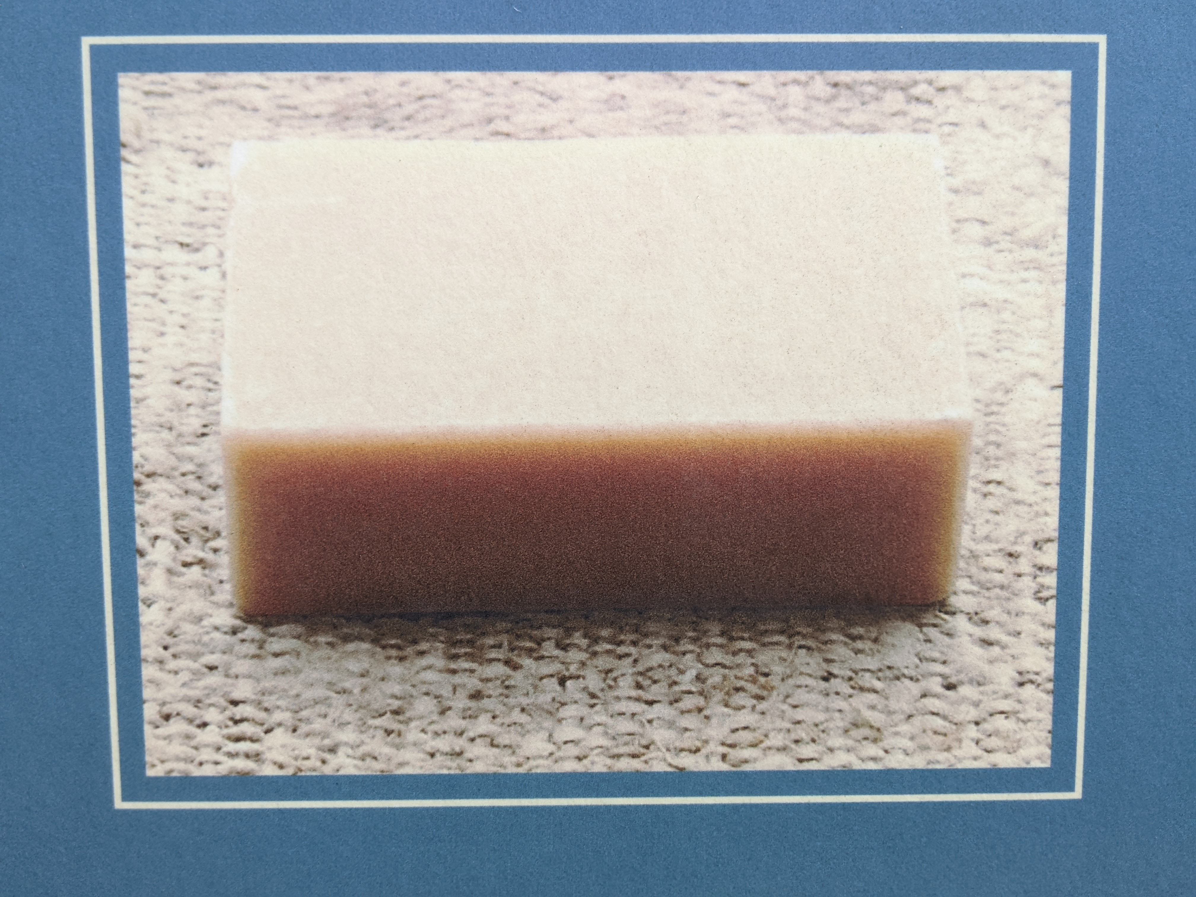
Lye soap was made by women to wash clothes and scrub wooden floors. The soap was made by combining lye or potash with seal oil in a large pot and boiling it for several minutes before cooling it in a pan and cutting it into squares or cakes.
Snowshoes were invaluable for winter travel and were made locally.

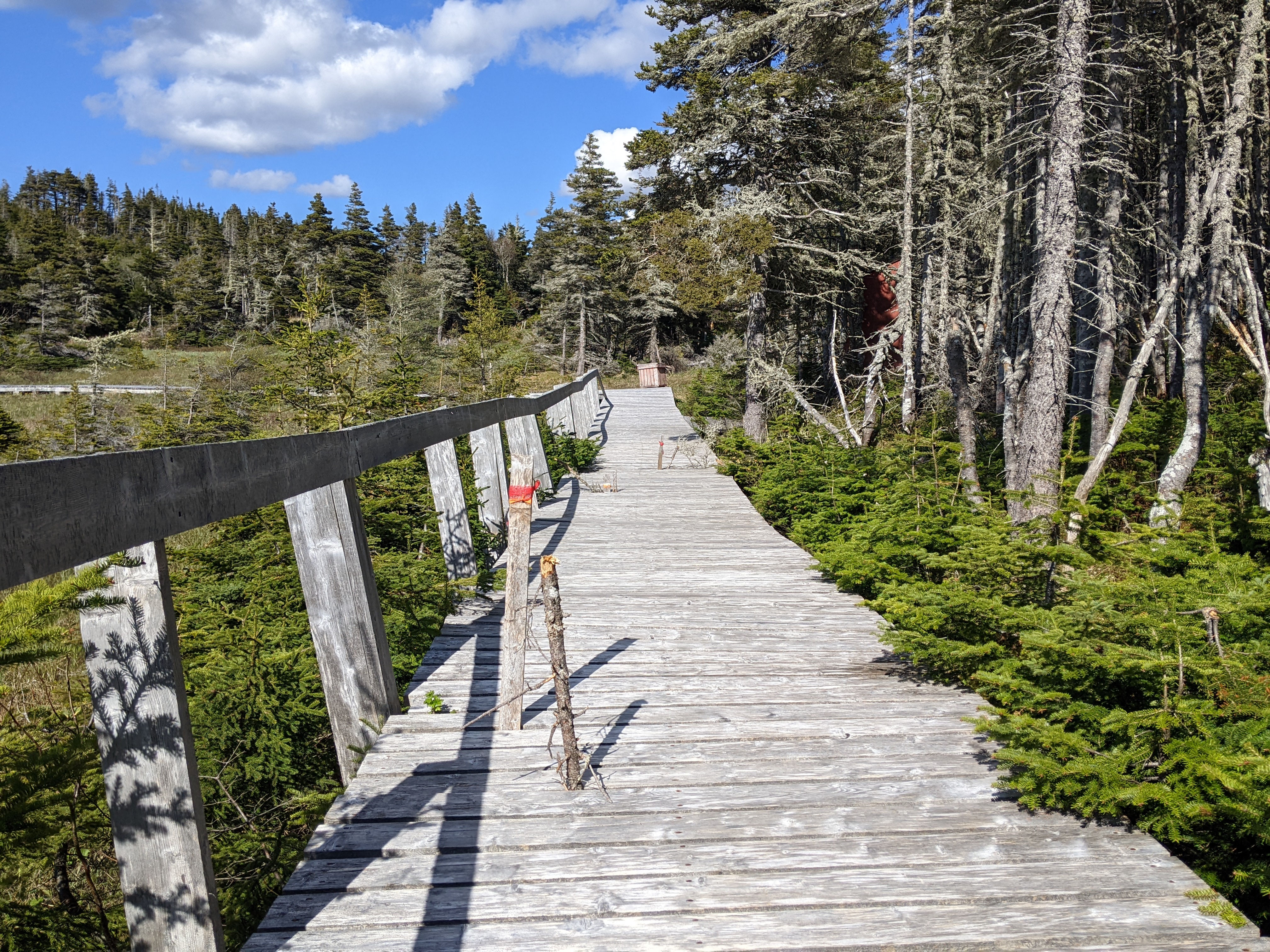
An elevated boardwalk led to the site.

Deep Cove was very shallow in the late afternoon.

A meat scaffold was used to preserve food that had to last the entire winter. As there was no refrigeration, canning, bottling, and salting were practiced. The scaffold was used to hold meat and bird carcasses for protection from other prey and also used to protect the food supply for dogs.


The few houses and gardens were all that testified to the presence of a once thriving winter community. When families moved from coastal fishing communities to winter quarters in more sheltered locations, they lived in homes known as tilts. During the winters, they hunted, trapped, cut firewood and timber, built boats, and made preparations for the next fishing season.

The time spent at Deep Cove was anticipated by both adults and children as it represented an escape from the pressures of everyday life. At Deep Cove, people continued to work hard but they enjoyed a closer sense of community where they could have fun, and maintain traditions and folklore. People moved to Deep Cove from Anchor Point by boat or by walking on the shoreline.

John: You'll be interested to know that all the families who wintered in Deep Cove were related to the two Genge brothers who first settled in Anchor Point. Here were a couple of examples.


There were 75 Genges listed on the rolls of Deep Cove, John!


The community of Deep Cove finally fell to the pressures of a changing world in the late 1950s and its services were no longer used as protection from northern Newfoundland's harsh winters.

There were a few hazards on the boardwalk that we needed to pay attention to!
There were huge amounts of information concerning every facet of people's lives at Deep Cove which I found interesting but was far too much to include here.
Deadman's Cove:

Yet more stockpiles of wood at Bear Cove, one minute north of Deadman's Cove!

The last stop of our journey up Newfoundland's western coast was Flower's Cove so we could walk on the Thrombolites Trail.


The community's Marjorie Bridge was constructed in the early 1900s to be used by folks traveling the coast by horse and cart and later by snowmobile or who walked to and from church and school. People could only get to and from Flower's Cove and the surrounding communities by passing on this bridge.


If you've never heard of thrombolites before, don't feel bad as I hadn't either before this trip! They are critically endangered microbial structures that resembled the earliest forms of life on earth. These organisms are the only known form of life from 3.5 billion to 650 million years ago!

Thrombolites or clotted structures were organisms thought to have thrived in the tidal zone of a warm, very salty sea, with some exposed at low tide, and some covered at high tide which explained the mud cracks. These structures are incredibly rare, only growing in one other place in the world in Shark Bay in Western Australia. Sounds like a place to add to our travel wish list!

I am the furthest thing from a science geek but even I was excited at seeing the very rare thrombolites given we were so close.

Because Flower's Cove was located so far north on the Great Northern Peninsula, this was as close as we'll likely ever get to Labrador across the Straight of Belle Isle which separated the island of Newfoundland from Labrador right here.

Steven and I were both surprised at how wealthy the homes in Flower's Cove appeared to be. Hardly fishing shacks as we'd expected quite frankly.

The road headed inland and across to the other side of the Great Northern Peninsula for the first time. Though we were inland, there was water, water everywhere!

I readily admit these are pretty lousy pictures but it was all I could do to take the photos of the moose and then the caribou who ran out of the woods and onto the highway in front of us within a half mile of each other.

Frankly, we were pretty excited seeing one of them, let alone both as remarkably few people we met were lucky enough to see either.

Community gardens beside the highway that were protected from invading moose and caribou:

I'll leave you with this serene image of a boat returning to the harbor in Gunner's Cove where we stayed for two nights.

Next post: Icebergs and the Viking settlement at L'Anse aux Meadows!
Posted on September 9th, 2022, from our home in Denver as I remain glued to the TV watching coverage of the passing of the beloved Queen Elizabeth II. What a sad time, too, for my native Canada as she was the head of state and she visited 'my home and native land' 22 times, more than any other nation.
I have not visited the west coast of Newfoundland but , after reading your posts, it has become a MUST see. I loved the Arches, the creatively painted rocks (glad you brought one home ), the miniature representation of the once thriving "Deep Cove" community, thrombolites, and your caribou/ moose siting (my first "live" siting was this past summer in New Brunswick) . You have profiled our most eastern province SO well, especially the listing of remarkable accomplishments attached to Newfoundland and Newfoundlanders. Thanks for the tour. xo Lina xo
ReplyDeleteLIna - Thanks for the very kind words! What a joy it was to tour the island from the southwest coast to the northwest and then all the way over to the far southeast. I hope you and Dan DO get to travel to the Great Northern Peninsula one day as I know you won't regret it.
ReplyDeleteThere is a Triple arch in Arches NP in Utah. Its not as well known as Delicate Arch which is on Utah license plate. Triple Arch in Newfoundland is also pretty amazing. Janina
ReplyDeleteThanks for pointing out Utah's triple arch, Janina. I wonder how many people jave seen the triple arches there as well as in Newfoundland!
ReplyDeleteThanks for the tour. As always informative and enjoyable. Most of my time in Newfoundland was on the eastern part and down the Avalon Peninsula. It's fascinating island with 5 tons of character! And the people were as friendly and helpful as their reputation.And what about those thrombolites eh? Who knew? That's the joy of travel - new things to learn.
ReplyDeleteThanks for reading and commenting about your own very enjoyable trip to The Rock. Thought of you at the Deep Cove Wintering Site because of all the Genges that wintered there.
ReplyDelete